FAA INFORMATION EFFECTIVE 14 MAY 2026
Location
| FAA Identifier: | ECG |
| Lat/Long: | 36-15-38.0720N 076-10-28.4420W
36-15.634533N 076-10.474033W
36.2605756,-76.1745672
(estimated) |
| Elevation: | 10.6 ft. / 3.2 m (surveyed) |
| Variation: | 11W (2020) |
| From city: | 3 miles SE of ELIZABETH CITY, NC |
| Time zone: | UTC -4 (UTC -5 during Standard Time) |
| Zip code: | 27909 |
Airport Operations
| Airport use: | Open to the public |
| Control tower: | yes |
| ARTCC: | WASHINGTON CENTER |
| FSS: | RALEIGH FLIGHT SERVICE STATION |
| NOTAMs facility: | ECG (NOTAM-D service available) |
| Attendance: | MON-FRI 0800-2100, ALL SAT-SUN 0800-1700
FOR GA ATTENDANCE AFTER HRS AND HOLIDAYS CALL 252-562-2472 OR CTC NOS. POSTED ON TRML DOOR. |
| Pattern altitude: | TPA: ROTARY WING 1000 FT AGL/1011 FT MSL, FIXED WING 1500 FT AGL/1511 FT MSL. |
| Wind indicator: | lighted |
| Segmented circle: | no |
| Lights: | ACTVT SALS RWY 10; HIRL RWY 10/28 - CTAF. WHEN ATCT CLSD, REILS RWY 10 & 28; PAPI RWY 10 & 28 OPR CONSLY. VASI RWY 01 & 19; MIRL RWY 01/19; TWY RWY 19 - OTS INDEFLY. |
| Beacon: | white-green (lighted land airport)
Operates sunset to sunrise. |
Airport Communications
| CTAF: | 120.5 |
| UNICOM: | 122.95 |
| WX ASOS: | 124.375 (252-338-4750) |
| ELIZABETH CITY GROUND: | 121.9 [1200-0300Z++.] |
| ELIZABETH CITY TOWER: | 120.5 355.6 [1200-0300Z++.] |
| NORFOLK APPROACH: | 119.55 |
| NORFOLK DEPARTURE: | 119.55 |
| CG OPS: | 345.0 ;E CITY AIR 381.8 ;ELIZABETH CITY AIR |
| EMERG: | 121.5 243.0 |
| WX AWOS-3 at ONX (11 nm NE): | 119.775 (252-453-8939) |
- 24 HOUR SEARCH AND RESCUE ACFT OPERATIONS MAY REQUIRE ATCT TO BE STAFFED 2200-0700; TRANSMIT INTENTIONS IN THE BLIND ON 120.5.
Nearby radio navigation aids
| VOR radial/distance | | VOR name | | Freq | | Var |
|---|
| ECG at field | | ELIZABETH CITY VOR/DME | | 115.75 | | 07W |
| RBXr319/30.9 | | WRIGHT BROTHERS VOR/DME | | 111.60 | | 08W |
| ORFr185/37.9 | | NORFOLK VORTAC | | 116.90 | | 07W |
| NDB name | | Hdg/Dist | | Freq | | Var | | ID |
|---|
| WOODVILLE | | 101/6.0 | | 254 | | 10W | | LLW | .-.. .-.. .-- |
Airport Services
| Fuel available: | 100LL JET-A1+
A1+:DLA MILITARY FUELING CONTRACT SVC AVBL ON GA RAMP, US GOVT AIRCARD ACCEPTED, NO DELAY FOR FUEL.
100LL:100LL FUEL 24 HR CREDIT CARD SVC AVBL. |
| Parking: | tiedowns |
| Airframe service: | MAJOR |
| Powerplant service: | MAJOR |
| Bottled oxygen: | NONE |
| Bulk oxygen: | NONE |
Runway Information
Runway 10/28
| Dimensions: | 7219 x 150 ft. / 2200 x 46 m |
| Surface: | concrete, in good condition |
| Weight bearing capacity: | | PCN 40 /R/B/W/T | | Single wheel: | 100.0 | | Double wheel: | 200.0 | | Double tandem: | 400.0, TWIN-TANDEM WEIGHT BEARING CAPACITY 400000 LBS. |
|
| Runway edge lights: | high intensity |
| RUNWAY 10 | | RUNWAY 28 |
| Latitude: | 36-15.680578N | | 36-15.630452N |
| Longitude: | 076-11.051578W | | 076-09.583753W |
| Elevation: | 10.5 ft. | | 10.0 ft. |
| Traffic pattern: | right | | left |
| Runway heading: | 103 magnetic, 092 true | | 283 magnetic, 272 true |
| Markings: | precision, in good condition | | precision, in good condition |
| Visual slope indicator: | 2-light PAPI on left (3.00 degrees glide path) | | 2-light PAPI on left (3.00 degrees glide path) |
| Approach lights: | SALS | | |
| Runway end identifier lights: | yes | | yes |
| Touchdown point: | yes, no lights | | yes, no lights |
| Instrument approach: | ILS/DME | | |
| Obstructions: | 15 ft. road, 800 ft. from runway, 40:1 slope to clear | | 22 ft. trees, 428 ft. from runway, 260 ft. left of centerline, 10:1 slope to clear
HAS +11 FT ROAD 156 FT FM THR OFFSET 337 L OF CNTRLN. |
Runway 1/19
| Dimensions: | 4518 x 150 ft. / 1377 x 46 m |
| Surface: | asphalt/concrete, in poor condition
PAVEMENT IS FAILED, NMRS RUTS, HEAVES, STRUCTURAL INTEGRITY UNKN. FOD POTENTIAL. SFC MRKS OBSC. NOT AUZD FOR USE. |
| Weight bearing capacity: | |
| Runway edge lights: | medium intensity |
| Runway edge markings: | MKD WITH X CLOSED. |
| Operational restrictions: | RWY 01/19 CLSD INDEFLY. |
| RUNWAY 1 | | RUNWAY 19 |
| Latitude: | 36-15.228960N | | 36-15.972915N |
| Longitude: | 076-10.743410W | | 076-10.704375W |
| Elevation: | 9.3 ft. | | 7.3 ft. |
| Traffic pattern: | right | | right |
| Runway heading: | 013 magnetic, 002 true | | 193 magnetic, 182 true |
| Displaced threshold: | 299 ft. | | no |
| Markings: | nonprecision, in poor condition | | nonprecision, in poor condition |
| Visual slope indicator: | 4-box VASI on left (2.75 degrees glide path) | | 4-box VASI on left (2.75 degrees glide path) |
| Touchdown point: | yes, no lights | | yes, no lights |
| Obstructions: | 15 ft. road, 200 ft. from runway, 230 ft. left of centerline
CLSD INDEFLY HAS +6 FT FENCE 0-200 FT FM THR 200-250 FT L. | | none |
Helipad H4
| Dimensions: | 100 x 100 ft. / 30 x 30 m |
| Surface: | concrete, in good condition |
| Runway edge lights: | PERI |
| Latitude: | 36-15.561667N | | |
| Longitude: | 076-10.023833W | | |
| Elevation: | 11.0 ft. | | |
| Traffic pattern: | left | | left |
| Markings: | basic, in good condition | | |
Helipad H1
| Dimensions: | 60 x 55 ft. / 18 x 17 m |
| Surface: | asphalt, in good condition |
| Latitude: | 36-15.290333N | | |
| Longitude: | 076-10.391167W | | |
| Elevation: | 8.0 ft. | | |
| Traffic pattern: | left | | left |
| Markings: | basic, in good condition | | |
| Obstructions: | 24 ft. acft, 1071 ft. from runway, 41 ft. right of centerline, 44:1 slope to clear | | |
Helipad H2
| Dimensions: | 50 x 50 ft. / 15 x 15 m |
| Surface: | asphalt, in good condition |
| Latitude: | 36-15.476667N | | |
| Longitude: | 076-10.002000W | | |
| Elevation: | 7.0 ft. | | |
| Traffic pattern: | left | | left |
| Markings: | numbers only, in good condition | | |
| Obstructions: | 23 ft. acft, 1168 ft. from runway, 22 ft. left of centerline | | |
Helipad H3
| Dimensions: | 50 x 50 ft. / 15 x 15 m |
| Surface: | asphalt, in good condition |
| Latitude: | 36-15.758833N | | |
| Longitude: | 076-10.549667W | | |
| Elevation: | 7.0 ft. | | |
| Traffic pattern: | left | | left |
| Markings: | numbers only, in good condition | | |
Airport Ownership and Management from official FAA records
| Ownership: | Publicly-owned
THIS IS A SHARED-USE ARPT. THE USCG OWNS AND OPERATES ALL RWYS AND THE MAJORITY OF THE TWYS. THE PASQUOTANK COUNTY AIRPORT AUTHORITY OPERATES THE FBO, CIVILIAN TERMINAL AND ASSOCIATED TAXIWAYS. |
| Owner: | USCG BASE ELIZABETH CITY
USCG BASE-ELIZABETH CITY OPS MNGR, 1664 WEEKSVILLE RD
ELIZABETH CITY, NC 27909
Phone 719-505-6367
USCG BASE - ELIZABETH CITY, AIRFIELD MANAGER: ROBERT POPP, PHONE: 719-505-6367; EMAIL: ROBERT.A.POPP@USCG.MIL |
| Manager: | ROBERT POPP, CIV USCG
1664 WEEKSVILLE RD
ELIZABETH CITY, NC 27909
Phone 719-505-6367
MR. ROBERT POPP IS THE USCG AIRFIELD MANAGER (SENIOR AIRPORT AUTHORITY). EMAIL: ROBERT.A.POPP@USCG.MIL; PHONE 719-505-6367. MR. SCOTT HINTON IS THE ELIZABETH CITY RGNL ARPT DIR FOR THE ELIZABETH CITY-PASQUOTANK COUNTY ARPT AUTH. EMAIL: MANAGER@ECGAIRPORT.COM; PHONE: 252-335-5634. |
Additional Remarks
| - | NO LINE-OF-SIGHT BETWEEN RWY ENDS. |
| - | COAST GUARD COMPLEX HAS NUMEROUS BLDGS WI THE BLDG RSTRN LINES. |
| - | RWY 01/19 & TWY K WEST OF THE CIVIL RAMP CLSD TO ALL OPNS. |
| - | ALL DOD TBJT ACFT FULL STOP ONLY, PRACTICE APCHS AND VFR TOUCH-N-GOS PROHIBITED. |
| - | FLUID: SP LHOX OIL: O-133-156 TRAN ALERT- NO TRANS MAINT, LTD SVC, TRAN A/C MUST REMAIN WITH ACFT TO PROVIDE TECH DRCT/ASSIST IN SVCG. |
| - | ACFT WITH TAIL HEIGHTS TO 50 FT PARKED ON APRON FIRST 2000 FT FM RWY 28 R SIDE 250 FT FM RWY CNTRLN. |
| - | CG ALC RAMP ATTENDED 1200-2000Z++. |
| - | CIV RAMP ATNDD M-F 0800-2100, SAT-SUN 0800-1700 FOR CIV ATTENDANT AFTER HRS & HOL C252-562-2472 DUR HR ATNDD. |
| - | SAR MAY RQR H24 ATCT STAFF 0200-1300Z++; TRANS INTENTIONS IN THE BLIND ON 120.5. |
| - | SEE FLIP AP/1 SUPP ARPT INFO. |
| - | NOISE ABATEMENT PROCEDURES IN EFFECT, CALL AMGR 719-505-6367. |
| - | ALL ACFT DESTINED FOR CG AIR STATION CTC ELIZABETH CITY AIR ON 345.0, 10 MIN PRIOR TO LDG. ALL ACFT DESTINED FOR CG ALC CTC ALC DUTY OFFICER (C252-333-5389) NLT 24HRS FOR PPR AND CTC ALC FLT OPS 123.1 PRIOR TO LANDING. |
| - | RWY AND TWY SFC COND NOT MNT WKENDS OR MON-FRI BTN 2000Z-1200Z. |
| - | MISC: NON-FRANGIBLE HIGH VOLTAGE BOXES LOCATED ON S EDGE OF ALC RAMP. |
| - | FACILITIES AND RAMPS NORTH OF RWY 10/28 RSTRD TO OFFL CG BUS ONLY. |
| - | MISC: PORTIONS OF ALC PRK RAMP NOT VIS FROM TWR. |
| - | MISC: AFLD MOWING SEASON APR-OCT. EXPCT INCREASED BIRD ACT IN VCNTY OF MOWERS OPR ON AFLD. |
| - | PPR IF ACN EXCEEDS PUBL PCN. CTC CG AFLD MGR C719-505-6367 TO OBTAIN APVL. |
| - | FOR CD WHEN ATCT CLSD, CTC NORFOLK APCH AT 757-464-0757. |
| - | RWY 10/28 INCRD POTENTIAL FOR HYDROPLANING DUE TO RUBBER DEPOSITS, CNTRLN OBSC. |
| - | INTERMITTENT TETHERED BLN OPNS 3 NM SE; DALGT HRS AT 5000 FT. |
| - | SEASONAL LOW-FLYING AGRI ACFT BASED IN THE LOCAL AREA. |
Instrument Procedures
NOTE: All procedures below are presented as PDF files. If you need a reader for these files, you should download the free Adobe Reader.NOT FOR NAVIGATION. Please procure official charts for flight.
FAA instrument procedures published for use from 14 May 2026 at 0901Z to 11 June 2026 at 0900Z.
IAPs - Instrument Approach Procedures |
|---|
| ILS OR LOC RWY 10 | |
download (273KB) |
| RNAV (GPS) RWY 01 | |
download (234KB) |
| RNAV (GPS) RWY 10 | |
download (239KB) |
| RNAV (GPS) RWY 19 | |
download (227KB) |
| RNAV (GPS) RWY 28 | |
download (225KB) |
| VOR/DME RWY 10 | |
download (236KB) |
| VOR/DME RWY 19 | |
download (261KB) |
| VOR/DME RWY 28 | |
download (246KB) |
| NDB RWY 10 | |
download (239KB) |
| NOTE: Special Alternate Minimums apply | |
download (168KB) |
| NOTE: Special Take-Off Minimums/Departure Procedures apply | |
download (355KB) |
Other nearby airports with instrument procedures:
KONX - Currituck County Regional Airport (11 nm NE)
KEDE - Northeastern Regional Airport (24 nm SW)
KCPK - Chesapeake Regional Airport (25 nm N)
KFFA - First Flight Airport (28 nm SE)
KMQI - Dare County Regional Airport (31 nm SE)
|
|

Road maps at:
MapQuest
Bing
Google
| Aerial photo |
|---|
WARNING: Photo may not be current or correct
 Photo taken 03-Aug-2009
on climb out from Rwy 1.
Photo taken 03-Aug-2009
on climb out from Rwy 1.
Do you have a better or more recent aerial photo of Elizabeth City Coast Guard Air Station/Regional Airport that you would like to share? If so, please send us your photo.
|
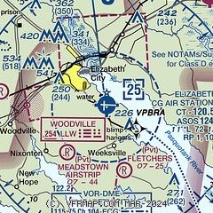
| Sectional chart |
|---|
|
CAUTION: Diagram may not be current
 Download PDF
of official airport diagram from the FAA
| Airport distance calculator |
|---|
|
|
| Sunrise and sunset |
|---|
|
Times for 17-May-2026
| | Local
(UTC-4) | | Zulu
(UTC) |
|---|
| Morning civil twilight | | 05:29 | | 09:29 |
| Sunrise | | 05:58 | | 09:58 |
| Sunset | | 20:04 | | 00:04 |
| Evening civil twilight | | 20:33 | | 00:33 |
|
| Current date and time |
|---|
| Zulu (UTC) | 17-May-2026 06:41:15 |
|---|
| Local (UTC-4) | 17-May-2026 02:41:15 |
|---|
|
| METAR |
|---|
| KECG | 170554Z AUTO 22010KT 10SM CLR 19/15 A3011 RMK AO2 SLP194 T01940150 10228 20194 50000
|
KONX
11nm NE | 170615Z AUTO 21008KT 10SM CLR 20/15 A3009 RMK AO2 T01950150
|
|
| TAF |
|---|
| KECG | 170520Z 1706/1806 21011G18KT P6SM SKC FM170900 24009KT P6SM FEW200 FM171800 20007KT P6SM FEW050
|
|
| NOTAMs |
|---|
NOTAMs are issued by the DoD/FAA and will open in a separate window not controlled by AirNav.
|
|


