FAA INFORMATION EFFECTIVE 14 MAY 2026
Location
| FAA Identifier: | ERV |
| Lat/Long: | 29-58-36.0000N 099-05-07.7000W
29-58.600000N 099-05.128333W
29.9766667,-99.0854722
(estimated) |
| Elevation: | 1616.8 ft. / 492.8 m (surveyed) |
| Variation: | 06E (2005) |
| From city: | 5 miles SE of KERRVILLE, TX |
| Time zone: | UTC -5 (UTC -6 during Standard Time) |
| Zip code: | 78028 |
Airport Operations
| Airport use: | Open to the public |
| Activation date: | 02/1943 |
| Control tower: | no |
| ARTCC: | HOUSTON CENTER |
| FSS: | SAN ANGELO FLIGHT SERVICE STATION |
| NOTAMs facility: | ERV (NOTAM-D service available) |
| Attendance: | 0600-2200
FBO PH 830-257-8840, AFT HRS ATTENDANT 830-496-0332. |
| Wind indicator: | lighted |
| Segmented circle: | yes |
| Lights: | DUSK-DAWN. MIRL RWYS 12/30 & 03/21 PRESET LOW INTST; TO INCR INTST AND ACTVT REIL RWYS 12 & 30 - CTAF. |
| Beacon: | white-green (lighted land airport)
Operates sunset to sunrise. |
Airport Communications
| CTAF/UNICOM: | 122.7 |
| WX AWOS-3: | 118.125 (830-895-2204) |
| WX AWOS-3 at T82 (18 nm NE): | 120.0 (830-990-2716) |
- APCH/DEP CTL SVC PRVDD BY HOUSTON ARTCC (ZHU) ON FREQS 134.95/ 269.4 (KERRVILLE RCAG SITES).
- HOUSTON ARTCC PROVIDES CLEARANCE DELIVERY ON REMOTED FREQ 134.95.
Nearby radio navigation aids
| VOR radial/distance | | VOR name | | Freq | | Var |
|---|
| CSIr056/7.5 | | CENTER POINT VORTAC | | 117.50 | | 08E |
| STVr227/24.1 | | STONEWALL VORTAC | | 113.80 | | 08E |
| SATr294/38.1 | | SAN ANTONIO VORTAC | | 116.80 | | 08E |
Airport Services
| Fuel available: | 100LL JET-A |
| Parking: | hangars and tiedowns |
| Airframe service: | MAJOR |
| Powerplant service: | MAJOR |
| Bottled oxygen: | HIGH |
Runway Information
Runway 12/30
| Dimensions: | 6004 x 100 ft. / 1830 x 30 m |
| Surface: | asphalt, in good condition |
| Weight bearing capacity: | | PCN 23 /F/C/W/T | | Single wheel: | 22.4 | | Double wheel: | 73.7 |
|
| Runway edge lights: | medium intensity |
| RUNWAY 12 | | RUNWAY 30 |
| Latitude: | 29-58.710362N | | 29-58.066562N |
| Longitude: | 099-05.513810W | | 099-04.649388W |
| Elevation: | 1573.4 ft. | | 1589.3 ft. |
| Traffic pattern: | left | | left |
| Runway heading: | 125 magnetic, 131 true | | 305 magnetic, 311 true |
| Displaced threshold: | 687 ft. | | no |
| Declared distances: | TORA:6000 TODA:6000 ASDA:6000 LDA:5313 | | TORA:6000 TODA:6000 ASDA:5300 LDA:5300 |
| Markings: | nonprecision, in fair condition | | nonprecision, in fair condition |
| Visual slope indicator: | 4-light PAPI on left (3.00 degrees glide path) | | 4-light PAPI on left (3.00 degrees glide path) |
| Runway end identifier lights: | yes | | yes |
| Touchdown point: | yes, no lights | | yes, no lights |
| Instrument approach: | | | LOCALIZER |
Runway 3/21
| Dimensions: | 3597 x 58 ft. / 1096 x 18 m |
| Surface: | asphalt, in fair condition |
| Weight bearing capacity: | |
| Runway edge lights: | medium intensity |
| RUNWAY 3 | | RUNWAY 21 |
| Latitude: | 29-58.706047N | | 29-59.203633N |
| Longitude: | 099-05.391200W | | 099-05.020078W |
| Elevation: | 1573.8 ft. | | 1616.8 ft. |
| Traffic pattern: | left | | left |
| Runway heading: | 027 magnetic, 033 true | | 207 magnetic, 213 true |
| Markings: | basic, in fair condition | | basic, in fair condition |
| Visual slope indicator: | 2-light PAPI on left (3.50 degrees glide path) | | 2-light PAPI on left (3.50 degrees glide path) |
| Touchdown point: | yes, no lights | | yes, no lights |
| Obstructions: | 40 ft. tree, 940 ft. from runway, 130 ft. right of centerline, 18:1 slope to clear | | 50 ft. trees, 960 ft. from runway, 290 ft. left of centerline, 15:1 slope to clear |
Airport Ownership and Management from official FAA records
| Ownership: | Publicly-owned |
| Owner: | CITY OF KERRVILLE
1877 AIRPORT LOOP
KERRVILLE, TX 78028-5069
Phone 830-896-9399
AND KERR COUNTY JOINTLY |
| Manager: | MARY L ROHRER
1877 AIRPORT LOOP
KERRVILLE, TX 78028-5069
Phone 830-896-9399 |
Additional Remarks
| A57-12 | APCH SLOPE 41:1 TO DSPLCD THR. |
| - | DEER ON & INVOF ARPT. |
| - | RWY 12 CALM WIND RWY. |
| - | FOR CD CTC HOUSTON ARTCC AT 281-230-5622. |
Instrument Procedures
NOTE: All procedures below are presented as PDF files. If you need a reader for these files, you should download the free Adobe Reader.NOT FOR NAVIGATION. Please procure official charts for flight.
FAA instrument procedures published for use from 14 May 2026 at 0901Z to 11 June 2026 at 0900Z.
IAPs - Instrument Approach Procedures |
|---|
| RNAV (GPS) RWY 12 | |
download (206KB) |
| RNAV (GPS) RWY 30 | |
download (202KB) |
| LOC RWY 30 | |
download (249KB) |
| VOR-A | |
download (201KB) |
| NOTE: Special Alternate Minimums apply | |
download (117KB) |
| NOTE: Special Take-Off Minimums/Departure Procedures apply | |
download (294KB) |
Other nearby airports with instrument procedures:
T82 - Gillespie County Airport (18 nm NE)
5C1 - Boerne Stage Airfield (25 nm SE)
KHDO - South Texas Regional Airport at Hondo (37 nm S)
KCVB - Castroville Municipal Airport (40 nm S)
KSAT - San Antonio International Airport (42 nm SE)
|
|

Road maps at:
MapQuest
Bing
Google
| Aerial photo |
|---|
WARNING: Photo may not be current or correct
 Photo by John Trolinger
Photo taken 25-Feb-2018
looking east.
Photo by John Trolinger
Photo taken 25-Feb-2018
looking east.
Do you have a better or more recent aerial photo of Kerrville Municipal Airport/Louis Schreiner Field that you would like to share? If so, please send us your photo.
|
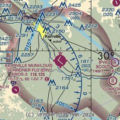
| Sectional chart |
|---|
|
| Airport distance calculator |
|---|
|
|
| Sunrise and sunset |
|---|
|
Times for 20-May-2026
| | Local
(UTC-5) | | Zulu
(UTC) |
|---|
| Morning civil twilight | | 06:15 | | 11:15 |
| Sunrise | | 06:41 | | 11:41 |
| Sunset | | 20:25 | | 01:25 |
| Evening civil twilight | | 20:51 | | 01:51 |
|
| Current date and time |
|---|
| Zulu (UTC) | 20-May-2026 09:33:13 |
|---|
| Local (UTC-5) | 20-May-2026 04:33:13 |
|---|
|
| METAR |
|---|
| KERV | 200855Z AUTO 08008KT 10SM CLR 18/16 A3001 RMK AO2 LTG DSNT S 60002 T01800160
|
KT82
19nm NE | 200855Z AUTO 06004KT 10SM CLR 18/16 A3001 RMK AO2 LTG DSNT SE PRESRR
|
|
| TAF |
|---|
KSAT
42nm SE | 200657Z 2007/2112 06010G20KT P6SM -RA FEW015 BKN070 OVC140 FM201100 02012KT P6SM SCT015 BKN070 TEMPO 2013/2017 BKN020 FM202000 11008KT P6SM BKN060 FM210600 12007KT P6SM BKN025 PROB30 2106/2112 -SHRA OVC015
|
KSKF
46nm SE | 200200Z 2002/2108 12012G20KT 9999 BKN025 OVC040 QNH2982INS BECMG 2003/2004 04015G25KT 9999 -SHRA VCTS BKN018CB OVC030 QNH2985INS TEMPO 2006/2008 VRB25G35KT 2400 +TSRA OVC018CB BECMG 2007/2008 VRB12G20KT 4800 -TSRA BKN012CB QNH2988INS BECMG 2009/2010 09010G15KT 8000 -SHRA BR SCT020 BKN030 OVC050 QNH2989INS BECMG 2011/2012 10009KT 9999 NSW SCT017 BKN025 OVC035 QNH2989INS BECMG 2016/2017 14012G20KT 9999 BKN025 OVC035 QNH2995INS BECMG 2021/2022 10010KT 9999 VCSH BKN020 OVC025 QNH2985INS TEMPO 2023/2
|
KJCT
47nm NW | 200529Z 2006/2106 08010KT P6SM BKN100 FM201000 05008KT P6SM BKN025 FM201900 09009KT P6SM BKN035 PROB30 2021/2024 4SM TSRA BKN035CB FM210400 VRB03KT P6SM BKN027
|
|
| NOTAMs |
|---|
NOTAMs are issued by the DoD/FAA and will open in a separate window not controlled by AirNav.
|
|

