FAA INFORMATION EFFECTIVE 14 MAY 2026
Location
| FAA Identifier: | MSS |
| Lat/Long: | 44-56-10.4680N 074-50-42.4310W
44-56.174467N 074-50.707183W
44.9362411,-74.8451197
(estimated) |
| Elevation: | 221.5 ft. / 67.5 m (surveyed) |
| Variation: | 14W (1980) |
| From city: | 2 miles E of MASSENA, NY |
| Time zone: | UTC -4 (UTC -5 during Standard Time) |
| Zip code: | 13662 |
Airport Operations
| Airport use: | Open to the public |
| Activation date: | 04/1940 |
| Control tower: | no |
| ARTCC: | BOSTON CENTER |
| FSS: | BURLINGTON FLIGHT SERVICE STATION |
| NOTAMs facility: | MSS (NOTAM-D service available) |
| Attendance: | MON-FRI 0400-1700, ALL SAT-SUN 0700-0800 |
| Wind indicator: | lighted |
| Segmented circle: | no |
| Lights: | ACTVT REIL RWY 05, 09 & 27; PAPI RWY 23, 27; HIRL RWY 05/23; MIRL RWY 09/27; TWY LGTS - CTAF. PAPI RWY 05 OPR CONSLY. |
| Beacon: | white-green (lighted land airport)
Operates sunset to sunrise. |
| Landing fee: | yes |
| Fire and rescue: | ARFF index A |
| Airline operations: | PPR 24 HRS FOR ACFT OPS WITH MORE THAN 30 PAX SEATS CALL AMGR (315) 769-7605. |
| International operations: | international airport of entry |
Airport Communications
| CTAF/UNICOM: | 123.0 |
| WX ASOS: | 128.075 (315-764-0481) |
| WX AWOS-3P at PTD (16 nm S): | 118.325 (315-265-6106) |
- APCH/DEP SVC PRVDD BY BOSTON ARTCC ON FREQS 135.25/377.1 (TURIN RCAG).
Nearby radio navigation aids
| NDB name | | Hdg/Dist | | Freq | | Var | | ID |
|---|
| MISSE | | 045/5.8 | | 278 | | 14W | | MS | -- ... |
| POTSDAM | | 021/12.9 | | 400 | | 14W | | PTD | .--. - -.. |
Airport Services
| Fuel available: | 100LL JET-A |
| Parking: | hangars and tiedowns |
| Airframe service: | MINOR |
| Powerplant service: | NONE |
| Bottled oxygen: | NONE |
| Bulk oxygen: | NONE |
Runway Information
Runway 5/23
| Dimensions: | 5601 x 100 ft. / 1707 x 30 m |
| Surface: | asphalt/grooved, in good condition
RWY 05 FIRST 50 FT NOT GRVD. |
| Weight bearing capacity: | | Single wheel: | 30.0 | | Double wheel: | 50.0 | | Double tandem: | 76.0 |
|
| Runway edge lights: | high intensity |
| RUNWAY 5 | | RUNWAY 23 |
| Latitude: | 44-55.801730N | | 44-56.589887N |
| Longitude: | 074-50.963777W | | 074-50.291143W |
| Elevation: | 203.5 ft. | | 221.5 ft. |
| Traffic pattern: | left | | left |
| Runway heading: | 045 magnetic, 031 true | | 225 magnetic, 211 true |
| Declared distances: | TORA:5601 TODA:5601 ASDA:5601 LDA:5601 | | TORA:5601 TODA:5601 ASDA:5601 LDA:5601 |
| Markings: | precision, in good condition | | nonprecision, in good condition |
| Visual slope indicator: | 4-light PAPI on left (3.00 degrees glide path) | | 4-light PAPI on left (3.00 degrees glide path) |
| Runway end identifier lights: | yes | | |
| Touchdown point: | yes, no lights | | yes, no lights |
| Instrument approach: | ILS | | |
| Obstructions: | 52 ft. pole, 1649 ft. from runway, 430 ft. right of centerline, 32:1 slope to clear | | none |
Runway 9/27
| Dimensions: | 4000 x 100 ft. / 1219 x 30 m |
| Surface: | asphalt/grooved, in good condition
RWY 09 FIRST 50 FT NOT GRVD. RWY 27 FIRST 50 FT NOT GRVD. |
| Weight bearing capacity: | | Single wheel: | 30.0 | | Double wheel: | 50.0 | | Double tandem: | 76.0 |
|
| Runway edge lights: | medium intensity |
| RUNWAY 9 | | RUNWAY 27 |
| Latitude: | 44-56.066233N | | 44-56.222910N |
| Longitude: | 074-51.268845W | | 074-50.368635W |
| Elevation: | 203.0 ft. | | 204.7 ft. |
| Traffic pattern: | left | | left |
| Runway heading: | 090 magnetic, 076 true | | 270 magnetic, 256 true |
| Declared distances: | TORA:4000 TODA:4000 ASDA:4000 LDA:4000 | | TORA:4000 TODA:4000 ASDA:4000 LDA:4000 |
| Markings: | nonprecision, in good condition | | nonprecision, in good condition |
| Visual slope indicator: | | | 4-light PAPI on left (3.00 degrees glide path) |
| Runway end identifier lights: | yes | | yes |
| Touchdown point: | yes, no lights | | yes, no lights |
| Obstructions: | 88 ft. trees, 1764 ft. from runway, 365 ft. left of centerline, 20:1 slope to clear | | none |
Airport Ownership and Management from official FAA records
| Ownership: | Publicly-owned |
| Owner: | TOWN OF MASSENA
MAIN ST - TOWN HALL
MASSENA, NY 13662
Phone 315-769-3588 |
| Manager: | DYLAN CASSELMAN
90 AVIATION ROAD
MASSENA, NY 13662
Phone 315-769-7605 |
Additional Remarks
| A39-05/23 | PCR VALUE: 360/F/D/X/T |
| A39-09/27 | PCR VALUE: 343/F/D/X/T |
| - | FREQUENT CONCENTRATION OF SEAGULLS AND CANADA GEESE ON AND INVOF ARPT PARTICULARLY DURG POOR WX PERIODS. |
| - | CTN NVD OPS CONDUCTED PERIODICALLY IN ARPT TFC PAT AREA. |
| - | MIL HEL TRNG ON & INVOF ARPT. |
| - | FOR CD IF UNA TO CTC ON FSS FREQ, CTC BOSTON ARTCC AT 603-879-6859 . |
| - | INDEX A COVERAGE AVBL DURG ATNDC HRS. FOR EMERGS OUTSIDE OF ATNDC HRS, CALL ST LAWRENCE CO EMERG SVCS AT 911. |
| - | 421 FT LGTD/MKD TWR 6000 FT S OF ARPT. |
| - | BIRDS & DEER ON & INVOF ARPT. |
| - | RY CONDS RPRTD DUR NML HRS OF OPN. |
| - | OVERNIGHT ACFT PARKING AVBL AT TERMINAL APRON. |
| - | AFTER ATTENDANCE HRS VEHICLE & PEDESTRIAN ACCESS TO FBO APRON & HANGAR ONLY AVBL WITH KEY CARD FOR AUTOMATIC GATE. |
| - | COMMUTER AIRCRAFT SECURE AREA CLOSED TO GENERAL AVIATION AIRCRAFT CLEARING CUSTOMS. PARKING AVAILABLE TO RIGHT OF TERMINAL BUILDING. |
Instrument Procedures
NOTE: All procedures below are presented as PDF files. If you need a reader for these files, you should download the free Adobe Reader.NOT FOR NAVIGATION. Please procure official charts for flight.
FAA instrument procedures published for use from 14 May 2026 at 0901Z to 11 June 2026 at 0900Z.
IAPs - Instrument Approach Procedures |
|---|
| ILS OR LOC RWY 05 | |
download (302KB) |
| RNAV (GPS) RWY 05 | |
download (337KB) |
| RNAV (GPS) RWY 09 | |
download (260KB) |
| RNAV (GPS) RWY 23 | |
download (258KB) |
| RNAV (GPS) RWY 27 | |
download (256KB) |
| NOTE: Special Alternate Minimums apply | |
download (163KB) |
| NOTE: Special Take-Off Minimums/Departure Procedures apply | |
download (442KB) |
Other nearby airports with instrument procedures:
KPTD - Potsdam Municipal Airport/Damon Field (16 nm S)
KMAL - Malone-Dufort Airport (22 nm E)
KOGS - Ogdensburg International Airport (30 nm SW)
KSLK - Adirondack Regional Airport (43 nm SE)
KLKP - Lake Placid Airport (55 nm SE)
|
|

Road maps at:
MapQuest
Bing
Google
| Aerial photo |
|---|
WARNING: Photo may not be current or correct
 Photo by David Voss
Photo taken 14-Nov-2008
Photo by David Voss
Photo taken 14-Nov-2008
Do you have a better or more recent aerial photo of Massena International Airport-Richards Field that you would like to share? If so, please send us your photo.
|
| Sectional chart |
|---|
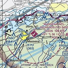
|
| Airport distance calculator |
|---|
|
|
| Sunrise and sunset |
|---|
|
Times for 23-May-2026
| | Local
(UTC-4) | | Zulu
(UTC) |
|---|
| Morning civil twilight | | 04:48 | | 08:48 |
| Sunrise | | 05:23 | | 09:23 |
| Sunset | | 20:29 | | 00:29 |
| Evening civil twilight | | 21:04 | | 01:04 |
|
| Current date and time |
|---|
| Zulu (UTC) | 23-May-2026 17:38:34 |
|---|
| Local (UTC-4) | 23-May-2026 13:38:34 |
|---|
|
| METAR |
|---|
| KMSS | 231653Z AUTO 05008KT 10SM CLR 19/06 A3043 RMK AO2 SLP306 T01890056
|
KPTD
16nm S | 231715Z AUTO 15006KT 10SM CLR 20/01 A3041 RMK AO2 PNO
|
|
| TAF |
|---|
| KMSS | 231120Z 2312/2412 VRB03KT P6SM BKN250 FM231400 06008KT P6SM BKN180 FM240400 VRB04KT P6SM OVC045 FM240800 10006KT 5SM -RA BR OVC025 FM241000 11006KT 5SM -RA BR OVC018 WS020/16035KT
|
|
| NOTAMs |
|---|
NOTAMs are issued by the DoD/FAA and will open in a separate window not controlled by AirNav.
|
|

