FAA INFORMATION EFFECTIVE 19 MARCH 2026
Location
| FAA Identifier: | PUB |
| Lat/Long: | 38-17-23.8110N 104-29-52.9010W
38-17.396850N 104-29.881683W
38.2899475,-104.4980281
(estimated) |
| Elevation: | 4729.3 ft. / 1441.5 m (surveyed) |
| Variation: | 08E (2015) |
| From city: | 5 miles E of PUEBLO, CO |
| Time zone: | UTC -6 (UTC -7 during Standard Time) |
| Zip code: | 81001 |
Airport Operations
| Airport use: | Open to the public |
| Activation date: | 02/1944 |
| Control tower: | yes |
| ARTCC: | DENVER CENTER |
| FSS: | DENVER FLIGHT SERVICE STATION |
| NOTAMs facility: | PUB (NOTAM-D service available) |
| Attendance: | 0600-2200 |
| Wind indicator: | yes |
| Segmented circle: | yes |
| Lights: | WHEN ATCT CLSD ACTVT MALSR RWY 08R; REIL RWY 08L, 17, 26R, 26L & 35; PAPI RWY 08R, 08L, 17, 26R & 35; HIRL RWY 08R/26L; MIRL RWY 08L/26R, 17/35 - CTAF. PAPI RWY 26L ON CONSLY. |
| Beacon: | white-green (lighted land airport)
Operates sunset to sunrise. |
| Fire and rescue: | ARFF index B |
Airport Communications
| CTAF: | 119.1 |
| UNICOM: | 122.95 |
| ATIS: | 125.25 |
| WX ASOS: | PHONE 719-225-7029 |
| PUEBLO GROUND: | 121.9 [0600-2200] |
| PUEBLO TOWER: | 119.1 257.8 [0600-2200] |
| DENVER APPROACH: | 120.1 |
| DENVER DEPARTURE: | 120.1 |
| CLEARANCE DELIVERY: | 120.9 |
| EMERG: | 121.5 243.0 |
- DENVER APCH (D01) PRVDDS APCH/DEP CTL SVC FM 0600-2200; DENVER ARTCC (ZDV) PRVDDS APCH/DEP SVC FM 2200-0600 ON FREQS 128.375/379.95 (PUEBLO RCAG).
- SAID IN USE. OPERATE TRANSPONDERS WITH ALTITUDE REPORTING MODE AND ADS-B (IF EQUIPPED) ENABLED ON ALL AIRPORT SURFACES.
Nearby radio navigation aids
| VOR radial/distance | | VOR name | | Freq | | Var |
|---|
| PUBr257/3.2 | | PUEBLO VORTAC | | 116.70 | | 08E |
| FCSr141/26.4 | | BUTTS VOR/DME | | 108.80 | | 12E |
| BRKr163/39.8 | | BLACK FOREST VOR/DME | | 112.50 | | 08E |
| NDB name | | Hdg/Dist | | Freq | | Var | | ID |
|---|
| IRONHORSE | | 145/26.2 | | 335 | | 08E | | IHS | .. .... ... |
Airport Services
| Fuel available: | 100LL JET-A
100LL:AFT HRS (719) 948-1310 OR USE 100LL SELF-SVC. |
| Parking: | hangars and tiedowns |
| Airframe service: | MAJOR |
| Powerplant service: | MAJOR |
| Bottled oxygen: | HIGH |
Runway Information
Runway 8R/26L
| Dimensions: | 10498 x 150 ft. / 3200 x 46 m |
| Surface: | asphalt/grooved, in good condition |
| Weight bearing capacity: | | Single wheel: | 75.0 | | Double wheel: | 170.0 | | Double tandem: | 250.0 |
|
| Runway edge lights: | high intensity |
| RUNWAY 8R | | RUNWAY 26L |
| Latitude: | 38-17.227247N | | 38-17.279210N |
| Longitude: | 104-30.604015W | | 104-28.411027W |
| Elevation: | 4669.4 ft. | | 4648.8 ft. |
| Traffic pattern: | right | | left |
| Runway heading: | 080 magnetic, 088 true | | 260 magnetic, 268 true |
| Declared distances: | TORA:10496 TODA:10496 ASDA:10496 LDA:10496 | | TORA:10496 TODA:10496 ASDA:10496 LDA:10496 |
| Markings: | precision, in good condition | | precision, in good condition |
| Visual slope indicator: | 4-light PAPI on left (3.00 degrees glide path) | | 4-light PAPI on left (3.00 degrees glide path) |
| Approach lights: | MALSR: 1,400 foot medium intensity approach lighting system with runway alignment indicator lights | | |
| Runway end identifier lights: | no | | yes |
| Touchdown point: | yes, no lights | | yes, no lights |
| Instrument approach: | ILS | | ILS |
Runway 17/35
| Dimensions: | 8310 x 150 ft. / 2533 x 46 m |
| Surface: | asphalt/grooved, in good condition |
| Weight bearing capacity: | | Single wheel: | 93.0 | | Double wheel: | 110.0 | | Double tandem: | 170.0 |
|
| Runway edge lights: | medium intensity |
| RUNWAY 17 | | RUNWAY 35 |
| Latitude: | 38-18.251015N | | 38-16.882862N |
| Longitude: | 104-30.244903W | | 104-30.193913W |
| Elevation: | 4729.3 ft. | | 4648.1 ft. |
| Traffic pattern: | left | | left |
| Runway heading: | 170 magnetic, 178 true | | 350 magnetic, 358 true |
| Declared distances: | TORA:8308 TODA:8308 ASDA:8308 LDA:8308 | | TORA:8308 TODA:8308 ASDA:8308 LDA:8308 |
| Markings: | nonprecision, in good condition | | nonprecision, in good condition |
| Visual slope indicator: | 4-light PAPI on left (3.00 degrees glide path) | | 4-light PAPI on left (3.00 degrees glide path) |
| Runway end identifier lights: | yes | | yes |
| Touchdown point: | yes, no lights | | yes, no lights |
Runway 8L/26R
| Dimensions: | 4690 x 75 ft. / 1430 x 23 m |
| Surface: | asphalt/grooved, in good condition |
| Weight bearing capacity: | |
| Runway edge lights: | medium intensity |
| Operational restrictions: | AVBL TO ACFT UNDER 20000 LBS DURING DALGT AND NIGHT HRS. |
| RUNWAY 8L | | RUNWAY 26R |
| Latitude: | 38-17.405135N | | 38-17.428357N |
| Longitude: | 104-30.610752W | | 104-29.631083W |
| Elevation: | 4681.2 ft. | | 4677.0 ft. |
| Traffic pattern: | left | | left |
| Runway heading: | 080 magnetic, 088 true | | 260 magnetic, 268 true |
| Declared distances: | TORA:4690 TODA:4690 ASDA:4690 LDA:4690 | | TORA:4690 TODA:4690 ASDA:4690 LDA:4690 |
| Markings: | basic, in good condition | | basic, in good condition |
| Visual slope indicator: | 4-light PAPI on left (3.00 degrees glide path) | | 4-light PAPI on left (3.00 degrees glide path) |
| Runway end identifier lights: | yes | | yes |
| Touchdown point: | yes, no lights | | yes, no lights |
Airport Ownership and Management from official FAA records
| Ownership: | Publicly-owned |
| Owner: | CITY OF PUEBLO
1 CITY HALL
PUEBLO, CO 81003
Phone (719) 553-2744 |
| Manager: | GREG PEDROZA
31201 BRYAN CIRCLE
PUEBLO, CO 81001
Phone 719-553-2760 |
Additional Remarks
| A39-17/35 | PCR VALUE: 610/F/B/X/T |
| A39-08R/26L | PCR VALUE: 517/F/D/X/T |
| - | SEE FLIP AP/1 SUPPLEMENTARY ARPT INFO. |
| - | CONDS NOT MNT 2200L-0600L. |
| - | TWY A BTN TWY D AND A6 50 FT WID. |
| - | FOR CD CTC PUEBLO APCH AT 303-342-1916, WHEN APCH CLSD CTC DENVER ARTCC AT 303-651-4257. |
| - | TXL E 30 FT WIDE BTN TWY E6 AND TWY E7. |
| - | RPD RFL AVBL F/W, R/W DUR FBO HR 0700L-2200L. CTC FBO 719-948-1310 24 HR PN & FREQ 122.95 PRIOR TO LNDG. ADZ ATC FOR RPD RFL OPS & PROCD TO WEST RAMP. |
| - | HIGH VOLUME TRNG DA-20 ACFT SR-SS MON-FRI. OVERHEAD PATTERN DURG TRNG. EXTENSIVE USE OF TRNG AREA 12-28 DME N-SW OF ARPT 500 FT AGL-8500 FT MSL. |
| - | BE ALERT; INTENSIVE USAF STUDENT TRAINING IN VICINITY OF COLORADO SPRINGS & PUEBLO COLORADO. |
Instrument Procedures
NOTE: All procedures below are presented as PDF files. If you need a reader for these files, you should download the free Adobe Reader.NOT FOR NAVIGATION. Please procure official charts for flight.
FAA instrument procedures published for use from 19 March 2026 at 0901Z to 16 April 2026 at 0900Z.
IAPs - Instrument Approach Procedures |
|---|
| ILS OR LOC RWY 08R | |
download (303KB) |
| ILS OR LOC RWY 26L | |
download (275KB) |
| RNAV (GPS) RWY 08R | |
download (242KB) |
| RNAV (GPS) RWY 17 | |
download (210KB) |
| RNAV (GPS) RWY 26L | |
download (223KB) |
| RNAV (GPS) RWY 35 | |
download (234KB) |
| VOR RWY 26L | |
download (254KB) |
| NOTE: Special Alternate Minimums apply | |
download (144KB) |
Departure Procedures |
|---|
| CANYON FOUR | |
2 pages:
[1] [2] (333KB) |
| NOTE: Special Take-Off Minimums/Departure Procedures apply | |
download (299KB) |
Other nearby airports with instrument procedures:
KFCS - Butts Army Airfield (Fort Carson) (26 nm NW)
1V6 - Fremont County Airport (30 nm W)
KCOS - City of Colorado Springs Municipal Airport (32 nm N)
4V1 - Spanish Peaks Airfield (38 nm S)
KFLY - Meadow Lake Airport (39 nm N)
|
|

Road maps at:
MapQuest
Bing
Google
| Aerial photo |
|---|
WARNING: Photo may not be current or correct
 Photo by Brandon Christensen
Photo taken 05-Oct-2013
looking west.
Photo by Brandon Christensen
Photo taken 05-Oct-2013
looking west.
Do you have a better or more recent aerial photo of Pueblo Memorial Airport that you would like to share? If so, please send us your photo.
|
| Sectional chart |
|---|
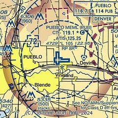
|
CAUTION: Diagram may not be current
 Download PDF
of official airport diagram from the FAA
| Airport distance calculator |
|---|
|
|
| Sunrise and sunset |
|---|
|
Times for 09-Apr-2026
| | Local
(UTC-6) | | Zulu
(UTC) |
|---|
| Morning civil twilight | | 06:05 | | 12:05 |
| Sunrise | | 06:32 | | 12:32 |
| Sunset | | 19:27 | | 01:27 |
| Evening civil twilight | | 19:54 | | 01:54 |
|
| Current date and time |
|---|
| Zulu (UTC) | 09-Apr-2026 22:27:30 |
|---|
| Local (UTC-6) | 09-Apr-2026 16:27:30 |
|---|
|
| METAR |
|---|
| KPUB | 092153Z 36007KT 300V040 10SM CLR 26/M06 A2990 RMK AO2 SLP084 T02611061 $
|
|
| TAF |
|---|
| KPUB | 091925Z 0919/1018 20012KT P6SM SCT150 FM092300 06011KT P6SM BKN120 FM100600 02008KT P6SM BKN150 FM101200 09005KT P6SM SCT070
|
|
| NOTAMs |
|---|
NOTAMs are issued by the DoD/FAA and will open in a separate window not controlled by AirNav.
|
|


