FAA INFORMATION EFFECTIVE 27 NOVEMBER 2025
Location
| FAA Identifier: | RLD |
| Lat/Long: | 46-18-20.3020N 119-18-15.0820W
46-18.338367N 119-18.251367W
46.3056394,-119.3041894
(estimated) |
| Elevation: | 394.3 ft. / 120.2 m (surveyed) |
| Variation: | 17E (2005) |
| From city: | 2 miles NW of RICHLAND, WA |
| Time zone: | UTC -8 (UTC -7 during Daylight Saving Time) |
| Zip code: | 99352 |
Airport Operations
| Airport use: | Open to the public |
| Activation date: | 10/1950 |
| Control tower: | no |
| ARTCC: | SEATTLE CENTER |
| FSS: | SEATTLE FLIGHT SERVICE STATION |
| NOTAMs facility: | SEA (NOTAM-D service available) |
| Attendance: | 0800-1800 |
| Pattern altitude: | 1194.3 ft. MSL |
| Wind indicator: | lighted |
| Segmented circle: | yes |
| Lights: | ACTVT MALS RWY 19; REIL RWYS 01 & 19; MIRL RWY 01/19 & 08/26 - CTAF. VASI RWY 26 & PAPI RWYS 01, 08 & 19 OPR 24 HRS. |
| Beacon: | white-green (lighted land airport)
Operates sunset to sunrise. |
Airport Communications
| CTAF/UNICOM: | 122.7 |
| WX AWOS-3PT: | 132.675 (509-375-4247) |
| SPOKANE APPROACH: | 128.75 ;NORTH & WEST |
| SPOKANE DEPARTURE: | 128.75 ;NORTH & WEST |
| WX ASOS at PSC (8 nm E): | PHONE 509-547-7379 |
- CD PRVDD BY SEATTLE RADIO ON 122.4.
- APCH/DEP CTL SVC PROVDD BY SEATTLE ARTCC (ZSE) ON 132.6/269.35 (YAKIMA RCAG), WHEN GEG APCH CLSD.
Nearby radio navigation aids
| VOR radial/distance | | VOR name | | Freq | | Var |
|---|
| PSCr270/8.0 | | PASCO VOR/DME | | 113.75 | | 15E |
| PDTr323/39.5 | | PENDLETON VORTAC | | 114.70 | | 14E |
Airport Services
| Fuel available: | 100LL JET-A
100LL:FUEL BY MAJOR CREDIT CARD - 24 HR AVAILABILITY. |
| Parking: | tiedowns |
| Airframe service: | MAJOR |
| Powerplant service: | MAJOR |
| Bottled oxygen: | NONE |
| Bulk oxygen: | HIGH |
Runway Information
Runway 1/19
| Dimensions: | 4009 x 75 ft. / 1222 x 23 m |
| Surface: | asphalt, in good condition |
| Weight bearing capacity: | | Single wheel: | 30.0 | | Double wheel: | 45.0 | | Double tandem: | 70.0 |
|
| Runway edge lights: | medium intensity |
| RUNWAY 1 | | RUNWAY 19 |
| Latitude: | 46-17.997682N | | 46-18.592502N |
| Longitude: | 119-18.506878W | | 119-18.095870W |
| Elevation: | 391.5 ft. | | 389.0 ft. |
| Traffic pattern: | left | | right |
| Runway heading: | 009 magnetic, 026 true | | 189 magnetic, 206 true |
| Markings: | nonprecision, in good condition | | nonprecision, in good condition |
| Visual slope indicator: | 2-light PAPI on left (3.00 degrees glide path)
PAPI UNUSBL BYD 3.0 NM FM THR FOR TRRN ON RIGHT SIDE OF RWY CNTRLN AT APRXLY 3.5 NM. | | 2-light PAPI on left (3.00 degrees glide path) |
| Approach lights: | | | MALS: 1,400 foot medium intensity approach lighting system |
| Runway end identifier lights: | yes | | yes |
| Touchdown point: | yes, no lights | | yes, no lights |
| Instrument approach: | | | LOC/DME |
| Obstructions: | 13 ft. ant, marked, 396 ft. from runway, 258 ft. right of centerline, 15:1 slope to clear
CLOSE-IN OBSTN GND. | | 24 ft. pole, 795 ft. from runway, 444 ft. left of centerline, 24:1 slope to clear |
Runway 8/26
| Dimensions: | 4001 x 100 ft. / 1220 x 30 m |
| Surface: | asphalt, in good condition |
| Weight bearing capacity: | | Single wheel: | 30.0 | | Double wheel: | 45.0 | | Double tandem: | 70.0 |
|
| Runway edge lights: | medium intensity |
| RUNWAY 8 | | RUNWAY 26 |
| Latitude: | 46-18.412898N | | 46-18.350510N |
| Longitude: | 119-18.674032W | | 119-17.728473W |
| Elevation: | 394.3 ft. | | 388.1 ft. |
| Traffic pattern: | left | | right |
| Runway heading: | 078 magnetic, 095 true | | 258 magnetic, 275 true |
| Markings: | nonprecision, in good condition | | nonprecision, in good condition |
| Visual slope indicator: | 2-light PAPI on left (3.00 degrees glide path)
UNUSBL BYD 8 DEG RIGHT OF CNTRLN. | | 4-box VASI on left (3.00 degrees glide path) |
| Touchdown point: | yes, no lights | | yes, no lights |
| Obstructions: | none | | 16 ft. rr, 573 ft. from runway, 23:1 slope to clear |
Airport Ownership and Management from official FAA records
| Ownership: | Publicly-owned |
| Owner: | PORT OF BENTON
3250 PORT OF BENTON BLVD
RICHLAND, WA 99354
Phone 509-375-3060 |
| Manager: | QUENTIN WRIGHT
3250 PORT OF BENTON BLVD
RICHLAND, WA 99354
Phone 509-975-6352 |
Additional Remarks
| E94 | SAWRS;DRCT PHONE LINE TO FSS. |
| - | ROAD 550' WEST APCH END RY 08. |
| - | PREFERRED RWY 01-19 IN CALM WIND CONDITIONS. |
| - | AIRFIELD CONDS UNMON NGTS, WKENDS AND HOLS. |
Instrument Procedures
NOTE: All procedures below are presented as PDF files. If you need a reader for these files, you should download the free Adobe Reader.NOT FOR NAVIGATION. Please procure official charts for flight.
FAA instrument procedures published for use from 27 November 2025 at 0901Z to 25 December 2025 at 0900Z.
IAPs - Instrument Approach Procedures |
|---|
| RNAV (GPS) RWY 26 | |
download (253KB) |
| RNAV (GPS) Y RWY 19 | |
download (246KB) |
| RNAV (GPS) Z RWY 19 | |
download (273KB) |
| LOC RWY 19 | |
download (310KB) |
| VOR/DME-A | |
download (190KB) |
| NOTE: Special Alternate Minimums apply | |
download (214KB) |
| NOTE: Special Take-Off Minimums/Departure Procedures apply | |
download |
Other nearby airports with instrument procedures:
KPSC - Tri-Cities Airport (8 nm E)
KHRI - Hermiston Municipal Airport (29 nm S)
KPDT - Eastern Oregon Regional Airport at Pendleton (41 nm SE)
KALW - Walla Walla Regional Airport (44 nm E)
9S9 - Lexington Airport (54 nm S)
|
|

Road maps at:
MapQuest
Bing
Google
| Aerial photo |
|---|
WARNING: Photo may not be current or correct
 Photo taken 19-Jan-2018
looking NE from 2200 ft.
Photo taken 19-Jan-2018
looking NE from 2200 ft.
Do you have a better or more recent aerial photo of Richland Airport that you would like to share? If so, please send us your photo.
|
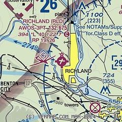
| Sectional chart |
|---|
|
| Airport distance calculator |
|---|
|
|
| Sunrise and sunset |
|---|
|
Times for 20-Dec-2025
| | Local
(UTC-8) | | Zulu
(UTC) |
|---|
| Morning civil twilight | | 07:03 | | 15:03 |
| Sunrise | | 07:38 | | 15:38 |
| Sunset | | 16:12 | | 00:12 |
| Evening civil twilight | | 16:47 | | 00:47 |
|
| Current date and time |
|---|
| Zulu (UTC) | 20-Dec-2025 13:53:52 |
|---|
| Local (UTC-8) | 20-Dec-2025 05:53:52 |
|---|
|
| METAR |
|---|
| KRLD | 201335Z AUTO 18009KT 10SM CLR 05/00 A2999 RMK AO2 T00520000
|
KPSC
8nm E | 201253Z AUTO 21013KT 10SM CLR 05/M01 A2998 RMK AO2 PK WND 22026/1225 SLP156 T00501011
|
|
| TAF |
|---|
KPSC
8nm E | 201120Z 2012/2112 22011G24KT P6SM SCT250 FM202100 19005KT P6SM SCT250 FM211000 VRB03KT P6SM OVC100
|
|
| NOTAMs |
|---|
NOTAMs are issued by the DoD/FAA and will open in a separate window not controlled by AirNav.
|
|


