FAA INFORMATION EFFECTIVE 27 NOVEMBER 2025
Location
| FAA Identifier: | TNU |
| Lat/Long: | 41-40-27.9480N 093-01-18.2220W
41-40.465800N 093-01.303700W
41.6744300,-93.0217283
(estimated) |
| Elevation: | 952.5 ft. / 290.3 m (surveyed) |
| Variation: | 00E (2015) |
| From city: | 2 miles SE of NEWTON, IA |
| Time zone: | UTC -6 (UTC -5 during Daylight Saving Time) |
| Zip code: | 50208 |
Airport Operations
| Airport use: | Open to the public |
| Activation date: | 10/1956 |
| Control tower: | no |
| ARTCC: | MINNEAPOLIS CENTER |
| FSS: | FORT DODGE FLIGHT SERVICE STATION |
| NOTAMs facility: | TNU (NOTAM-D service available) |
| Attendance: | MON-FRI 0730-1800, ALL SAT-SUN 0800-1700
AFT HRS ONLY CALL (515) 360-1807. |
| Wind indicator: | lighted |
| Segmented circle: | no |
| Lights: | ACTVT MIRL RY 14/32, VASI RYS 14 & 32, REIL RWY 14 AND MALSR RWY 32 - CTAF. |
| Beacon: | white-green (lighted land airport)
Operates sunset to sunrise. |
Airport Communications
| CTAF/UNICOM: | 122.8 |
| WX AWOS-3: | 132.275 (641-791-3302) |
| DES MOINES APPROACH: | 123.9 |
| DES MOINES DEPARTURE: | 123.9 |
| CLEARANCE DELIVERY: | 126.3 |
| WX AWOS-3 at GGI (13 nm E): | 120.725 (641-236-9720) |
| WX AWOS-3 at PEA (17 nm S): | 118.875 (641-628-3459) |
Nearby radio navigation aids
| VOR radial/distance | | VOR name | | Freq | | Var |
|---|
| TNUr146/7.6 | | NEWTON VOR/DME | | 112.50 | | 03E |
| DSMr056/31.5 | | DES MOINES VORTAC | | 117.50 | | 07E |
Airport Services
| Fuel available: | 100LL JET-A |
| Parking: | hangars and tiedowns |
| Airframe service: | MAJOR |
| Powerplant service: | MAJOR |
| Bottled oxygen: | NONE |
| Bulk oxygen: | NONE |
Runway Information
Runway 14/32
| Dimensions: | 5600 x 100 ft. / 1707 x 30 m |
| Surface: | asphalt, in good condition |
| Weight bearing capacity: | | PCN 32 /F/D/X/T | | Single wheel: | 45.0 | | Double wheel: | 51.0 |
|
| Runway edge lights: | medium intensity |
| RUNWAY 14 | | RUNWAY 32 |
| Latitude: | 41-40.825145N | | 41-40.106417N |
| Longitude: | 093-01.688882W | | 093-00.918587W |
| Elevation: | 952.4 ft. | | 945.5 ft. |
| Traffic pattern: | left | | left |
| Runway heading: | 141 | | 321 |
| Markings: | nonprecision, in fair condition | | precision, in fair condition |
| Visual slope indicator: | 4-box VASI on left (3.00 degrees glide path) | | 4-box VASI on left (3.00 degrees glide path) |
| Approach lights: | | | MALSR: 1,400 foot medium intensity approach lighting system with runway alignment indicator lights |
| Runway end identifier lights: | yes | | |
| Touchdown point: | yes, no lights | | yes, no lights |
| Instrument approach: | | | ILS |
| Obstructions: | 18 ft. road, 860 ft. from runway, 350 ft. left of centerline, 36:1 slope to clear | | none |
Airport Ownership and Management from official FAA records
| Ownership: | Publicly-owned |
| Owner: | CITY OF NEWTON
115 N. 2ND AVE E. PO BOX 399
NEWTON, IA 50208
Phone 641-792-2787 |
| Manager: | ETHAN NASALROAD
BOX 986-2901 RUSTY WALLACE DRIVE
NEWTON, IA 50208
Phone 641-792-1292 |
Additional Remarks
| A96 | ULTRA-LIGHT ACTIVITY DISCOURAGED. |
| - | RY 14 IS CALM WIND RY. |
| - | STADIUM WITHIN 3NM, CHECK FOR EVENTS. |
| - | SEASONAL MIGRATORY WATERFOWL INVOF ARPT. |
| - | FOR CD CTC DES MOINES ATCT ON 126.3 OR CALL 515-974-8016. |
Instrument Procedures
NOTE: All procedures below are presented as PDF files. If you need a reader for these files, you should download the free Adobe Reader.NOT FOR NAVIGATION. Please procure official charts for flight.
FAA instrument procedures published for use from 27 November 2025 at 0901Z to 25 December 2025 at 0900Z.
IAPs - Instrument Approach Procedures |
|---|
| ILS OR LOC RWY 32 | |
download (207KB) |
| RNAV (GPS) RWY 14 | |
download (227KB) |
| RNAV (GPS) RWY 32 | |
download (203KB) |
| VOR RWY 14 | |
download (190KB) |
| NOTE: Special Alternate Minimums apply | |
download (124KB) |
| NOTE: Special Take-Off Minimums/Departure Procedures apply | |
download (428KB) |
Other nearby airports with instrument procedures:
KGGI - Grinnell Regional Airport (13 nm E)
KPEA - Pella Municipal Airport (17 nm S)
KOXV - Knoxville Municipal Airport (23 nm S)
KIKV - Ankeny Regional Airport (24 nm W)
KMIW - Marshalltown Municipal Airport (27 nm N)
|
|

Road maps at:
MapQuest
Bing
Google
| Aerial photo |
|---|
WARNING: Photo may not be current or correct
 Taken in December 2006
Do you have a better or more recent aerial photo of Newton Municipal Airport-Earl Johnson Field that you would like to share? If so, please send us your photo.
|
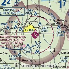
| Sectional chart |
|---|
|
| Airport distance calculator |
|---|
|
|
| Sunrise and sunset |
|---|
|
Times for 08-Dec-2025
| | Local
(UTC-6) | | Zulu
(UTC) |
|---|
| Morning civil twilight | | 06:56 | | 12:56 |
| Sunrise | | 07:27 | | 13:27 |
| Sunset | | 16:41 | | 22:41 |
| Evening civil twilight | | 17:12 | | 23:12 |
|
| Current date and time |
|---|
| Zulu (UTC) | 09-Dec-2025 03:27:56 |
|---|
| Local (UTC-6) | 08-Dec-2025 21:27:56 |
|---|
|
| METAR |
|---|
| KTNU | 090315Z AUTO 16006KT 10SM FEW027 BKN036 BKN110 M06/M07 A2998 RMK A01
|
KGGI
13nm E | 090315Z AUTO 00000KT 10SM BKN032 OVC120 M05/M08 A3001 RMK AO2 T10551080
|
KPEA
17nm S | 090315Z AUTO 12005KT 10SM SCT041 BKN120 M07/M09 A3001 RMK AO2 T10661087
|
|
| TAF |
|---|
KDSM
30nm W | 081720Z 0818/0918 19007KT P6SM OVC014 FM082200 17009KT P6SM BKN020 FM090100 18008KT P6SM BKN045
|
|
| NOTAMs |
|---|
NOTAMs are issued by the DoD/FAA and will open in a separate window not controlled by AirNav.
|
|

