FAA INFORMATION EFFECTIVE 11 JUNE 2026
Location
| FAA Identifier: | OXV |
| Lat/Long: | 41-17-56.7489N 093-06-49.4740W
41-17.945815N 093-06.824567W
41.2990969,-93.1137428
(estimated) |
| Elevation: | 928.3 ft. / 282.9 m (surveyed) |
| Variation: | 02E (2000) |
| From city: | 2 miles S of KNOXVILLE, IA |
| Time zone: | UTC -5 (UTC -6 during Standard Time) |
| Zip code: | 50138 |
Airport Operations
| Airport use: | Open to the public |
| Activation date: | 08/1963 |
| Control tower: | no |
| ARTCC: | MINNEAPOLIS CENTER |
| FSS: | FORT DODGE FLIGHT SERVICE STATION |
| NOTAMs facility: | OXV (NOTAM-D service available) |
| Attendance: | DAWN-DUSK
FOR SERVICE AFTER HOURS CALL 702-466-9560. |
| Wind indicator: | lighted |
| Segmented circle: | no |
| Lights: | ACTVT MIRL RY 15/33 AND PAPI RYS 15 & 33 AND REIL RYS 15 & 33 - CTAF. |
| Beacon: | white-green (lighted land airport)
Operates sunset to sunrise. |
Airport Communications
| CTAF/UNICOM: | 122.8 |
| WX AWOS-3: | 119.775 (641-828-8406) |
| DES MOINES APPROACH: | 123.9 |
| DES MOINES DEPARTURE: | 123.9 |
| WX AWOS-3 at PEA (10 nm NE): | 118.875 (641-628-3459) |
Nearby radio navigation aids
| VOR radial/distance | | VOR name | | Freq | | Var |
|---|
| DSMr102/25.5 | | DES MOINES VORTAC | | 117.50 | | 07E |
| TNUr177/29.1 | | NEWTON VOR/DME | | 112.50 | | 03E |
Airport Services
| Fuel available: | 100LL JET-A |
| Parking: | hangars and tiedowns |
| Airframe service: | MAJOR |
| Powerplant service: | MAJOR |
| Bottled oxygen: | NONE |
| Bulk oxygen: | NONE |
Runway Information
Runway 15/33
| Dimensions: | 4000 x 75 ft. / 1219 x 23 m |
| Surface: | concrete, in good condition |
| Weight bearing capacity: | | PCN 5 /R/C/W/U | | Single wheel: | 28.0 | | Double wheel: | 48.0 |
|
| Runway edge lights: | medium intensity |
| RUNWAY 15 | | RUNWAY 33 |
| Latitude: | 41-18.246470N | | 41-17.645158N |
| Longitude: | 093-07.003260W | | 093-06.645872W |
| Elevation: | 923.9 ft. | | 927.4 ft. |
| Traffic pattern: | left | | left |
| Runway heading: | 154 magnetic, 156 true | | 334 magnetic, 336 true |
| Markings: | nonprecision, in good condition | | nonprecision, in good condition |
| Visual slope indicator: | 2-light PAPI on left (3.00 degrees glide path) | | 2-light PAPI on left (3.00 degrees glide path) |
| Runway end identifier lights: | yes | | yes |
| Touchdown point: | yes, no lights | | yes, no lights |
| Obstructions: | 26 ft. pole, 819 ft. from runway, 325 ft. left of centerline, 23:1 slope to clear | | 23 ft. tree, 773 ft. from runway, 99 ft. right of centerline, 24:1 slope to clear |
Airport Ownership and Management from official FAA records
| Ownership: | Publicly-owned |
| Owner: | CITY OF KNOXVILLE
305 SOUTH 3RD
KNOXVILLE, IA 50138
Phone 641-842-3147 |
| Manager: | KATHERINE SHAWVER
1770 S LINCOLN STREET
KNOXVILLE, IA 50138
Phone 702-466-9560 |
Additional Remarks
| - | FOR CD CTC DES MOINES ATCT AT 515-974- 8016. |
Instrument Procedures
NOTE: All procedures below are presented as PDF files. If you need a reader for these files, you should download the free Adobe Reader.NOT FOR NAVIGATION. Please procure official charts for flight.
FAA instrument procedures published for use from 11 June 2026 at 0901Z to 09 July 2026 at 0900z.
IAPs - Instrument Approach Procedures |
|---|
| RNAV (GPS) RWY 15 | |
download (240KB) |
| RNAV (GPS) RWY 33 | |
download (223KB) |
| NOTE: Special Alternate Minimums apply | |
download (26KB) |
| NOTE: Special Take-Off Minimums/Departure Procedures apply | |
download (158KB) |
Other nearby airports with instrument procedures:
KPEA - Pella Municipal Airport (10 nm NE)
KCNC - Chariton Municipal Airport (20 nm SW)
KTNU - Newton Municipal Airport-Earl Johnson Field (23 nm N)
4C8 - Albia Municipal Airport (24 nm SE)
KOOA - Oskaloosa Municipal Airport (28 nm E)
|
|

Road maps at:
MapQuest
Bing
Google
| Aerial photo |
|---|
WARNING: Photo may not be current or correct

Do you have a better or more recent aerial photo of Knoxville Municipal Airport that you would like to share? If so, please send us your photo.
|
| Sectional chart |
|---|
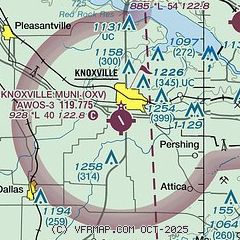
|
| Airport distance calculator |
|---|
|
|
| Sunrise and sunset |
|---|
|
Times for 12-Jun-2026
| | Local
(UTC-5) | | Zulu
(UTC) |
|---|
| Morning civil twilight | | 05:06 | | 10:06 |
| Sunrise | | 05:40 | | 10:40 |
| Sunset | | 20:45 | | 01:45 |
| Evening civil twilight | | 21:19 | | 02:19 |
|
| Current date and time |
|---|
| Zulu (UTC) | 12-Jun-2026 23:57:41 |
|---|
| Local (UTC-5) | 12-Jun-2026 18:57:41 |
|---|
|
| METAR |
|---|
| KOXV | 122335Z AUTO 22008KT 10SM CLR 27/12 A2994 RMK AO2
|
KPEA
10nm NE | 122335Z AUTO 23005KT 10SM CLR 27/14 A2994 RMK AO2 T02670140
|
|
| TAF |
|---|
KDSM
29nm NW | 121728Z 1218/1318 27009KT P6SM SKC FM122200 22008KT P6SM SKC FM130100 19006KT P6SM SCT250
|
KOTM
32nm E | 121728Z 1218/1318 27009KT P6SM SKC FM122200 22008KT P6SM SKC FM130100 19006KT P6SM SCT250
|
|
| NOTAMs |
|---|
NOTAMs are issued by the DoD/FAA and will open in a separate window not controlled by AirNav.
|
|

