FAA INFORMATION EFFECTIVE 11 JUNE 2026
Location
| FAA Identifier: | TYR |
| Lat/Long: | 32-21-12.7700N 095-24-10.7200W
32-21.212833N 095-24.178667W
32.3535472,-95.4029778
(estimated) |
| Elevation: | 543.9 ft. / 165.8 m (surveyed) |
| Variation: | 03E (2015) |
| From city: | 3 miles W of TYLER, TX |
| Time zone: | UTC -5 (UTC -6 during Standard Time) |
| Zip code: | 75704 |
Airport Operations
| Airport use: | Open to the public |
| Activation date: | 11/1937 |
| Control tower: | yes |
| ARTCC: | FORT WORTH CENTER |
| FSS: | FORT WORTH FLIGHT SERVICE STATION |
| NOTAMs facility: | TYR (NOTAM-D service available) |
| Attendance: | 0500-2200 |
| Wind indicator: | lighted |
| Segmented circle: | yes |
| Lights: | WHEN ATCT CLSD ACTVT MALSR RWY 04; REIL RWY 22; HIRL RWY 04/22; MIRL RWY 18/36; TWY LGTS - CTAF. HIRL RWY 13/31 PRESET MED INTST, TO INCR INTST ACTVT - CTAF. PAPI RWYS 04 & 22, VASI RWY 31 OPR CONSLY. |
| Beacon: | white-green (lighted land airport)
Operates sunset to sunrise. |
| Fire and rescue: | ARFF index B |
Airport Communications
| CTAF: | 120.1 |
| UNICOM: | 122.95 |
| ATIS: | 126.25 |
| WX ASOS: | PHONE 903-535-9105 |
| POUNDS GROUND: | 121.9 [0630-2130] |
| POUNDS TOWER: | 120.1 257.8 [0630-2130] |
| LONGVIEW APPROACH: | 128.75 |
| LONGVIEW DEPARTURE: | 128.75 |
| EMERG: | 121.5 243.0 |
- APCH/DEP SVC PRVDD BY FORT WORTH ARTCC (ZFW) ON FREQS 135.25/279.65 (TYLER RCAG) WHEN LONGVIEW APCH CLSD.
Nearby radio navigation aids
| VOR radial/distance | | VOR name | | Freq | | Var |
|---|
| TYR at field | | TYLER VOR/DME | | 114.20 | | 06E |
| FZTr015/18.0 | | FRANKSTON VOR/DME | | 111.40 | | 06E |
| GGGr256/33.1 | | GREGG COUNTY VORTAC | | 112.90 | | 07E |
| NDB name | | Hdg/Dist | | Freq | | Var | | ID |
|---|
| AMBASSADOR | | 220/20.2 | | 404 | | 07E | | ABG | .- -... --. |
| CROSSROADS | | 056/33.1 | | 215 | | 02E | | CSZ | -.-. ... --.. |
Airport Services
| Fuel available: | 100LL JET-A |
| Parking: | hangars and tiedowns |
| Airframe service: | MAJOR |
| Powerplant service: | MAJOR |
| Bottled oxygen: | HIGH |
| Bulk oxygen: | HIGH |
Runway Information
Runway 4/22
| Dimensions: | 8334 x 150 ft. / 2540 x 46 m |
| Surface: | concrete/grooved, in excellent condition |
| Weight bearing capacity: | | Single wheel: | 120.0 | | Double wheel: | 222.0 | | Double tandem: | 357.0 |
|
| Runway edge lights: | high intensity |
| RUNWAY 4 | | RUNWAY 22 |
| Latitude: | 32-20.624778N | | 32-21.594627N |
| Longitude: | 095-24.797305W | | 095-23.650150W |
| Elevation: | 540.3 ft. | | 529.5 ft. |
| Traffic pattern: | left | | left |
| Runway heading: | 042 magnetic, 045 true | | 222 magnetic, 225 true |
| Displaced threshold: | no | | 600 ft. |
| Declared distances: | TORA:8334 TODA:8334 ASDA:7734 LDA:7734 | | TORA:8334 TODA:8334 ASDA:8334 LDA:7734 |
| Markings: | precision, in good condition | | precision, in good condition |
| Visual slope indicator: | 4-light PAPI on left (3.00 degrees glide path) | | 4-light PAPI on left (3.00 degrees glide path)
UNUSBL BYD 9 DEG LEFT AND RIGHT OF RWY CNTRLN. |
| Approach lights: | MALSR: 1,400 foot medium intensity approach lighting system with runway alignment indicator lights | | |
| Runway end identifier lights: | no | | yes |
| Touchdown point: | yes, no lights | | yes, no lights |
| Instrument approach: | ILS/DME | | |
| Obstructions: | none | | 28 ft. tree, 1146 ft. from runway, 80 ft. right of centerline, 33:1 slope to clear |
Runway 13/31
| Dimensions: | 5198 x 150 ft. / 1584 x 46 m |
| Surface: | asphalt/grooved, in fair condition |
| Weight bearing capacity: | | Single wheel: | 25.0 | | Double wheel: | 40.0 |
|
| Runway edge lights: | high intensity |
| RUNWAY 13 | | RUNWAY 31 |
| Latitude: | 32-21.672735N | | 32-21.065010N |
| Longitude: | 095-24.324485W | | 095-23.612177W |
| Elevation: | 515.4 ft. | | 542.3 ft. |
| Traffic pattern: | left | | left |
| Runway heading: | 132 magnetic, 135 true | | 312 magnetic, 315 true |
| Declared distances: | TORA:5198 TODA:5198 ASDA:5198 LDA:5198 | | TORA:5198 TODA:5198 ASDA:5198 LDA:5198 |
| Markings: | precision, in good condition | | precision, in good condition |
| Visual slope indicator: | | | 4-box VASI on left (3.00 degrees glide path) |
| Touchdown point: | yes, no lights | | yes, no lights |
| Obstructions: | 28 ft. pole, 1550 ft. from runway, 550 ft. right of centerline, 49:1 slope to clear | | 14 ft. road, 600 ft. from runway, 520 ft. right of centerline, 28:1 slope to clear |
Runway 18/36
| Dimensions: | 4832 x 150 ft. / 1473 x 46 m |
| Surface: | asphalt/grooved, in good condition |
| Weight bearing capacity: | | Single wheel: | 109.0 | | Double wheel: | 172.0 | | Double tandem: | 289.0 |
|
| Runway edge lights: | medium intensity |
| RUNWAY 18 | | RUNWAY 36 |
| Latitude: | 32-21.621220N | | 32-20.824365N |
| Longitude: | 095-24.325888W | | 095-24.328423W |
| Elevation: | 517.0 ft. | | 543.6 ft. |
| Traffic pattern: | left | | left |
| Runway heading: | 177 magnetic, 180 true | | 357 magnetic, 000 true |
| Declared distances: | TORA:4832 TODA:4832 ASDA:4832 LDA:4832 | | TORA:4832 TODA:4832 ASDA:4832 LDA:4832 |
| Markings: | nonprecision, in good condition | | nonprecision, in good condition |
| Touchdown point: | yes, no lights | | yes, no lights |
| Obstructions: | 38 ft. tree, 1100 ft. from runway, 13 ft. left of centerline, 23:1 slope to clear | | 43 ft. tree, 1158 ft. from runway, 239 ft. left of centerline, 30:1 slope to clear |
Airport Ownership and Management from official FAA records
| Ownership: | Publicly-owned |
| Owner: | CITY OF TYLER
PO BOX 2039
TYLER, TX 75710
Phone 903-531-9825 |
| Manager: | STEVE M. THOMPSON
700 SKYWAY BLVD, SUITE 201
TYLER, TX 75704
Phone 903-531-2343 |
Additional Remarks
| A39-18/36 | PCR VALUE: 670/F/C/X/T |
| A39-13/31 | PCR VALUE: 150/F/D/X/T |
| A39-04/22 | PCR VALUE: 640/R/B/W/T |
| - | HELICOPTERS OPERATING INBOUND OR OUTBOUND TO/FROM THE DOWNTOWN HOSPITALS STATE INTENTION ON 123.075. |
| - | WEST SIDE PSGR TERMINAL RAMP ACCESS RSTD TO ACR. |
| - | NOISE ABATEMENT PROCEDURES IN EFFECT CALL 903-590-3048. |
| - | CONDS NOT MNTD BTN THE HRS OF 9:30 PM AND 6:30 AM LOCAL. |
| - | FOR CD IF UNA TO CTC ON FSS FREQ, CTC FORT WORTH ARTCC AT 817-858-7584. |
Instrument Procedures
NOTE: All procedures below are presented as PDF files. If you need a reader for these files, you should download the free Adobe Reader.NOT FOR NAVIGATION. Please procure official charts for flight.
FAA instrument procedures published for use from 11 June 2026 at 0901Z to 09 July 2026 at 0900z.
IAPs - Instrument Approach Procedures |
|---|
| ILS OR LOC RWY 04 | |
download (251KB) |
| RNAV (GPS) RWY 04 | |
download (232KB) |
| RNAV (GPS) RWY 13 | |
download (217KB) |
| RNAV (GPS) RWY 18 | |
download (207KB) |
| RNAV (GPS) RWY 22 | |
download (217KB) |
| RNAV (GPS) RWY 31 | |
download (243KB) |
| RNAV (GPS) RWY 36 | |
download (219KB) |
| NOTE: Special Alternate Minimums apply **CHANGED** | |
download (139KB) |
| NOTE: Special Take-Off Minimums/Departure Procedures apply | |
download (309KB) |
Other nearby airports with instrument procedures:
KJDD - Wood County Airport/Collins Field (24 nm N)
07F - Gladewater Municipal Airport (24 nm NE)
F44 - Athens Municipal Airport (24 nm SW)
KJSO - Cherokee County Airport (31 nm S)
KRFI - Rusk County Airport (31 nm SE)
|
|

Road maps at:
MapQuest
Bing
Google
| Aerial photo |
|---|
WARNING: Photo may not be current or correct
 Photo by Troy Whistman
Photo taken 18-Oct-2019
looking east.
Photo by Troy Whistman
Photo taken 18-Oct-2019
looking east.
Do you have a better or more recent aerial photo of Tyler Pounds Regional Airport that you would like to share? If so, please send us your photo.
|
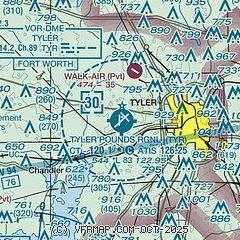
| Sectional chart |
|---|
|
 Download PDF
of official airport diagram from the FAA
| Airport distance calculator |
|---|
|
|
| Sunrise and sunset |
|---|
|
Times for 18-Jun-2026
| | Local
(UTC-5) | | Zulu
(UTC) |
|---|
| Morning civil twilight | | 05:47 | | 10:47 |
| Sunrise | | 06:16 | | 11:16 |
| Sunset | | 20:30 | | 01:30 |
| Evening civil twilight | | 20:58 | | 01:58 |
|
| Current date and time |
|---|
| Zulu (UTC) | 18-Jun-2026 08:11:40 |
|---|
| Local (UTC-5) | 18-Jun-2026 03:11:40 |
|---|
|
| METAR |
|---|
| KTYR | 180753Z AUTO 16006KT 10SM CLR 24/23 A2966 RMK AO2 SLP035 T02390228
|
|
| TAF |
|---|
| KTYR | 180520Z 1806/1906 14006KT P6SM SKC TEMPO 1808/1812 OVC007 FM181500 18007KT P6SM BKN025 FM181800 17008KT P6SM SCT040 FM190000 13006KT P6SM VCSH BKN250
|
|
| NOTAMs |
|---|
NOTAMs are issued by the DoD/FAA and will open in a separate window not controlled by AirNav.
|
|


