FAA INFORMATION EFFECTIVE 14 MAY 2026
Location
| FAA Identifier: | MSY |
| Lat/Long: | 29-59-35.7800N 090-15-32.4990W
29-59.596333N 090-15.541650W
29.9932722,-90.2590275
(estimated) |
| Elevation: | 3 ft. / 0.9 m (surveyed) |
| Variation: | 01W (2020) |
| From city: | 10 miles W of NEW ORLEANS, LA |
| Time zone: | UTC -5 (UTC -6 during Standard Time) |
| Zip code: | 70062 |
Airport Operations
| Airport use: | Open to the public |
| Activation date: | 10/1944 |
| Control tower: | yes |
| ARTCC: | HOUSTON CENTER |
| FSS: | DE RIDDER FLIGHT SERVICE STATION |
| NOTAMs facility: | MSY (NOTAM-D service available) |
| Attendance: | CONTINUOUS |
| Wind indicator: | lighted |
| Segmented circle: | no |
| Lights: | SS-SR |
| Beacon: | white-green (lighted land airport)
Operates sunset to sunrise. |
| Landing fee: | yes |
| Fire and rescue: | ARFF index D |
| International operations: | customs landing rights airport |
Airport Communications
| UNICOM: | 122.95 |
| WX ASOS: | PHONE 504-471-4486 |
| NEW ORLEANS GROUND: | 121.9 273.525 |
| NEW ORLEANS TOWER: | 119.5 254.3 |
| NEW ORLEANS APPROACH: | 125.5 ;WEST 133.15 ;EAST 290.3 ;EAST 350.35 ;WEST 269.2 |
| NEW ORLEANS DEPARTURE: | 125.5 ;WEST 133.15 ;EAST 290.3 ;EAST 350.35 ;WEST |
| CLEARANCE DELIVERY: | 120.925 120.925 |
| PRE-TAXI CLEARANCE: | 120.925 |
| AWDAD STAR: | 125.5 ;WEST 350.35 ;WEST |
| CLASS B: | 123.85 ;SE & SOUTH 125.5 ;WEST 133.15 ;NORTH & EAST 256.9 ;SE & SOUTH 290.3 ;NORTH & EAST 350.35 ;WEST |
| D-ATIS: | 127.55 |
| EMERG: | 121.5 243.0 |
| MNSTR STAR: | 133.15 ;EAST 290.3 ;EAST |
| OLEDD STAR: | 125.5 ;WEST 350.35 ;WEST |
| WX ASOS at NEW (12 nm E): | PHONE 504-245-4366 |
| WX AWOS-3PT at APS (18 nm W): | 125.45 (985-536-1009) |
- ASSC IN USE. OPERATE TRANSPONDERS WITH ALTITUDE REPORTING MODE AND ADS-B (IF EQUIPPED) ENABLED ON ALL AIRPORT SURFACES.
Nearby radio navigation aids
| VOR radial/distance | | VOR name | | Freq | | Var |
|---|
| HRVr301/15.8 | | HARVEY VORTAC | | 114.10 | | 02E |
| RQRr106/18.0 | | RESERVE VOR/DME | | 110.80 | | 02E |
| TBDr054/35.6 | | TIBBY VOR/DME | | 117.15 | | 02E |
Airport Services
| Fuel available: | 100LL JET-A |
| Parking: | tiedowns |
| Airframe service: | NONE |
| Powerplant service: | NONE |
| Bottled oxygen: | NONE |
| Bulk oxygen: | NONE |
Runway Information
Runway 11/29
| Dimensions: | 10104 x 150 ft. / 3080 x 46 m |
| Surface: | concrete/grooved, in good condition |
| Weight bearing capacity: | | Single wheel: | 75.0 | | Double wheel: | 180.0 | | Double tandem: | 380.0 |
|
| Runway edge lights: | high intensity |
| RUNWAY 11 | | RUNWAY 29 |
| Latitude: | 29-59.797617N | | 29-59.352862N |
| Longitude: | 090-16.903723W | | 090-15.058085W |
| Elevation: | 3.0 ft. | | 0.5 ft. |
| Traffic pattern: | left | | left |
| Runway heading: | 106 magnetic, 105 true | | 286 magnetic, 285 true |
| Displaced threshold: | no | | 304 ft. |
| Declared distances: | TORA:10104 TODA:10104 ASDA:9800 LDA:9800 | | TORA:10104 TODA:10104 ASDA:10104 LDA:9800 |
| Markings: | precision, in good condition | | precision, in good condition |
| Visual slope indicator: | 4-light PAPI on right (2.80 degrees glide path) | | 4-light PAPI on right (3.00 degrees glide path) |
| RVR equipment: | touchdown, midfield, rollout | | touchdown, midfield, rollout |
| Approach lights: | ALSF2: standard 2,400 foot high intensity approach lighting system with centerline sequenced flashers (category II or III) | | MALSR: 1,400 foot medium intensity approach lighting system with runway alignment indicator lights |
| Centerline lights: | yes | | yes |
| Touchdown point: | yes, lighted | | yes, no lights |
| Instrument approach: | ILS/DME | | ILS/DME |
| Obstructions: | none | | 53 ft. tree, 1557 ft. from runway, 694 ft. right of centerline, 25:1 slope to clear
+53 FT TREE, 1557 FT DIST, 694 FT R, 30:1 BASED ON DSPLCD THLD. |
Runway 2/20
| Dimensions: | 7002 x 150 ft. / 2134 x 46 m |
| Surface: | concrete/grooved, in good condition |
| Weight bearing capacity: | | Single wheel: | 75.0 | | Double wheel: | 180.0 | | Double tandem: | 380.0 |
|
| Runway edge lights: | high intensity |
| RUNWAY 2 | | RUNWAY 20 |
| Latitude: | 29-59.070077N | | 30-00.183228N |
| Longitude: | 090-15.084915W | | 090-14.730617W |
| Elevation: | 1.3 ft. | | -2.9 ft. |
| Traffic pattern: | left | | left |
| Runway heading: | 016 magnetic, 015 true | | 196 magnetic, 195 true |
| Declared distances: | TORA:7002 TODA:7002 ASDA:7002 LDA:7002 | | TORA:7002 TODA:7002 ASDA:6948 LDA:6948 |
| Markings: | precision, in good condition | | precision, in good condition |
| Visual slope indicator: | 4-light PAPI on left (3.00 degrees glide path) | | 4-light PAPI on left (3.00 degrees glide path) |
| RVR equipment: | touchdown, rollout | | touchdown, rollout |
| Approach lights: | RLLS | | MALS: 1,400 foot medium intensity approach lighting system |
| Centerline lights: | yes | | yes |
| Touchdown point: | yes, no lights | | yes, no lights |
| Instrument approach: | ILS/DME | | LOC/DME |
| Obstructions: | 12 ft. road, lighted, 200 ft. from runway, 365 ft. right of centerline
+12 FT ROAD PARALLEL TO AND 365 FT RIGHT OF CNTRLN 0-200 FT FM RY END. | | 13 ft. road, lighted, 200 ft. from runway, 289 ft. left of centerline
+13 FT ROAD PARALLEL TO AND 289 FT LEFT OF CNTRLN 0-200 FT FM RY END. |
Helipad H1
| Dimensions: | 50 x 50 ft. / 15 x 15 m |
| Surface: | asphalt, in fair condition |
| Latitude: | 29-59.531667N | | |
| Longitude: | 090-16.114000W | | |
| Elevation: | 0.0 ft. | | |
| Traffic pattern: | left | | left |
Helipad H2
| Dimensions: | 50 x 50 ft. / 15 x 15 m |
| Surface: | concrete, in fair condition |
| Latitude: | 29-59.691667N | | |
| Longitude: | 090-15.900167W | | |
| Elevation: | 0.0 ft. | | |
| Traffic pattern: | left | | left |
Airport Ownership and Management from official FAA records
| Ownership: | Publicly-owned |
| Owner: | CITY OF NEW ORLEANS
PO BOX 20007
NEW ORLEANS, LA 70141
Phone 504-658-4900 |
| Manager: | KEVIN DOLLIOLE
PO BOX 20007
NEW ORLEANS, LA 70141
Phone (504) 303-7652 |
Additional Remarks
| A39-11/29 | PCR VALUE: 510/R/B/W/T |
| A39-02/20 | PCR VALUE: 600/R/D/W/T |
| - | 180 DEG & LOCKED WHEEL TURNS PROHIBITED ON ASPH SFC ACFT 12500 LBS & OVER. |
| - | FLOCKS OF BIRDS ON & IN VICINITY OF ARPT. |
| - | RY 11 NOISE SENSITIVE FOR DEP; AVBL FOR OPNL NECESSITY. ALL RYS NOISE SENSITIVE FOR ARR. ARRIVING TURBOJETS MUST MAKE 5 MILE FINAL APCH TO MINIMIZE NOISE. |
| - | TWY G BTN RWY 11/29 AND TWY S SFC MOV GUIDANCE AND CTL SYSTEM U/S PERM |
Instrument Procedures
NOTE: All procedures below are presented as PDF files. If you need a reader for these files, you should download the free Adobe Reader.NOT FOR NAVIGATION. Please procure official charts for flight.
FAA instrument procedures published for use from 14 May 2026 at 0901Z to 11 June 2026 at 0900Z.
STARs - Standard Terminal Arrivals |
|---|
| AWDAD ONE | |
download (210KB) |
| MNSTR TWO (RNAV) **NEW** | |
2 pages:
[1] [2] (343KB) |
| OLEDD FOUR | |
download (150KB) |
| TRSSH TWO (RNAV) **NEW** | |
2 pages:
[1] [2] (298KB) |
| TRSSH TWO (RNAV), CONT.2 **NEW** | |
download (200KB) |
IAPs - Instrument Approach Procedures |
|---|
| ILS OR LOC RWY 02 | |
download (325KB) |
| ILS OR LOC RWY 11 | |
download (354KB) |
| ILS OR LOC RWY 29 | |
download (352KB) |
| ILS RWY 11 (SA CAT I) | |
download (294KB) |
| ILS RWY 11 (CAT II - III) | |
download (338KB) |
| RNAV (RNP) Z RWY 11 | |
download (236KB) |
| RNAV (RNP) Z RWY 20 | |
download (231KB) |
| RNAV (RNP) Z RWY 29 | |
download (225KB) |
| RNAV (GPS) RWY 02 | |
download (266KB) |
| RNAV (GPS) Y RWY 11 | |
download (271KB) |
| RNAV (GPS) Y RWY 20 | |
download (269KB) |
| RNAV (GPS) Y RWY 29 | |
download (278KB) |
| LOC RWY 20 | |
download (235KB) |
| VOR/DME RWY 11 | |
download (259KB) |
| NOTE: Special Take-Off Minimums/Departure Procedures apply | |
download (168KB) |
Other nearby airports with instrument procedures:
KNEW - Lakefront Airport (12 nm E)
KNBG - New Orleans Naval Air Station Joint Reserve Base - Alvin Callender Field (16 nm SE)
KAPS - Port of South Louisiana Executive Regional Airport (18 nm W)
KASD - Slidell Airport (31 nm NE)
KHDC - Hammond Northshore Regional Airport (33 nm N)
|
|

Road maps at:
MapQuest
Bing
Google
| Aerial photo |
|---|
WARNING: Photo may not be current or correct
 Photo by Brandon Echols
Photo taken 10-Apr-2010
Photo by Brandon Echols
Photo taken 10-Apr-2010
Do you have a better or more recent aerial photo of Louis Armstrong New Orleans International Airport that you would like to share? If so, please send us your photo.
|
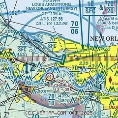
| Sectional chart |
|---|
|
CAUTION: Diagram may not be current
 Download PDF
of official airport diagram from the FAA
| Airport distance calculator |
|---|
|
|
| Sunrise and sunset |
|---|
|
Times for 27-May-2026
| | Local
(UTC-5) | | Zulu
(UTC) |
|---|
| Morning civil twilight | | 05:36 | | 10:36 |
| Sunrise | | 06:03 | | 11:03 |
| Sunset | | 19:54 | | 00:54 |
| Evening civil twilight | | 20:20 | | 01:20 |
|
| Current date and time |
|---|
| Zulu (UTC) | 27-May-2026 21:38:27 |
|---|
| Local (UTC-5) | 27-May-2026 16:38:27 |
|---|
|
| METAR |
|---|
| KMSY | 272053Z 15009G18KT 10SM CLR 30/22 A2991 RMK AO2 SLP131 CB DSNT N-NW T03000217 56011
|
KNEW
12nm E | 272053Z 17012KT 10SM CLR 31/22 A2992 RMK AO1 SLP124 T03060217 56011
|
KNBG
16nm SE | 272055Z 17011KT 10SM SCT025 BKN036 BKN250 29/22 A2991 RMK AO2 SLP128 T02940222 56010
|
KAPS
18nm W | 272115Z AUTO 12013G16KT 10SM SCT031 BKN046 OVC050 30/23 A2990 RMK AO2 T02950225
|
|
| TAF |
|---|
| KMSY | 271720Z 2718/2824 15008KT P6SM FEW023 SCT045 TEMPO 2718/2722 4SM -TSRA BKN023CB FM272200 16007KT P6SM -TSRA FEW021CB SCT090 FM280000 VRB04KT P6SM FEW022 SCT100 PROB30 2800/2804 4SM -TSRA BKN022CB FM280600 00000KT P6SM SCT018 BKN250 PROB30 2815/2818 4SM -TSRA BKN012CB BKN013 FM281800 VRB04KT P6SM TSRA SCT015CB BKN090 FM282000 15005KT P6SM SCT018 BKN100 PROB30 2820/2823 4SM TSRA BKN018CB BKN019 BKN021
|
KNEW
12nm E | 271720Z 2718/2818 14009KT P6SM BKN022 BKN024 TEMPO 2718/2719 4SM -TSRA OVC015CB FM271900 14009KT P6SM SCT017 BKN021 TEMPO 2719/2722 4SM -TSRA BKN017CB BKN021 FM272300 15006KT P6SM -SHRA FEW013 SCT020 PROB30 2723/2724 4SM TSRA BKN013CB FM280000 15005KT P6SM SCT020 BKN100 PROB30 2800/2803 4SM -TSRA BKN020CB FM280300 VRB04KT P6SM BKN006 BKN018 PROB30 2803/2804 4SM -SHRA OVC004 FM281100 00000KT P6SM BKN006 BKN015 PROB30 2811/2817 4SM -TSRA OVC004CB
|
KNBG
16nm SE | 271500Z 2715/2815 15010KT 9999 SCT015 BKN030 BKN250 QNH2997INS BECMG 2716/2718 16010G15KT 9999 VCSH SCT013CB BKN030 OVC150 QNH2991INS TEMPO 2718/2722 VRB20G30KT 3200 -TSRA BR BKN013CB BKN035 BKN100 BECMG 2722/2800 18006KT 9999 VCSH SCT015 BKN030 BKN150 QNH2994INS BECMG 2800/2802 18005KT 9999 NSW SCT013 BKN025 OVC150 QNH2993INS BECMG 2807/2809 19006KT 9999 BKN013CB BKN020 OVC100 QNH2992INS BECMG 2811/2815 VRB25G35KT 1600 TSRA BR BKN010CB OVC020 TX30/2719Z TN23/2810Z COR 1515 FN20040
|
|
| NOTAMs |
|---|
NOTAMs are issued by the DoD/FAA and will open in a separate window not controlled by AirNav.
|
|


