FAA INFORMATION EFFECTIVE 14 MAY 2026
Location
| FAA Identifier: | 6A1 |
| Lat/Long: | 32-34-05.6490N 084-14-48.0750W
32-34.094150N 084-14.801250W
32.5682358,-84.2466875
(estimated) |
| Elevation: | 667 ft. / 203 m (estimated) |
| Variation: | 05W (2020) |
| From city: | 1 mile NW of BUTLER, GA |
| Time zone: | UTC -4 (UTC -5 during Standard Time) |
| Zip code: | 31006 |
Airport Operations
| Airport use: | Open to the public |
| Activation date: | 05/1941 |
| Control tower: | no |
| ARTCC: | ATLANTA CENTER |
| FSS: | MACON FLIGHT SERVICE STATION |
| NOTAMs facility: | MCN (NOTAM-D service available) |
| Attendance: | UNATNDD |
| Wind indicator: | lighted |
| Segmented circle: | yes |
| Lights: | MIRL RWY 01/19 OPER DUSK-2400; AFT 2400 ACTVT - CTAF. PAPI RWY 01 & 19 OPER CONSLY. |
| Beacon: | white-green (lighted land airport)
Operates sunset to sunrise. |
Airport Communications
| CTAF: | 122.9 |
| WX AWOS-3: | 119.525 (478-862-2966) |
| ATLANTA APPROACH: | 124.2 [0645-2300] |
| ATLANTA DEPARTURE: | 124.2 [0645-2300] |
- APCH/DEP SVC PRVDD BY ATLANTA LARGE TRACON 0615-2300; APCH/DEP SVC PRVDD BY ATLANTA ARTCC APCH/DEP SVC 2300-0615 ON FREQS 120.45/298.850 (COLUMBUS RCAG).
Nearby radio navigation aids
| NDB name | | Hdg/Dist | | Freq | | Var | | ID |
|---|
| LINDBERGH | | 347/24.6 | | 242 | | 04W | | LKG | .-.. -.- --. |
| CONEY | | 336/39.4 | | 400 | | 06W | | OHY | --- .... -.-- |
Airport Services
| Fuel available: | 100LL |
| Parking: | tiedowns |
| Airframe service: | MAJOR |
| Powerplant service: | MAJOR |
| Bottled oxygen: | NONE |
| Bulk oxygen: | NONE |
Runway Information
Runway 1/19
| Dimensions: | 5002 x 75 ft. / 1525 x 23 m |
| Surface: | asphalt, in good condition |
| Weight bearing capacity: | |
| Runway edge lights: | medium intensity |
| RUNWAY 1 | | RUNWAY 19 |
| Latitude: | 32-33.773883N | | 32-34.598653N |
| Longitude: | 084-14.710747W | | 084-14.710353W |
| Elevation: | 659.2 ft. | | 620.6 ft. |
| Traffic pattern: | left | | left |
| Runway heading: | 005 magnetic, 000 true | | 185 magnetic, 180 true |
| Markings: | nonprecision, in good condition | | nonprecision, in good condition |
| Visual slope indicator: | 2-light PAPI on left (3.00 degrees glide path) | | 2-light PAPI on left (3.00 degrees glide path) |
| Touchdown point: | yes, no lights | | yes, no lights |
| Obstructions: | 39 ft. trees, 980 ft. from runway, 150 ft. right of centerline, 20:1 slope to clear | | none |
Runway 6/24
| Dimensions: | 2405 x 180 ft. / 733 x 55 m |
| Surface: | turf, in good condition |
| Runway edge markings: | RWY 06/24 ENDS AND EDGES MKD WITH INGROUND CONCRETE PADS. |
| RUNWAY 6 | | RUNWAY 24 |
| Latitude: | 32-33.812000N | | 32-33.993167N |
| Longitude: | 084-15.198167W | | 084-14.781500W |
| Elevation: | 662.0 ft. | | 655.0 ft. |
| Traffic pattern: | left | | left |
| Runway heading: | 068 magnetic, 063 true | | 248 magnetic, 243 true |
| Markings: | NSTD, in fair condition | | NSTD, in fair condition |
| Touchdown point: | yes, no lights | | yes, no lights |
| Obstructions: | 36 ft. trees, 216 ft. from runway, 130 ft. right of centerline, 6:1 slope to clear
RWY 06 APCH RATIO 20:1 TO DSPLCD THLD, 54 FT TREE, 1280 FT FROM DSPLCD THLD, 160 FT RIGHT. | | 56 ft. trees, 728 ft. from runway, 146 ft. left of centerline, 13:1 slope to clear |
Airport Ownership and Management from official FAA records
| Ownership: | Publicly-owned |
| Owner: | TAYLOR COUNTY
BOX 278
BUTLER, GA 31006
Phone 478-862-3336 |
| Manager: | CODY RUSTIN
BOX 553
BUTLER, GA 31006
Phone 478-837-5490 |
Additional Remarks
| - | FOR CD CTC ATLANTA APCH AT 678-364-6132, WHEN APCH CLSD CTC ATLANTA ARTCC AT 770-210-7692. |
Instrument Procedures
NOTE: All procedures below are presented as PDF files. If you need a reader for these files, you should download the free Adobe Reader.NOT FOR NAVIGATION. Please procure official charts for flight.
FAA instrument procedures published for use from 14 May 2026 at 0901Z to 11 June 2026 at 0900Z.
IAPs - Instrument Approach Procedures |
|---|
| RNAV (GPS) RWY 01 | |
download (204KB) |
| RNAV (GPS) RWY 19 | |
download (195KB) |
| NOTE: Special Alternate Minimums apply | |
download (67KB) |
| NOTE: Special Take-Off Minimums/Departure Procedures apply | |
download (407KB) |
Other nearby airports with instrument procedures:
53A - Dr. C P Savage Sr. Airport (20 nm SE)
KOPN - Thomaston-Upson County Airport (23 nm N)
KPXE - Perry-Houston County Airport (24 nm E)
KACJ - Jimmy Carter Regional Airport (28 nm S)
KMCN - Middle Georgia Regional Airport (31 nm E)
|
|

Road maps at:
MapQuest
Bing
Google
| Aerial photo |
|---|
WARNING: Photo may not be current or correct
 Photo courtesy of AirNav, LLC
Photo taken 03-Feb-2013
looking southeast.
Photo courtesy of AirNav, LLC
Photo taken 03-Feb-2013
looking southeast.
Do you have a better or more recent aerial photo of Butler Municipal Airport that you would like to share? If so, please send us your photo.
|
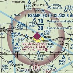
| Sectional chart |
|---|
|
| Airport distance calculator |
|---|
|
|
| Sunrise and sunset |
|---|
|
Times for 23-May-2026
| | Local
(UTC-4) | | Zulu
(UTC) |
|---|
| Morning civil twilight | | 06:07 | | 10:07 |
| Sunrise | | 06:35 | | 10:35 |
| Sunset | | 20:33 | | 00:33 |
| Evening civil twilight | | 21:00 | | 01:00 |
|
| Current date and time |
|---|
| Zulu (UTC) | 23-May-2026 10:24:57 |
|---|
| Local (UTC-4) | 23-May-2026 06:24:57 |
|---|
|
| TAF |
|---|
KMCN
31nm E | 230819Z 2308/2406 VRB03KT P6SM VCSH BKN008 BKN030 TEMPO 2308/2312 4SM -SHRA OVC004 FM231500 VRB03KT P6SM SCT015 FM231800 20004KT P6SM -SHRA BKN035 PROB30 2318/2324 4SM TSRA OVC025CB FM240400 00000KT 5SM BR BKN030
|
KWRB
34nm E | 212340Z 2123/2301 16009KT 9999 VCTS BKN040CB QNH2995INS TEMPO 2200/2203 23015G25KT 8000 -SHRA VCTS BKN030CB BECMG 2202/2203 15006KT 9999 NSW BKN030 QNH2998INS BECMG 2208/2209 17006KT 9999 SCT045 BKN120 QNH2997INS BECMG 2218/2219 16009KT 9999 VCTS BKN035CB QNH2996INS TEMPO 2219/2221 23020G35KT 3200 -TSRA BKN025CB BECMG 2221/2222 15009KT 9999 -SHRA OVC100 QNH2996INS TX31/2123Z TN20/2210Z
|
KCSG
36nm W | 230520Z 2306/2406 00000KT P6SM VCSH SCT015 BKN035 FM230800 00000KT P6SM BKN018 FM231100 00000KT P6SM BKN009 TEMPO 2311/2315 4SM -SHRA OVC004 FM231500 20004KT P6SM BKN015 FM231800 21005KT P6SM -SHRA BKN035 PROB30 2318/2324 4SM -TSRA OVC025CB FM240100 00000KT P6SM BKN070
|
|
| NOTAMs |
|---|
NOTAMs are issued by the DoD/FAA and will open in a separate window not controlled by AirNav.
|
|


