FAA INFORMATION EFFECTIVE 16 APRIL 2026
Location
| FAA Identifier: | GUS |
| Lat/Long: | 40-38-53.1300N 086-09-07.6300W
40-38.885500N 086-09.127167W
40.6480917,-86.1521194
(estimated) |
| Elevation: | 810.6 ft. / 247.1 m (surveyed) |
| Variation: | 02W (1985) |
| From city: | 5 miles S of PERU, IN |
| Time zone: | UTC -4 (UTC -5 during Standard Time) |
| Zip code: | 46914 |
Airport Operations
| Airport use: | Open to the public |
| Activation date: | 02/1944 |
| Control tower: | yes |
| ARTCC: | CHICAGO CENTER |
| FSS: | TERRE HAUTE FLIGHT SERVICE STATION |
| NOTAMs facility: | GUS (NOTAM-D service available) |
| Attendance: | |
| Wind indicator: | yes |
| Segmented circle: | no |
| Beacon: | white-green (lighted land airport)
Operates sunset to sunrise. |
Airport Communications
| ATIS: | 132.55 270.8 |
| GRISSOM GROUND: | 128.425 275.8 [1230-0400Z++, CLSD FED HOLS.] |
| GRISSOM TOWER: | 133.7 290.45 [1230-0400Z++, CLSD FED HOLS.] |
| GRISSOM APPROACH: | 121.05 ;EAST 123.85 ;WEST 291.675 ;WEST 351.8 ;EAST [1230-0400Z++] |
| CHICAGO ARTCC APPROACH: | 135.25 279.575 326.2 |
| GRISSOM DEPARTURE: | 121.05 ;EAST 123.85 ;WEST 291.675 ;WEST 351.8 ;EAST [1230-0400Z++] |
| CHICAGO ARTCC DEPARTURE: | 135.25 279.575 326.2 |
| CLEARANCE DELIVERY: | 128.425 275.8 |
| IC: | 121.05 ;EAST 123.85 ;WEST 291.675 ;WEST 351.8 ;EAST |
| OPS: | 354.2 ;TFW OPS |
| PMSV METRO: | 348.4 |
| PTD: | 372.2 |
| WX AWOS-3PT at OKK (8 nm SE): | 128.675 (765-452-3014) |
| WX AWOS-3P at GGP (11 nm W): | 118.5 (574-737-7310) |
- APCH/DEP SVC PRVDD BY CHICAGO ARTCC ON FREQS 121.05/338.275 EAST (REMOTED FROM GRISSOM) WHEN GRISSOM APCH CTL CLSD.
- TA31 ASR-8/PAR
- ARW COMD POST; CALL BRICKYARD, FONE PATCH 251.1 311.0.
- PMSV; FULL SVC 1200-0400Z.
- (ATIS PHONE NR) C765-688-2293.
Nearby radio navigation aids
| VOR radial/distance | | VOR name | | Freq | | Var |
|---|
| MZZr296/23.5 | | MARION VOR/DME | | 108.60 | | 03W |
Airport Services
| Fuel available: | 100 |
| Parking: | hangars |
| Airframe service: | MAJOR |
| Powerplant service: | MAJOR |
| Bulk oxygen: | HIGH/LOW |
Runway Information
Runway 5/23
| Dimensions: | 12501 x 200 ft. / 3810 x 61 m
50 FT NON WT BRG SHOULDER EA SIDE. |
| Surface: | asphalt |
| Weight bearing capacity: | |
| Runway edge lights: | high intensity |
| RUNWAY 5 | | RUNWAY 23 |
| Latitude: | 40-38.150000N | | 40-39.621000N |
| Longitude: | 086-10.072667W | | 086-08.181667W |
| Elevation: | 808.7 ft. | | 798.6 ft. |
| Traffic pattern: | left | | left |
| Runway heading: | 046 magnetic, 044 true | | 226 magnetic, 224 true |
| Markings: | precision, in fair condition | | precision, in fair condition |
| Visual slope indicator: | 4-light PAPI on left (2.50 degrees glide path) | | 4-light PAPI on left (2.50 degrees glide path) |
| RVR equipment: | touchdown | | touchdown |
| Approach lights: | ALSF1: standard 2,400 foot high intensity approach lighting system with centerline sequenced flashers (category I) | | ALSF1: standard 2,400 foot high intensity approach lighting system with centerline sequenced flashers (category I) |
| Runway end identifier lights: | no | | no |
| Touchdown point: | yes, no lights | | yes, no lights |
| Instrument approach: | ILS | | LOC/GS |
Airport Ownership and Management from official FAA records
| Ownership: | U.S. Air Force |
| Owner: | USAF-RESERVE
434 AERIAL REFUELING WING, 7207 GRISSOM AVE
GRISSOM ARB, IN 46971
Phone 765-688-4340 |
| Manager: | 434 ARW WING COMMANDER
434 AERIAL REFUELING WING, 7207 GRISSOM AVE
GRISSOM ARB, IN 46971
Phone 765-688-2613
765-688-2254. |
Additional Remarks
| - | JASU; A/M32A-86, MD-3, AM32-95 & MA-1A. |
| - | RSTD: PAX/CARGO ACFT CTC COMMAND POST NLT 30 MIN PRIOR TO LNDG. |
| - | BIRD WATCH COND: MNT ATIS; PHASE I NOV-APR & JUN LGT; PHASE II MAY, JUL-OCT HVY. |
| - | CTN: UNCTLD VEHICLE ON MOVEMENT AREAS. |
| - | SVC LGT - FLOODS. |
| - | FLUID: SP PRESAIR LHOX. |
| - | OIL: O-133-148-156 JOAP. |
| - | TRANS ALERT: AVBL DURG OPS HRS; NO PRIORITY BASIS; SVC AVBL PRIOR ARNG; FLEET SVC NA. |
| - | MISC: WX SVC AVBL DURG OPS HR - D388-2203/2204; C765-688-2203/2204. |
| - | CTN: DURG RAIN EXP STANDING WATER ON RWY. |
| - | GA PRAC APCH NA, ALFD IS OFFL BUS ONLY DUR HOTPIT REFUELING. |
| - | FBO E END; PRIOR PMSN NOT RQR FOR ACFT LDG CIV FBO; CTC TWR; EXP TAXI INSTR; 100LL & JET A AVBL. |
| - | CIV TRNG NA PER JOINT USE AGREEMENT. |
| - | PPR FOR CIV ACFT ON MIL RAMP. |
| - | SUA OVHD & NW; HVY & FIGHTER JET TRNG RMN NW WI 10 NM. |
| - | EXP DELAY WHEN TACTICAL ARR & DEP TRNG IN PROG & DURG SNOW REMOVAL OPS. |
| - | FOR RAPCON SVC - 121.05 OR 379.3 |
| - | CTN: RWY LGTS 28 FT FM EDGE. |
| - | FUEL: MIL 1200-0400Z++; CLSD FEDERAL HOL. |
| - | OPR 1230-0400Z++; CLSD FEDERAL HOL; FBO CLSD FRI 2200Z THRU MON 1230Z; PPR - AFLD OPS D388-2254/C765-688-2254. |
| - | RWY COND CODES UNAVBL. |
| - | RSTD: AFRC ACFT EXP RSTRN WHEN MOD OR HIGHER; NO LCL IFR/VFR TFC; OPS NA WO OG/CC APVL. |
Instrument Procedures
NOTE: All procedures below are presented as PDF files. If you need a reader for these files, you should download the free Adobe Reader.NOT FOR NAVIGATION. Please procure official charts for flight.
FAA instrument procedures published for use from 16 April 2026 at 0901Z to 14 May 2026 at 0900Z.
IAPs - Instrument Approach Procedures |
|---|
| ILS OR LOC RWY 05 | |
download (134KB) |
| ILS OR LOC RWY 23 | |
download (130KB) |
| RNAV (GPS) RWY 05 | |
download (85KB) |
| RNAV (GPS) RWY 23 | |
download (86KB) |
| TACAN OR VOR RWY 05 | |
download (121KB) |
| TACAN OR VOR RWY 23 | |
download (122KB) |
Other nearby airports with instrument procedures:
I76 - Peru Municipal Airport (8 nm N)
KOKK - Kokomo Municipal Airport (8 nm SE)
KGGP - Logansport/Cass County Airport (11 nm W)
KIWH - Wabash Municipal Airport (17 nm NE)
KMZZ - Marion Municipal Airport - McKinney Field (24 nm SE)
|
|

Road maps at:
MapQuest
Bing
Google
| Aerial photo |
|---|
WARNING: Photo may not be current or correct
 Photo taken 01-Aug-2006
from a Cessna 340
Photo taken 01-Aug-2006
from a Cessna 340
Do you have a better or more recent aerial photo of Grissom Air Reserve Base that you would like to share? If so, please send us your photo.
|
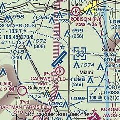
| Sectional chart |
|---|
|
 Download PDF
of official airport diagram from the FAA
| Airport distance calculator |
|---|
|
|
| Sunrise and sunset |
|---|
|
Times for 22-Apr-2026
| | Local
(UTC-4) | | Zulu
(UTC) |
|---|
| Morning civil twilight | | 06:28 | | 10:28 |
| Sunrise | | 06:57 | | 10:57 |
| Sunset | | 20:30 | | 00:30 |
| Evening civil twilight | | 20:59 | | 00:59 |
|
| Current date and time |
|---|
| Zulu (UTC) | 22-Apr-2026 11:56:50 |
|---|
| Local (UTC-4) | 22-Apr-2026 07:56:50 |
|---|
|
| METAR |
|---|
| KGUS | 221055Z AUTO 24009KT 10SM CLR 14/09 A2995 RMK AO2 LTG DSNT SE SLP142 T01370091 $
|
KOKK
8nm SE | 221056Z AUTO 25010KT 10SM CLR 14/10 A2999 RMK AO2 SLP151 T01440100 $
|
KGGP
11nm W | 221136Z AUTO 23007KT 10SM CLR 13/09 A2999 RMK AO2
|
|
| TAF |
|---|
| KGUS | 220020Z 2200/2303 23020G30KT 9000 -SHRA BKN030 BKN080 510005 QNH2987INS TEMPO 2200/2203 VRB15G25KT 6000 -TSRA BKN018CB OVC030 BECMG 2208/2209 23008KT 9999 NSW OVC015 QNH2988INS BECMG 2210/2211 VRB06KT 4800 BR OVC010 QNH2990INS BECMG 2214/2215 27008KT 9999 NSW BKN025 OVC120 QNH2998INS TX24/2221Z TN12/2213Z LAST NO AMDS AFT 2203 NEXT 2213
|
|
| NOTAMs |
|---|
NOTAMs are issued by the DoD/FAA and will open in a separate window not controlled by AirNav.
|
|


