FAA INFORMATION EFFECTIVE 10 JULY 2025
Location
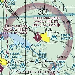
| FAA Identifier: | PEA |
| Lat/Long: | 41-24-04.4000N 092-56-45.1000W
41-24.073333N 092-56.751667W
41.4012222,-92.9458611
(estimated) |
| Elevation: | 884.8 ft. / 269.7 m (surveyed) |
| Variation: | 02E (2000) |
| From city: | 1 mile W of PELLA, IA |
| Time zone: | UTC -5 (UTC -6 during Standard Time) |
| Zip code: | 50219 |
Airport Operations
| Airport use: | Open to the public |
| Activation date: | 01/1968 |
| Control tower: | no |
| ARTCC: | MINNEAPOLIS CENTER |
| FSS: | FORT DODGE FLIGHT SERVICE STATION |
| NOTAMs facility: | PEA (NOTAM-D service available) |
| Attendance: | MON-SAT 0700-DUSK, ALL SUN 0900-1700
AFTER HRS CALL 641-780-0244. |
| Pattern altitude: | 1700.8 ft. MSL
ONLY APPLIES TO NON-TURBINE ACFT. |
| Wind indicator: | lighted |
| Segmented circle: | no |
| Lights: | MIRL RWY 16/34 PRESET LOW INTST; TO INCREASE INTST AND ACTVT PAPI RWY 16 & 34; REIL RWYS 16 & 34 - CTAF. |
| Beacon: | white-green (lighted land airport)
Operates sunset to sunrise. |
Airport Communications
| CTAF/UNICOM: | 122.8 |
| WX AWOS-3: | 118.875 (641-628-3459) |
| DES MOINES APPROACH: | 123.9 |
| DES MOINES DEPARTURE: | 123.9 |
| WX AWOS-3 at OXV (10 nm SW): | 119.775 (641-828-8406) |
| WX AWOS-3 at TNU (17 nm N): | 132.275 (641-791-3302) |
Nearby radio navigation aids
| VOR radial/distance | | VOR name | | Freq | | Var |
|---|
| TNUr159/24.1 | | NEWTON VOR/DME | | 112.50 | | 03E |
| DSMr087/31.7 | | DES MOINES VORTAC | | 117.50 | | 07E |
Airport Services
| Fuel available: | 100LL JET-A |
| Parking: | hangars and tiedowns |
| Airframe service: | MAJOR |
| Powerplant service: | MAJOR |
Runway Information
Runway 16/34
| Dimensions: | 5403 x 75 ft. / 1647 x 23 m |
| Surface: | concrete, in fair condition |
| Weight bearing capacity: | | PCN 8 /R/D/W/T | | Single wheel: | 30.0 | | Double wheel: | 40.0 |
|
| Runway edge lights: | medium intensity |
| RUNWAY 16 | | RUNWAY 34 |
| Latitude: | 41-24.507313N | | 41-23.639008N |
| Longitude: | 092-56.879908W | | 092-56.623452W |
| Elevation: | 884.8 ft. | | 869.6 ft. |
| Traffic pattern: | left | | left |
| Runway heading: | 165 magnetic, 167 true | | 345 magnetic, 347 true |
| Displaced threshold: | 200 ft. | | 201 ft. |
| Declared distances: | TORA:5400 TODA:5400 ASDA:5200 LDA:5000 | | TORA:5400 TODA:5400 ASDA:5200 LDA:5000 |
| Markings: | nonprecision, in fair condition | | nonprecision, in fair condition |
| Visual slope indicator: | 2-light PAPI on left (3.30 degrees glide path) | | 2-light PAPI on left (3.00 degrees glide path) |
| Runway end identifier lights: | yes | | yes |
| Touchdown point: | yes, no lights | | yes, no lights |
| Obstructions: | 32 ft. tree, 527 ft. from runway, 191 ft. left of centerline, 10:1 slope to clear
RWY 16 APCH SLP TO DTHR 22:1. | | 31 ft. trees, 474 ft. from runway, 188 ft. left of centerline, 8:1 slope to clear
RWY 34 APCH SLP TO DTHR 21:1. |
Airport Ownership and Management from official FAA records
| Ownership: | Publicly-owned |
| Owner: | CITY OF PELLA
717 MAIN
PELLA, IA 50219
Phone 641-628-4173 |
| Manager: | SHANE VANDEVOORT
501 WEST 15TH STREET
PELLA, IA 50219
Phone 641-628-9393
CELL PHONE 641-780-0244 |
Additional Remarks
| - | FOR CD CTC DES MOINES ATCT AT 515-974-8016. |
Instrument Procedures
NOTE: All procedures below are presented as PDF files. If you need a reader for these files, you should download the free Adobe Reader.NOT FOR NAVIGATION. Please procure official charts for flight.
FAA instrument procedures published for use from 10 July 2025 at 0901Z to 07 August 2025 at 0900z.
IAPs - Instrument Approach Procedures |
|---|
| RNAV (GPS) RWY 16 | |
download (231KB) |
| RNAV (GPS) RWY 34 | |
download (205KB) |
| NOTE: Special Alternate Minimums apply | |
download (146KB) |
| NOTE: Special Take-Off Minimums/Departure Procedures apply | |
download (158KB) |
Other nearby airports with instrument procedures:
KOXV - Knoxville Municipal Airport (10 nm SW)
KTNU - Newton Municipal Airport-Earl Johnson Field (17 nm N)
KGGI - Grinnell Regional Airport (21 nm NE)
KOOA - Oskaloosa Municipal Airport (23 nm SE)
4C8 - Albia Municipal Airport (26 nm S)
|
|

Road maps at:
MapQuest
Bing
Google
| Aerial photo |
|---|
WARNING: Photo may not be current or correct

Do you have a better or more recent aerial photo of Pella Municipal Airport that you would like to share? If so, please send us your photo.
|
| Sectional chart |
|---|
|
| Airport distance calculator |
|---|
|
|
| Sunrise and sunset |
|---|
|
Times for 01-Aug-2025
| | Local
(UTC-5) | | Zulu
(UTC) |
|---|
| Morning civil twilight | | 05:37 | | 10:37 |
| Sunrise | | 06:08 | | 11:08 |
| Sunset | | 20:28 | | 01:28 |
| Evening civil twilight | | 21:00 | | 02:00 |
|
| Current date and time |
|---|
| Zulu (UTC) | 01-Aug-2025 07:03:07 |
|---|
| Local (UTC-5) | 01-Aug-2025 02:03:07 |
|---|
|
| METAR |
|---|
| KPEA | 010655Z AUTO 36004KT 4SM BR CLR 15/14 A3034 RMK AO2 T01470137
|
KOXV
10nm SW | 010655Z AUTO 02004KT 7SM CLR 17/14 A3033 RMK AO2
|
KTNU
16nm N | 010655Z AUTO 04005KT 6SM BR CLR 16/14 A3034 RMK A01
|
|
| TAF |
|---|
KOTM
29nm SE | 010520Z 0106/0206 03005KT 5SM FU BKN045 OVC100
|
KDSM
33nm W | 010520Z 0106/0206 05004KT 5SM FU FEW040 SCT100
|
|
| NOTAMs |
|---|
NOTAMs are issued by the DoD/FAA and will open in a separate window not controlled by AirNav.
|
|


