FAA INFORMATION EFFECTIVE 09 JULY 2026
Location
| FAA Identifier: | PIT |
| Lat/Long: | 40-29-29.1000N 080-13-57.7000W
40-29.485000N 080-13.961667W
40.4914167,-80.2326944
(estimated) |
| Elevation: | 1202.9 ft. / 366.6 m (surveyed) |
| Variation: | 09W (2020) |
| From city: | 12 miles NW of PITTSBURGH, PA |
| Time zone: | UTC -4 (UTC -5 during Standard Time) |
| Zip code: | 15231 |
Airport Operations
| Airport use: | Open to the public |
| Activation date: | 03/1944 |
| Control tower: | yes |
| ARTCC: | CLEVELAND CENTER |
| FSS: | ALTOONA FLIGHT SERVICE STATION |
| NOTAMs facility: | PIT (NOTAM-D service available) |
| Attendance: | CONTINUOUS |
| Wind indicator: | lighted |
| Segmented circle: | no |
| Beacon: | white-green (lighted land airport)
Operates sunset to sunrise. |
| Landing fee: | yes |
| Fire and rescue: | ARFF index D |
| International operations: | customs landing rights airport |
Airport Communications
| UNICOM: | 122.95 |
| WX ASOS: | PHONE 215-798-0218 |
| PITTSBURGH GROUND: | 121.9 ;SOUTH 127.8 ;NORTH 348.6 |
| PITTSBURGH TOWER: | 128.3 291.7 |
| PITTSBURGH APPROACH: | 121.25 ;271-360 123.95 ;091-180 124.15 ;001-090 133.7 ;181-270 279.625 ;270-089 336.2 360.8 ;090-269 |
| PITTSBURGH DEPARTURE: | 119.35 ;SOUTH 124.75 ;NORTH 285.575 ;090-269 336.2 338.2 ;NORTH 125.275 |
| CLEARANCE DELIVERY: | 126.75 353.7 |
| PRE-TAXI CLEARANCE: | 126.75 |
| ANG OPS: | 311.0 |
| CLASS B: | 121.25 ;271-360 123.95 ;091-180 124.15 ;001-090 133.7 ;181-270 279.625 ;270-089 360.8 ;090-269 |
| COMD POST: | 252.1 |
| D-ATIS: | 127.25 ;ARR 135.9 ;DEP |
| EMERG: | 121.5 243.0 |
| IC: | 123.95 ;091-180 |
| OPS: | 36.35FM |
| WX AWOS-A at 42PN (11 nm E): | PHONE 412-442-2213 |
| WX ASOS at AGC (16 nm SE): | 120.55 (412-466-8968) |
| WX AWOS-3PT at BVI (18 nm NW): | 118.35 (724-843-1024) |
| WX AWOS-3PT at PJC (19 nm N): | 118.45 (724-452-5304) |
- CALL IRON CITY COMMAND POST PRIOR TO ENTRY SOUTH RAMP.
- ASSC IN USE. OPERATE TRANSPONDERS WITH ALTITUDE REPORTING MODE AND ADS-B (IF EQUIPPED) ENABLED ON ALL AIRPORT SURFACES.
Nearby radio navigation aids
| VOR radial/distance | | VOR name | | Freq | | Var |
|---|
| AGCr335/15.5 | | ALLEGHENY VOR/DME | | 110.00 | | 09W |
| EWCr191/20.0 | | ELLWOOD CITY VOR/DME | | 115.80 | | 08W |
| HLGr055/20.7 | | WHEELING VOR/DME | | 114.25 | | 07W |
| AIRr050/39.1 | | BELLAIRE VOR/DME | | 117.10 | | 07W |
| NDB name | | Hdg/Dist | | Freq | | Var | | ID |
|---|
| CASTLE | | 174/33.0 | | 272 | | 09W | | UCP | ..- -.-. .--. |
| CADIZ | | 074/38.8 | | 239 | | 07W | | CFX | -.-. ..-. -..- |
Airport Services
| Fuel available: | 100LL JET-A
100LL:LOX SOAP (AVBL DURG ANG DUTY HOURS ONLY. 30 MIN PRIOR NOTICE RQRD.). |
| Parking: | hangars and tiedowns |
| Airframe service: | MINOR |
| Powerplant service: | MINOR |
| Bottled oxygen: | NONE |
| Bulk oxygen: | NONE |
Runway Information
Runway 10R/28L
| Dimensions: | 11500 x 200 ft. / 3505 x 61 m |
| Surface: | concrete/grooved, in good condition |
| Weight bearing capacity: | | Single wheel: | 100.0 | | Double wheel: | 225.0 | | Double tandem: | 350.0 |
|
| Runway edge lights: | high intensity |
| RUNWAY 10R | | RUNWAY 28L |
| Latitude: | 40-29.203748N | | 40-29.138730N |
| Longitude: | 080-15.114280W | | 080-12.635415W |
| Elevation: | 1134.8 ft. | | 1121.9 ft. |
| Traffic pattern: | left | | left |
| Runway heading: | 101 magnetic, 092 true | | 281 magnetic, 272 true |
| Declared distances: | TORA:11500 TODA:11500 ASDA:11492 LDA:11492 | | TORA:11500 TODA:11500 ASDA:11500 LDA:11500 |
| Markings: | precision, in good condition | | precision, in good condition |
| Visual slope indicator: | 4-light PAPI on left (3.00 degrees glide path) | | 4-light PAPI on left (3.00 degrees glide path) |
| RVR equipment: | touchdown, midfield, rollout | | touchdown, midfield, rollout |
| Approach lights: | ALSF2: standard 2,400 foot high intensity approach lighting system with centerline sequenced flashers (category II or III) | | MALSR: 1,400 foot medium intensity approach lighting system with runway alignment indicator lights |
| Centerline lights: | yes | | yes |
| Touchdown point: | yes, lighted | | yes, lighted |
| Instrument approach: | ILS | | ILS |
| Obstructions: | 92 ft. trees, 3890 ft. from runway, 930 ft. left of centerline, 40:1 slope to clear | | 154 ft. trees, 4954 ft. from runway, 348 ft. left of centerline, 30:1 slope to clear |
Runway 10C/28C
| Dimensions: | 10775 x 150 ft. / 3284 x 46 m |
| Surface: | asphalt/concrete/grooved, in fair condition |
| Weight bearing capacity: | | Single wheel: | 100.0 | | Double wheel: | 149.0 | | Double tandem: | 260.0 |
|
| Runway edge lights: | high intensity |
| RUNWAY 10C | | RUNWAY 28C |
| Latitude: | 40-29.394982N | | 40-29.334032N |
| Longitude: | 080-14.875792W | | 080-12.552923W |
| Elevation: | 1140.2 ft. | | 1136.6 ft. |
| Traffic pattern: | left | | left |
| Runway heading: | 101 magnetic, 092 true | | 281 magnetic, 272 true |
| Displaced threshold: | 465 ft. | | 602 ft. |
| Declared distances: | TORA:10775 TODA:10775 ASDA:10173 LDA:9708 | | TORA:10775 TODA:10775 ASDA:10310 LDA:9708 |
| Markings: | precision, in good condition | | precision, in good condition |
| Visual slope indicator: | 4-light PAPI on left (3.00 degrees glide path) | | 4-light PAPI on left (3.00 degrees glide path) |
| RVR equipment: | touchdown, midfield, rollout | | touchdown, midfield, rollout |
| Runway end identifier lights: | yes | | |
| Centerline lights: | yes | | yes |
| Touchdown point: | yes, no lights | | yes, lighted |
| Obstructions: | none | | 58 ft. trees, 2100 ft. from runway, 402 ft. right of centerline, 32:1 slope to clear |
Runway 10L/28R
| Dimensions: | 10502 x 150 ft. / 3201 x 46 m |
| Surface: | asphalt/concrete/grooved, in good condition |
| Weight bearing capacity: | | Single wheel: | 100.0 | | Double wheel: | 225.0 | | Double tandem: | 400.0 |
|
| Runway edge lights: | high intensity |
| RUNWAY 10L | | RUNWAY 28R |
| Latitude: | 40-30.140020N | | 40-30.081112N |
| Longitude: | 080-16.271145W | | 080-14.006747W |
| Elevation: | 1202.9 ft. | | 1174.1 ft. |
| Traffic pattern: | left | | left |
| Runway heading: | 101 magnetic, 092 true | | 281 magnetic, 272 true |
| Declared distances: | TORA:10502 TODA:10502 ASDA:10502 LDA:10502 | | TORA:10502 TODA:10502 ASDA:10102 LDA:10102 |
| Markings: | precision, in good condition | | precision, in good condition |
| Visual slope indicator: | 4-light PAPI on left (3.00 degrees glide path) | | 4-light PAPI on left (3.00 degrees glide path) |
| RVR equipment: | touchdown, midfield, rollout | | touchdown, midfield, rollout |
| Approach lights: | ALSF2: standard 2,400 foot high intensity approach lighting system with centerline sequenced flashers (category II or III)
ALSF2/SSALR IS A DUAL MODE SYSTEM & CONTROLLED BY ATCT & REMOTE MONITORED. | | MALSR: 1,400 foot medium intensity approach lighting system with runway alignment indicator lights |
| Centerline lights: | yes | | yes |
| Touchdown point: | yes, lighted | | yes, lighted |
| Instrument approach: | ILS | | ILS |
| Obstructions: | none | | 107 ft. ant, 4165 ft. from runway, 909 ft. right of centerline, 37:1 slope to clear |
Runway 14/32
| Dimensions: | 8101 x 150 ft. / 2469 x 46 m |
| Surface: | concrete/grooved, in good condition |
| Weight bearing capacity: | | Single wheel: | 100.0 | | Double wheel: | 225.0 | | Double tandem: | 410.0 |
|
| Runway edge lights: | high intensity |
| RUNWAY 14 | | RUNWAY 32 |
| Latitude: | 40-29.760907N | | 40-28.794833N |
| Longitude: | 080-13.491978W | | 080-12.286972W |
| Elevation: | 1147.6 ft. | | 1113.4 ft. |
| Traffic pattern: | left | | left |
| Runway heading: | 145 magnetic, 136 true | | 325 magnetic, 316 true |
| Displaced threshold: | no | | 335 ft. |
| Declared distances: | TORA:8101 TODA:8101 ASDA:7366 LDA:7366 | | TORA:8101 TODA:8101 ASDA:7801 LDA:7466 |
| Markings: | precision, in good condition | | precision, in good condition |
| Visual slope indicator: | 4-light PAPI on left (3.00 degrees glide path) | | 4-light PAPI on left (3.00 degrees glide path) |
| RVR equipment: | touchdown, midfield, rollout | | touchdown, midfield, rollout |
| Approach lights: | | | MALS: 1,400 foot medium intensity approach lighting system |
| Centerline lights: | yes | | yes |
| Touchdown point: | yes, no lights | | yes, lighted |
| Instrument approach: | | | ILS/DME |
| Obstructions: | 24 ft. pole, 451 ft. from runway, 510 ft. left of centerline, 10:1 slope to clear | | 42 ft. trees, 1653 ft. from runway, 679 ft. left of centerline, 34:1 slope to clear |
Airport Ownership and Management from official FAA records
| Ownership: | Publicly-owned |
| Owner: | ALLEGHENY CO ARPT AUTHORITY
PO BOX 12370, SUITE. 4000
PITTSBURGH, PA 15231-0370
Phone 412-472-3500 |
| Manager: | CHRISTINA A. CASSOTIS
PO BOX 12370, SUITE 4000
PITTSBURGH, PA 15231-0370
Phone (412) 472-3509 |
Additional Remarks
| A39-10L/28R | PCR VALUE: 980/R/A/W/T |
| A39-14/32 | PCR VALUE: 835/R/A/W/T |
| A39-10C/28C | PCR VALUE: 804/R/A/W/T |
| A39-10R/28L | PCR VALUE: 980/R/A/W/T |
| - | DEER & BIRDS ON & INVOF ARPT. |
| - | ATCT IS AUTHORIZED TO HAVE ACFT LINE-UP & WAIT ON RYS 28L AT TWY 'P' DURG HRS OF DARKNESS. THE SPECIFIC RY SHALL BE USED ONLY FOR DEPARTURES & THE INTXN MUST BE VSB FM ATCT. |
| - | SERVICE-JASU: (ANG) (A/M32A-86) (AM 32-95; (AFRC - 2(A/M32-86 (AM32-95). |
| - | SERVICE-FLUID: LPOX LHNIT. |
| - | SERVICE-OIL: O-156. |
| - | SERVICE-TRAN ALERT: NO PRIORITY BASIS. |
| - | ANG: OPR 1130-2030Z++MON-FRI EXCP HOL. (CLSD EV OTH MON). NSTD PAVEMENT MARKINGS ON ANG RAMP. NO TRAN DE-ICE CAPABILITY ON ANG RAMP. |
| - | TWY G INTXN AT RY 10L/28R RIGHT TURN NA. |
| - | FUEL: A++ PROVIDED BY ANG AND AFRC.(MIL). |
| - | ACFT USING TWY 'N' PROHIBITED TO STOP ON OVERPASS AREA DUE TO POSSIBLE EMERGENCY EVACUATION HAZARD. |
| - | PPR/OFFL BUS MIN 48 HR CTC AFLD MGMT DSN 277 8163, C412 474 8163. LTD TRAN SVC. AFLD MGT NML DUTY HRS 1300 0100++ MON, WED, FRI, 1300-0500++ TUE, THU, EXC HOL. UNIT TRAINING ASSEMBLY 1300 2100Z++SAT. TRAN ACFT MUST HAVE APPVL OF 911OG/CC FOR PPR DUR OFF DUTY HR. NO SVC AVBL FOR SPACE AVBL PAX DUR OFF DUTY HR. CALL PITT COMD POST (IRON CITY) BY RDO 15 MIN PRIOR TO ARRIVAL. ALFD MGMT DOES NOT ISSUE OR STOR COMSEC. COMSEC STOR CTC COMD POST DSN 277 8146. |
| - | TWY AA NO TURN-OFF ONTO TWY A FOR ACFT WINGSPAN 171 FT OR GREATER EXC PPR (412) 472-5630. |
| - | MILITARY: CAUTION: BASH PHASE II OPS IN EFFECT 1 JUL - 30 SEP ANNUALLY. UNLESS MSN REQUIREMENTS DIRECT OTHERWISE, FLIGHTS SHOULD NOT BE SKED WITHIN +/-1HR OF SS/SR. TRAN AIRCREW SHOULD REQ BIRD WATCH COND FR AFRC (PITT OPS) ON 252.1 OR ANG OPS (STEEL CTL) ON 311.0. AIRCREW WILL BE INFORMED BY STEEL CONTROL OR PITT OPS (AS APPLICABLE) IF CURRENT BWC IS OTHER THAN LOW REGARDLESS OF BASH PHASE. RSTD - NO HAZ CL/DIV 1.1 EXPLOSIVES PERMITTED. |
| - | TRML APN UNCONTROLLED. PUSHBACK PILOT DESCRETION. DO NOT EXIT TRML APN AT TWY C1, C4, V3, V4, D1, W. CTC GC WHEN HLDG AT TWY C2, C3, V1, V2, V5, V6, D2, D3. |
| - | LDG FEE. |
| - | PUSHBACK CLNC REQUIRED FR GATES A100 AND A101 AT CARGO A. CTC GC. PUSHBACK FM THESE GATES ENTERS TWY N. |
| - | TWY Z BTN TWY P AND HANGAR 7 APRON RSTRD TO ACFT WINGSPAN 118 FT OR LESS. |
| - | ANG ACFT MUST CTC TANKER 303.0/FTR OPNS 293.7 BEFORE CROSSING RWY 28L TO OBTAIN CLNC TO ENTER. |
| - | TERML TAXILANES E OF CONCOURSES A & B RESTRD TO GROUP 3 ACFT & SMALLER. |
Instrument Procedures
NOTE: All procedures below are presented as PDF files. If you need a reader for these files, you should download the free Adobe Reader.NOT FOR NAVIGATION. Please procure official charts for flight.
FAA instrument procedures published for use from 09 July 2026 at 0901Z to 06 August 2026 at 0900Z.
STARs - Standard Terminal Arrivals |
|---|
| DEMME FIVE (RNAV) **NEW** | |
download (205KB) |
| FEWGA SEVEN (RNAV) **NEW** | |
download (253KB) |
| HAYNZ SEVEN (RNAV) **NEW** | |
download (204KB) |
| JESEY FIVE (RNAV) **NEW** | |
download (186KB) |
IAPs - Instrument Approach Procedures |
|---|
| ILS OR LOC RWY 10L | |
download (302KB) |
| ILS OR LOC RWY 10R | |
download (308KB) |
| ILS OR LOC RWY 28L | |
download (330KB) |
| ILS OR LOC RWY 28R | |
download (327KB) |
| ILS OR LOC RWY 32 | |
download (326KB) |
| ILS RWY 10R (SA CAT I) | |
download (263KB) |
| ILS RWY 28R (SA CAT I - II) | |
download (315KB) |
| ILS RWY 10L (CAT II - III) | |
download (288KB) |
| ILS RWY 10R (CAT II - III) | |
download (262KB) |
| RNAV (RNP) Z RWY 10C | |
download (213KB) |
| RNAV (RNP) Z RWY 10R | |
download (232KB) |
| RNAV (RNP) Z RWY 28C | |
download (246KB) |
| RNAV (RNP) Z RWY 28L | |
download (249KB) |
| RNAV (RNP) Z RWY 28R | |
download (230KB) |
| RNAV (RNP) Z RWY 32 | |
download (227KB) |
| RNAV (GPS) RWY 10L | |
download (265KB) |
| RNAV (GPS) RWY 14 | |
download (235KB) |
| RNAV (GPS) Y RWY 10C | |
download (251KB) |
| RNAV (GPS) Y RWY 10R | |
download (255KB) |
| RNAV (GPS) Y RWY 28C | |
download (290KB) |
| RNAV (GPS) Y RWY 28L | |
download (281KB) |
| RNAV (GPS) Y RWY 28R | |
download (264KB) |
| RNAV (GPS) Y RWY 32 | |
download (279KB) |
| NOTE: Special Alternate Minimums apply | |
download (147KB) |
Departure Procedures |
|---|
| PITTSBURGH FIVE | |
download (239KB) |
| NOTE: Special Take-Off Minimums/Departure Procedures apply | |
download (227KB) |
Other nearby airports with instrument procedures:
KAGC - Allegheny County Airport (16 nm SE)
G05 - Finleyville Airpark (18 nm SE)
KBVI - Beaver County Airport (18 nm NW)
KPJC - Zelienople Municipal Airport (19 nm N)
KBTP - Pittsburgh/Butler Regional Airport (21 nm NE)
|
|

Road maps at:
MapQuest
Bing
Google
| Aerial photo |
|---|
WARNING: Photo may not be current or correct
 Photo by Steve Kalasky
Taken in October 2009
looking northwest.
Photo by Steve Kalasky
Taken in October 2009
looking northwest.
Do you have a better or more recent aerial photo of Pittsburgh International Airport that you would like to share? If so, please send us your photo.
|
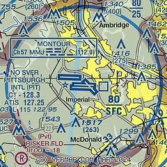
| Sectional chart |
|---|
|
 Download PDF
of official airport diagram from the FAA
| Airport distance calculator |
|---|
|
|
| Sunrise and sunset |
|---|
|
Times for 29-Jul-2026
| | Local
(UTC-4) | | Zulu
(UTC) |
|---|
| Morning civil twilight | | 05:45 | | 09:45 |
| Sunrise | | 06:16 | | 10:16 |
| Sunset | | 20:38 | | 00:38 |
| Evening civil twilight | | 21:09 | | 01:09 |
|
| Current date and time |
|---|
| Zulu (UTC) | 30-Jul-2026 00:04:34 |
|---|
| Local (UTC-4) | 29-Jul-2026 20:04:34 |
|---|
|
| METAR |
|---|
KPIT
2nm W | 292351Z 32013KT 10SM SCT050 24/13 A2988 RMK AO2 SLP117 T02390133 10261 20233 53010
|
KAGC
17nm SE | 292353Z 32009G17KT 10SM SCT043 BKN055 OVC070 23/14 A2987 RMK AO2 SLP110 T02280144 10256 20228 53010
|
KBVI
18nm NW | 292355Z AUTO 35003KT 10SM CLR 24/13 A2990 RMK AO2 T02410128
|
|
| TAF |
|---|
KPIT
2nm W | 292102Z 2921/3024 33012G20KT P6SM BKN080 FM300100 33007KT P6SM SCT250 FM301600 34009G17KT P6SM SCT250
|
KAGC
17nm SE | 291720Z 2918/3018 33009G18KT P6SM BKN040 FM300100 32006KT P6SM SKC FM301500 34009G17KT P6SM SCT250
|
KBVI
18nm NW | 291720Z 2918/3018 32008KT P6SM SCT020 BKN040 FM300000 32003KT P6SM SKC FM301500 34009G17KT P6SM SCT250
|
|
| NOTAMs |
|---|
NOTAMs are issued by the DoD/FAA and will open in a separate window not controlled by AirNav.
|
|


