FAA INFORMATION EFFECTIVE 07 AUGUST 2025
Location
| FAA Identifier: | PVG |
| Lat/Long: | 36-46-50.7533N 076-27-04.6093W
36-46.845888N 076-27.076822W
36.7807648,-76.4512804
(estimated) |
| Elevation: | 28 ft. / 8.5 m (surveyed) |
| Variation: | 10W (2000) |
| From city: | 7 miles SW of NORFOLK, VA |
| Time zone: | UTC -4 (UTC -5 during Standard Time) |
| Zip code: | 23321 |
Airport Operations
| Airport use: | Open to the public |
| Control tower: | no |
| ARTCC: | WASHINGTON CENTER |
| FSS: | LEESBURG FLIGHT SERVICE STATION |
| NOTAMs facility: | DCA (NOTAM-D service available) |
| Attendance: | 0630 - 2130 |
| Pattern altitude: | TPA 677 FT AGL FOR HELICOPTERS. |
| Wind indicator: | lighted |
| Segmented circle: | no |
| Lights: | ACTVT REIL RWY 10 & 28; PAPI RWY 10 & 28; MIRL RWY 02/20; HIRL RWY 10/28 - CTAF. |
| Beacon: | white-green (lighted land airport)
Operates sunset to sunrise. |
Airport Communications
| CTAF/UNICOM: | 122.725 |
| WX AWOS-3PT: | 118.375 (757-465-2175) |
| NORFOLK APPROACH: | 118.9 125.2 |
| NORFOLK DEPARTURE: | 118.9 125.2 |
| DRONE STAR: | 118.9 |
| TERKS STAR: | 118.9 |
| WX AWOS-3 at SFQ (9 nm SW): | 119.375 (757-934-3942) |
| WX AWOS-3 at CPK (9 nm SE): | 123.675 (757-204-4290) |
| WX ASOS at ORF (14 nm NE): | PHONE 276-200-0952 |
Nearby radio navigation aids
| VOR radial/distance | | VOR name | | Freq | | Var |
|---|
| ORFr248/13.8 | | NORFOLK VORTAC | | 116.90 | | 07W |
| CVIr049/31.8 | | COFIELD VORTAC | | 114.60 | | 09W |
| ECGr344/34.1 | | ELIZABETH CITY VOR/DME | | 115.75 | | 07W |
| NDB name | | Hdg/Dist | | Freq | | Var | | ID |
|---|
| WAKEFIELD | | 126/29.0 | | 274 | | 11W | | AKQ | .- -.- --.- |
| WOODVILLE | | 357/31.9 | | 254 | | 10W | | LLW | .-.. .-.. .-- |
Airport Services
| Fuel available: | 100LL JET-A+ |
| Parking: | hangars and tiedowns |
| Airframe service: | MAJOR |
| Powerplant service: | MAJOR |
| Bottled oxygen: | NONE |
| Bulk oxygen: | NONE |
Runway Information
Runway 10/28
| Dimensions: | 5350 x 100 ft. / 1631 x 30 m |
| Surface: | asphalt/grooved, in good condition |
| Weight bearing capacity: | |
| Runway edge lights: | high intensity |
| RUNWAY 10 | | RUNWAY 28 |
| Latitude: | 36-46.850430N | | 36-46.813307N |
| Longitude: | 076-27.728995W | | 076-26.633872W |
| Elevation: | 27.9 ft. | | 23.1 ft. |
| Traffic pattern: | right
FIXED WING ACFT. | | left |
| Runway heading: | 102 magnetic, 092 true | | 282 magnetic, 272 true |
| Markings: | precision, in good condition | | nonprecision, in good condition |
| Visual slope indicator: | 4-light PAPI on left (3.00 degrees glide path) | | 4-light PAPI on left (3.00 degrees glide path) |
| Runway end identifier lights: | yes | | yes |
| Touchdown point: | yes, no lights | | yes, no lights |
| Instrument approach: | ILS/DME | | |
| Obstructions: | 31 ft. tree, 1424 ft. from runway, 232 ft. right of centerline, 39:1 slope to clear | | 100 ft. tree, 2430 ft. from runway, 271 ft. right of centerline, 22:1 slope to clear
BRUSH LCTD APRXLY 240 FT FM CNTRLN. |
Runway 2/20
| Dimensions: | 3525 x 70 ft. / 1074 x 21 m |
| Surface: | asphalt, in poor condition
RWY HAS NMRS CRACKS. TWYS SUPPORTING RWY HAVE NMRS CRACKS AND FOD POTENTIAL. |
| Weight bearing capacity: | |
| Runway edge lights: | medium intensity |
| RUNWAY 2 | | RUNWAY 20 |
| Latitude: | 36-46.580053N | | 36-47.154263N |
| Longitude: | 076-26.972608W | | 076-26.863460W |
| Elevation: | 21.2 ft. | | 19.6 ft. |
| Traffic pattern: | left | | right
FIXED WING ACFT. |
| Runway heading: | 019 magnetic, 009 true | | 199 magnetic, 189 true |
| Displaced threshold: | 898 ft. | | 928 ft. |
| Markings: | nonprecision, in fair condition | | nonprecision, in fair condition |
| Touchdown point: | yes, no lights | | yes, no lights |
| Obstructions: | 10 ft. road, 244 ft. from runway, 125 ft. right of centerline, 4:1 slope to clear
APCH RATIO 94:1 TO DSPLCD THR (ROAD); APCH RATIO 22:1 TO DSPLCD THR FM 70 FT TREE 883 FT FM RWY END, 189 FT LEFT. | | 63 ft. trees, 1541 ft. from runway, 201 ft. right of centerline, 21:1 slope to clear
APCH RATIO 22:1 TO DSPLCD THR CTLG OBST; APCH RATIO 21:1 TO DSPLCD THR FM 104 FT TREE 1505 FT FM RWY END, 108 FT RIGHT. |
Airport Ownership and Management from official FAA records
| Ownership: | Privately-owned |
| Owner: | VIRGINIA AVIATION ASSOCIATES, L.L.C
5172 W. MILITARY HWY, SUITE A
CHESAPEAKE, VA 23321
Phone 757-465-0260 |
| Manager: | STEVE FOX
5172 W. MILITARY HWY
CHESAPEAKE, VA 23321
Phone 757-465-0260
STEVEN I. FOX AUTH PSNAL TO MAKE CHGS 757-465-0260. |
Additional Remarks
| - | DEER ON & INVOF ARPT. |
| - | EXTENSIVE HELICOPTER TRAINING. |
| - | RWY 10/28 PREFERRED USE RWY. BE ALERT FOR MULTIPLE 1000 FT AGL TWRS 1.5 NM NW OF FLD. |
| - | FOR CD CTC NORFOLK APCH AT 757-464-0757. |
Instrument Procedures
NOTE: All procedures below are presented as PDF files. If you need a reader for these files, you should download the free Adobe Reader.NOT FOR NAVIGATION. Please procure official charts for flight.
FAA instrument procedures published for use from 07 August 2025 at 0901Z to 04 September 2025 at 0900z.
STARs - Standard Terminal Arrivals |
|---|
| DRONE TWO | |
2 pages:
[1] [2] (267KB) |
| TERKS TWO | |
download (168KB) |
IAPs - Instrument Approach Procedures |
|---|
| ILS OR LOC RWY 10 | |
download (276KB) |
| RNAV (GPS) RWY 10 | |
download (226KB) |
| RNAV (GPS) RWY 28 | |
download (186KB) |
| NOTE: Special Alternate Minimums apply | |
download (144KB) |
| NOTE: Special Take-Off Minimums/Departure Procedures apply | |
download (357KB) |
Other nearby airports with instrument procedures:
KSFQ - Suffolk Executive Airport (9 nm SW)
KCPK - Chesapeake Regional Airport (9 nm SE)
KNGU - Norfolk Naval Station (Chambers Field) (12 nm NE)
KNHU - Norfolk Naval Station Airport (13 nm NE)
KORF - Norfolk International Airport (14 nm NE)
KLFI - Langley Air Force Base (19 nm N)
|
|

Road maps at:
MapQuest
Bing
Google
| Aerial photo |
|---|
WARNING: Photo may not be current or correct
 Photo taken 07-Mar-2016
looking east.
Photo taken 07-Mar-2016
looking east.
Do you have a better or more recent aerial photo of Hampton Roads Executive Airport that you would like to share? If so, please send us your photo.
|
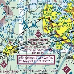
| Sectional chart |
|---|
|
CAUTION: Diagram may not be current

| Airport distance calculator |
|---|
|
|
| Sunrise and sunset |
|---|
|
Times for 21-Aug-2025
| | Local
(UTC-4) | | Zulu
(UTC) |
|---|
| Morning civil twilight | | 06:02 | | 10:02 |
| Sunrise | | 06:29 | | 10:29 |
| Sunset | | 19:49 | | 23:49 |
| Evening civil twilight | | 20:16 | | 00:16 |
|
| Current date and time |
|---|
| Zulu (UTC) | 21-Aug-2025 18:57:51 |
|---|
| Local (UTC-4) | 21-Aug-2025 14:57:51 |
|---|
|
| METAR |
|---|
| KPVG | 211855Z 34006KT 10SM OVC017 23/22 A2982 RMK AO2 SLP298 PWINO FZRANO RVRNO
|
KSFQ
9nm SW | 211855Z AUTO 24/21 A2982 RMK AO2 T02380207 PWINO TSNO
|
KCPK
9nm SE | 211855Z AUTO 35010G16KT 7SM RA OVC016 23/20 A2980 RMK AO2 T02300204
|
KNGU
12nm NE | 211759Z 36020G29KT 6SM -RA BKN016 OVC023 24/21 A2980 RMK AO2 PK WND 36030/1731 RAB50 SLP092 P0000 60000 T02390206 10250 20233 53005
|
KORF
14nm NE | 211851Z 36018G32KT 10SM SCT016 BKN023 OVC029 24/21 A2979 RMK AO2 PK WND 02036/1824 SLP087 T02390211
|
KNFE
16nm E | 211758Z AUTO 36011G25KT 9SM OVC017 24/21 A2977 RMK AO2 PK WND 35026/1731 RAB02E19 SLP082 P0000 60000 T02390211 10256 20239 53008
|
KLFI
18nm N | 211825Z 01013G23KT 10SM OVC014 23/20 A2980 RMK AO2A DZB15E25 SLP097 $
|
|
| TAF |
|---|
KNGU
12nm NE | 2115/2215 01020G28KT 9999 SCT015 BKN025 BKN250 580009 580909 QNH2974INS TEMPO 2115/2121 03022G34KT 8000 SHRA OVC010 FM212100 01020G30KT 9999 SCT025 BKN040 BKN250 580009 580909 QNH2978INS TEMPO 2121/2201 8000 SHRA BKN025 OVC040 FM220100 01015G25KT 9999 SCT040 BKN250 540009 QNH2985INS FM220800 01012KT 9999 FEW040 SCT250 500000 QNH2991INS TX27/2119Z TN21/2209Z FN20067
|
KORF
14nm NE | 211720Z 2118/2218 36021G33KT P6SM VCSH OVC012 FM220000 36016G24KT P6SM OVC020 FM220600 01011KT P6SM BKN030 FM220900 01011KT P6SM BKN040 FM221200 02010KT P6SM SCT200
|
KLFI
18nm N | 211805Z 2118/2223 02018G30KT 9999 OVC013 530001 550109 551009 QNH2970INS TEMPO 2118/2120 6000 -RA BECMG 2119/2120 01015G25KT 9999 BKN010 OVC015 530001 550109 QNH2970INS BECMG 2202/2203 02015G25KT 9999 BKN015 OVC020 530002 QNH2975INS BECMG 2209/2210 01012KT 9999 BKN020 QNH2989INS TX28/2217Z TN24/2118Z LAST NO AMDS AFT 2118 NEXT 2509
|
|
| NOTAMs |
|---|
NOTAMs are issued by the DoD/FAA and will open in a separate window not controlled by AirNav.
|
|


