FAA INFORMATION EFFECTIVE 16 APRIL 2026
Location
| FAA Identifier: | OAK |
| Lat/Long: | 37-43-16.5410N 122-13-16.1420W
37-43.275683N 122-13.269033W
37.7212614,-122.2211506
(estimated) |
| Elevation: | 9 ft. / 2.7 m (surveyed) |
| Variation: | 14E (2015) |
| From city: | 4 miles S of OAKLAND, CA |
| Time zone: | UTC -7 (UTC -8 during Standard Time) |
| Zip code: | 94502 |
Airport Operations
| Airport use: | Open to the public |
| Activation date: | 04/1940 |
| Control tower: | yes |
| ARTCC: | OAKLAND CENTER |
| FSS: | OAKLAND FLIGHT SERVICE STATION |
| NOTAMs facility: | OAK (NOTAM-D service available) |
| Attendance: | CONTINUOUS |
| Pattern altitude: | TFC PAT ALT RWY 28L 606' MSL; RWY 28R 1006' MSL. |
| Wind indicator: | lighted |
| Segmented circle: | no |
| Beacon: | white-green (lighted land airport)
Operates sunset to sunrise. |
| Landing fee: | yes, LDG FEE IN EFCT 24 HRS/DAY, CTC AIRFIELD OPS (510) 563-3361. |
| Fire and rescue: | ARFF index D |
| International operations: | customs landing rights airport |
Airport Communications
| UNICOM: | 122.95 |
| WX ASOS: | PHONE 510-214-1776 |
| OAKLAND GROUND: | 121.75 ;RWY 12/30 121.9 ;RWY 10L/28R, 10R/28L, 15/33 |
| OAKLAND TOWER: | 118.3 ;RWY 10L/28R, 10R/28L, 15/33 127.2 ;RWY 12/30 256.9 ;RWY 12/30 291.65 ;RWY 10L/28R, 10R/28L, 15/33 124.9 |
| NORCAL APPROACH: | 125.35 ;EAST 125.35 ;RWY 28L/R 128.325 135.1 ;WEST 133.95 134.5 |
| NORCAL DEPARTURE: | 120.9 ;NW 135.1 ;WEST |
| CLEARANCE DELIVERY: | 121.1 |
| AANET STAR: | 125.35 |
| CLASS C: | 120.9 ;NW 125.35 ;EAST 127.0 ;NORTH 133.95 ;SOUTH 135.1 ;WEST |
| CNDEL DP: | 135.1 |
| COAST DP: | 135.1 |
| D-ATIS: | 133.775 |
| EMERG: | 243.0 |
| EMZOH STAR: | 124.525 |
| HUSSH DP: | 120.9 |
| IC: | 125.35 ;EAST 125.35 ;RWY 28L/R |
| KATFH DP: | 135.1 |
| MARINA DP: | 120.9 |
| NIMITZ DP: | 127.0 |
| NUEVO DP: | 135.1 |
| OAKES STAR: | 124.8 |
| OAKLAND DP: | 120.9 |
| PANOCHE STAR: | 124.525 |
| QUAKE DP: | 135.1 |
| SALAD DP: | 120.9 |
| SCAGGS ISLAND DP: | 120.9 |
| SILENT DP: | 120.9 |
| SKYLINE DP: | 135.1 |
| SUNNE DP: | 135.1 |
| WNDSR STAR: | 120.9 |
| WX ASOS at HWD (6 nm SE): | PHONE 510-786-3052 |
| WX AWOS-AV at 18CN (8 nm W): | 119.925 (415-514-4209) |
| WX ASOS at SFO (10 nm SW): | PHONE 650-250-5841 |
| WX AWOS-3P at SQL (13 nm S): | 125.9 (650-593-0613) |
| WX ASOS at CCR (18 nm NE): | PHONE 925-689-2077 |
| WX AWOS-3 at HAF (18 nm SW): | 127.275 (650-728-5649) |
| WX ASOS at LVK (19 nm E): | PHONE 925-606-5412 |
- MASTER (NCT) ARPT PRVDS CLASS B SVC FOR SAN FRANCISCO INTL.
- FREQ 121.5/243.0 NOT AVBL AT ATCT.
- SAID IN USE. OPERATE TRANSPONDERS WITH ALTITUDE REPORTING MODE AND ADS-B (IF EQUIPPED) ENABLED ON ALL AIRPORT SURFACES.
Nearby radio navigation aids
| VOR radial/distance | | VOR name | | Freq | | Var |
|---|
| OAK at field | | OAKLAND VOR/DME | | 116.80 | | 17E |
| SFOr033/9.5 | | SAN FRANCISCO VOR/DME | | 115.80 | | 17E |
| SAUr102/16.4 | | SAUSALITO VOR/DME | | 116.20 | | 17E |
| OSIr351/19.9 | | WOODSIDE VOR/DME | | 113.90 | | 17E |
| CCRr186/21.1 | | CONCORD VOR/DME | | 117.00 | | 17E |
| SJCr312/24.6 | | SAN JOSE VOR/DME | | 114.10 | | 16E |
| SGDr148/28.4 | | SCAGGS ISLAND VORTAC | | 112.10 | | 17E |
| PYEr108/37.4 | | POINT REYES VOR/DME | | 113.70 | | 17E |
Airport Services
| Fuel available: | 100LL JET-A |
| Parking: | tiedowns |
| Airframe service: | MAJOR |
| Powerplant service: | MAJOR |
| Bottled oxygen: | HIGH/LOW |
| Bulk oxygen: | HIGH/LOW |
Runway Information
Runway 12/30
| Dimensions: | 10520 x 150 ft. / 3206 x 46 m |
| Surface: | asphalt/grooved, in good condition |
| Weight bearing capacity: | | Single wheel: | 120.0 | | Double wheel: | 250.0 | | Double tandem: | 550.0 | | Dual double tandem: | 1120.0 |
|
| Runway edge lights: | high intensity |
| RUNWAY 12 | | RUNWAY 30 |
| Latitude: | 37-43.203757N | | 37-42.089592N |
| Longitude: | 122-14.526907W | | 122-12.855478W |
| Elevation: | 8.3 ft. | | 9.0 ft. |
| Traffic pattern: | right | | left |
| Runway heading: | 116 magnetic, 130 true | | 296 magnetic, 310 true |
| Displaced threshold: | no | | 114 ft. |
| Declared distances: | TORA:10000 TODA:10000 ASDA:10000 LDA:10000 | | TORA:10000 TODA:10000 ASDA:10000 LDA:10000 |
| Markings: | precision, in good condition | | precision, in good condition |
| Visual slope indicator: | 4-light PAPI on right (2.75 degrees glide path) | | 4-light PAPI on left (3.00 degrees glide path) |
| RVR equipment: | touchdown, midfield, rollout | | touchdown, midfield, rollout |
| Approach lights: | MALSR: 1,400 foot medium intensity approach lighting system with runway alignment indicator lights | | ALSF2: standard 2,400 foot high intensity approach lighting system with centerline sequenced flashers (category II or III) |
| Runway end identifier lights: | no | | no |
| Centerline lights: | yes | | yes |
| Touchdown point: | yes, no lights | | yes, lighted |
| Instrument approach: | ILS | | ILS/DME |
Runway 10R/28L
| Dimensions: | 6213 x 150 ft. / 1894 x 46 m |
| Surface: | asphalt/grooved, in good condition |
| Weight bearing capacity: | | Single wheel: | 120.0 | | Double wheel: | 250.0 | | Double tandem: | 550.0 | | Dual double tandem: | 1120.0 |
|
| Runway edge lights: | high intensity |
| RUNWAY 10R | | RUNWAY 28L |
| Latitude: | 37-43.722493N | | 37-43.336432N |
| Longitude: | 122-13.554145W | | 122-12.360558W |
| Elevation: | 8.0 ft. | | 8.2 ft. |
| Traffic pattern: | left | | left |
| Runway heading: | 098 magnetic, 112 true | | 278 magnetic, 292 true |
| Declared distances: | TORA:6213 TODA:6213 ASDA:6213 LDA:6213 | | TORA:6213 TODA:6213 ASDA:6213 LDA:6213 |
| Markings: | nonprecision, in good condition | | precision, in good condition |
| Visual slope indicator: | 4-light PAPI on left (3.00 degrees glide path) | | 4-light PAPI on right (3.00 degrees glide path) |
| Runway end identifier lights: | yes | | no |
| Touchdown point: | yes, no lights | | yes, no lights |
Runway 10L/28R
| Dimensions: | 5457 x 150 ft. / 1663 x 46 m |
| Surface: | asphalt/grooved, in good condition |
| Weight bearing capacity: | | Single wheel: | 120.0 | | Double wheel: | 250.0 | | Double tandem: | 550.0 | | Dual double tandem: | 1120.0 |
|
| Runway edge lights: | high intensity |
| RUNWAY 10L | | RUNWAY 28R |
| Latitude: | 37-43.828153N | | 37-43.488873N |
| Longitude: | 122-13.330803W | | 122-12.282523W |
| Elevation: | 5.5 ft. | | 5.8 ft. |
| Traffic pattern: | left | | right |
| Runway heading: | 098 magnetic, 112 true | | 278 magnetic, 292 true |
| Declared distances: | TORA:5457 TODA:5457 ASDA:5336 LDA:5336 | | TORA:5457 TODA:5457 ASDA:5457 LDA:5457 |
| Markings: | nonprecision, in good condition | | precision, in good condition |
| Visual slope indicator: | 4-light PAPI on right (3.00 degrees glide path) | | 4-light PAPI on left (3.00 degrees glide path) |
| RVR equipment: | rollout | | touchdown |
| Approach lights: | | | MALSR: 1,400 foot medium intensity approach lighting system with runway alignment indicator lights |
| Runway end identifier lights: | no | | no |
| Touchdown point: | yes, no lights | | yes, no lights |
| Instrument approach: | | | ILS |
| Obstructions: | none | | 11 ft. bldg, lighted, 530 ft. from runway, 480 ft. right of centerline, 30:1 slope to clear |
Runway 15/33
| Dimensions: | 3376 x 75 ft. / 1029 x 23 m |
| Surface: | asphalt, in good condition |
| Weight bearing capacity: | | Single wheel: | 12.5 | | Double wheel: | 65.0 | | Double tandem: | 100.0 |
|
| Runway edge lights: | medium intensity |
| Operational restrictions: | RWY 15/33 NOT AVBL FOR PART 121/PART 380 OPS WITH SKED PAX CARRYING OPS MORE THAN 9 PAX SEATS AND NON-SKED PAX CARRYING OPS MORE THAN 30 PAX SEATS. |
| RUNWAY 15 | | RUNWAY 33 |
| Latitude: | 37-44.417557N | | 37-43.881765N |
| Longitude: | 122-13.368568W | | 122-13.180435W |
| Elevation: | 1.4 ft. | | 3.9 ft. |
| Traffic pattern: | left | | right |
| Runway heading: | 150 magnetic, 164 true | | 330 magnetic, 344 true |
| Markings: | basic, in good condition | | basic, in good condition |
| Runway end identifier lights: | no | | no |
| Touchdown point: | yes, no lights | | yes, no lights |
Airport Ownership and Management from official FAA records
| Ownership: | Publicly-owned |
| Owner: | PORT OF OAKLAND
530 WATER ST.
OAKLAND, CA 94607
Phone 510-563-3300 |
| Manager: | MATT DAVIS
OAKLAND INTL ARPT, 1 AIRPORT DRIVE
OAKLAND, CA 94621
Phone 510-563-6436
OPERATIONS - DARRON EVANS, OPNS SUPERINTENDENT (510)563-6432, CELL: (510) 715-6286 24HR OPERATIONS (510) 563-3361. |
Additional Remarks
| A39-10L/28R | PCR VALUE: 1266/F/B/X/T |
| A39-12/30 | PCR VALUE: 1295/F/B/X/T |
| A39-10R/28L | PCR VALUE: 934/F/B/X/T |
| E60-28L | ENGINEERED MATERIALS ARRESTING SYSTEM (EMAS) 162 FT IN LENGTH BY 154 FT IN WIDTH LCTD AT THE DER 28L. |
| - | BIRDS ON & INVOF ARPT. |
| - | RWYS 30, 28R AND RWY 28L DIST RMNG SIGNS L SIDE. |
| - | FOR NOISE ABATEMENT INFO CTC NOISE ABATEMENT OFC AT (510) 563-6463. |
| - | 24 HR NOISE ABATEMENT PROC: TBJT AND TURBOFAN PWRD ACFT, TURBOROPS OVER 17000 LBS, FOUR-ENG RECIPROCATING PWRD ACFT, AND SURPLUS MIL ACFT OVER 12500 LBS SHOULD USE RWY 12/30. |
| - | TWY A, E, G, H BTN RWY 28R AND TWY C MAX ACFT WT 150,000 LBS. |
| - | TWY G & H BTN RWY 28L & 28R: MAX ACFT WT 12,500 LBS. |
| - | TWY P MAX ACFT WT 116,000 LBS SINGLE; 190,000 LBS DUAL; 305,000 LBS DUAL TANDEM; 735,000 LBS DOUBLE DUAL TANDEM. |
| - | TWY C BTN RWY 28R & TWY G AND TWYS B, J, AND D MAX ACFT WT 861,000 LBS. |
| - | TWY C BTN TWY G & J MAX ACFT WEIGHT 90,000 LBS SINGLE; 144,000 LBS DUAL; 257,000 LBS TANDEM. |
| - | TWY C BTN TWY J & F MAX ACFT WEIGHT 76,000 LBS SINGLE; 115,000 LBS DUAL; 257,000 LBS TANDEM (DUAL TANDEM NA). |
| - | TWY K BTN TWY D & INT TWYS F, L, K MAX ACFT WEIGHT 56,000 LBS SINGLE; 70,000 LBS DUAL; 130,000 LBS TANDEM. |
| - | TWY K BTN TWY J AND INT TWYS F, L, K MAX ACFT WT 33000 LBS SINGLE; 45000 LBS DUAL; TANDEM NA. |
| - | 400 FT BY 220 FT BLAST PAD RWY 12 AND RWY 30. |
| - | UNDERLIES CLASS B ASP, BE AWARE OF SPEEDS ON ARR AND DEP. |
| - | NOISE ABATEMENT PROCS N/A IN EMERGS OR WHENEVER RWY 12/30 IS UNAVBL DUE TO MAINT, SAFETY, WINDS OR WX. |
| - | ACFT WITH EXPERIMENTAL OR LTD CERTIF HAVING OVER 1000 HORSEPOWER OR 4000 LBS ARE RSTRD TO RWY 12/30. |
| - | 100 FT LGTD MICROWAVE ANT TWR LCTD 1320 FT WSW OF OAK VORTAC; S OF UPWIND END OF RWY 28L. |
Instrument Procedures
NOTE: All procedures below are presented as PDF files. If you need a reader for these files, you should download the free Adobe Reader.NOT FOR NAVIGATION. Please procure official charts for flight.
FAA instrument procedures published for use from 16 April 2026 at 0901Z to 14 May 2026 at 0900Z.
STARs - Standard Terminal Arrivals |
|---|
| AANET ONE (RNAV) | |
download (170KB) |
| EMZOH FOUR (RNAV) | |
2 pages:
[1] [2] (401KB) |
| OAKES THREE (RNAV) | |
2 pages:
[1] [2] (449KB) |
| PANOCHE SIX | |
download (194KB) |
| PIRAT THREE (RNAV) | |
download (242KB) |
| WNDSR TWO (RNAV) | |
download (243KB) |
IAPs - Instrument Approach Procedures |
|---|
| ILS OR LOC RWY 12 | |
download (283KB) |
| ILS OR LOC RWY 28R | |
download (322KB) |
| ILS OR LOC RWY 30 | |
download (294KB) |
| ILS RWY 12 (SA CAT I) | |
download (271KB) |
| ILS RWY 30 (SA CAT I) | |
download (290KB) |
| ILS RWY 30 (CAT II - III) | |
download (301KB) |
| RNAV (RNP) Z RWY 12 | |
download (253KB) |
| RNAV (RNP) Z RWY 28L | |
download (239KB) |
| RNAV (RNP) Z RWY 28R | |
download (248KB) |
| RNAV (RNP) Z RWY 30 | |
download (265KB) |
| RNAV (GPS) RWY 10L | |
download (228KB) |
| RNAV (GPS) RWY 10R | |
download (215KB) |
| RNAV (GPS) Y RWY 12 | |
download (238KB) |
| RNAV (GPS) Y RWY 28L | |
download (256KB) |
| RNAV (GPS) Y RWY 28R | |
download (265KB) |
| RNAV (GPS) Y RWY 30 | |
download (264KB) |
| VOR RWY 10R | |
download (259KB) |
| NOTE: Special Alternate Minimums apply | |
download (139KB) |
Departure Procedures |
|---|
| CNDEL FIVE (RNAV) | |
download (231KB) |
| COAST NINE | |
2 pages:
[1] [2] (404KB) |
| HUSSH TWO (RNAV) | |
download (216KB) |
| KATFH THREE (RNAV) | |
download (225KB) |
| NIMITZ FIVE | |
download (171KB) |
| NUEVO EIGHT | |
2 pages:
[1] [2] (330KB) |
| OAKLAND SIX | |
2 pages:
[1] [2] (359KB) |
| QUAKE TWO | |
download (188KB) |
| SALAD FIVE | |
download (168KB) |
| SILENT THREE | |
2 pages:
[1] [2] (304KB) |
| SKYLINE ONE | |
2 pages:
[1] [2] (422KB) |
| SUNNE ONE | |
download (109KB) |
| NOTE: Special Take-Off Minimums/Departure Procedures apply | |
download (363KB) |
Other nearby airports with instrument procedures:
KHWD - Hayward Executive Airport (6 nm SE)
KSFO - San Francisco International Airport (10 nm SW)
KSQL - San Carlos Airport (13 nm S)
KPAO - Palo Alto Airport (16 nm S)
KCCR - Buchanan Field Airport (18 nm NE)
KHAF - Half Moon Bay Airport (18 nm SW)
KLVK - Livermore Municipal Airport (19 nm E)
|
|

Road maps at:
MapQuest
Bing
Google
| Aerial photo |
|---|
WARNING: Photo may not be current or correct

Do you have a better or more recent aerial photo of Oakland San Francisco Bay Airport that you would like to share? If so, please send us your photo.
|
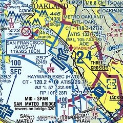
| Sectional chart |
|---|
|
CAUTION: Diagram may not be current
 Download PDF
of official airport diagram from the FAA
| Airport distance calculator |
|---|
|
|
| Sunrise and sunset |
|---|
|
Times for 30-Apr-2026
| | Local
(UTC-7) | | Zulu
(UTC) |
|---|
| Morning civil twilight | | 05:47 | | 12:47 |
| Sunrise | | 06:15 | | 13:15 |
| Sunset | | 19:57 | | 02:57 |
| Evening civil twilight | | 20:25 | | 03:25 |
|
| Current date and time |
|---|
| Zulu (UTC) | 30-Apr-2026 20:51:36 |
|---|
| Local (UTC-7) | 30-Apr-2026 13:51:36 |
|---|
|
| METAR |
|---|
| KOAK | 301953Z 29008KT 10SM FEW015 17/11 A2998 RMK AO2 SLP153 T01720106
|
KHWD
6nm SE | 301954Z 10SM CLR 18/11 A2997 RMK AO2 SLP159 T01780111
|
KSFO
9nm SW | 301956Z 29015KT 10SM FEW006 19/11 A2997 RMK AO2 SLP150 T01890106
|
KSQL
12nm S | 301355Z AUTO 00000KT 7SM BKN012 11/09 A2999 RMK A01
|
KPAO
16nm S | 301947Z 35008KT 10SM SKC 17/12 A2998
|
KHAF
18nm SW | 302035Z AUTO 32007G13KT 5SM BR OVC013 14/12 A3001 RMK AO2
|
KLVK
19nm E | 301953Z 29005KT 10SM CLR 22/11 A2994 RMK AO2 SLP136 T02220106
|
|
| TAF |
|---|
| KOAK | 301730Z 3018/0124 24007KT P6SM SKC FM302200 27012KT P6SM SKC FM010500 27006KT P6SM BKN015 FM010800 26005KT P6SM OVC007 FM011700 25006KT P6SM BKN013 FM011900 28009KT P6SM SKC
|
KSFO
9nm SW | 301756Z 3018/0124 26010KT P6SM FEW007 FM302100 27015KT P6SM SKC FM010300 28011KT P6SM SCT015 FM010900 27005KT P6SM OVC010 FM011400 28006KT P6SM FEW007 SCT013 FM011900 27010KT P6SM SKC
|
KHAF
18nm SW | 301720Z 3018/0118 30004KT 5SM BR OVC013 FM302200 31012KT 6SM BR SCT003 BKN007 FM010400 30004KT 1/2SM FG OVC003 FM011500 29004KT 4SM BR OVC007
|
KLVK
19nm E | 301720Z 3018/0118 VRB04KT P6SM FEW012 FM302100 29015KT P6SM SKC FM010400 30005KT P6SM SKC FM010900 VRB03KT P6SM SCT012 TEMPO 0112/0116 BKN012
|
|
| NOTAMs |
|---|
NOTAMs are issued by the DoD/FAA and will open in a separate window not controlled by AirNav.
|
|


