FAA INFORMATION EFFECTIVE 22 JANUARY 2026
Location
| FAA Identifier: | GFL |
| Lat/Long: | 43-20-28.4000N 073-36-37.1000W
43-20.473333N 073-36.618333W
43.3412222,-73.6103056
(estimated) |
| Elevation: | 328.4 ft. / 100.1 m (surveyed) |
| Variation: | 14W (1980) |
| From city: | 3 miles NE of GLENS FALLS, NY |
| Time zone: | UTC -5 (UTC -4 during Daylight Saving Time) |
| Zip code: | 12804 |
Airport Operations
| Airport use: | Open to the public |
| Activation date: | 11/1942 |
| Control tower: | no |
| ARTCC: | BOSTON CENTER |
| FSS: | BURLINGTON FLIGHT SERVICE STATION |
| NOTAMs facility: | GFL (NOTAM-D service available) |
| Attendance: | 0800-1800 |
| Wind indicator: | lighted |
| Segmented circle: | no |
| Lights: | ACTVT MALSR RWY 01; PAPI RWY 01, 19, 12, 30; HIRL RWY 01/19; MIRL RWY 12/30; TWY LGTS - CTAF. |
| Beacon: | white-green (lighted land airport)
Operates sunset to sunrise. |
| Fire and rescue: | ARFF index A |
| Airline operations: | PPR 48 HRS FOR ACFT OPS WITH MORE THAN 30 PAX SEATS CALL AMGR 518-792-5995. |
| International operations: | customs landing rights airport |
Airport Communications
| CTAF/UNICOM: | 123.0 |
| WX ASOS: | 119.925 (518-743-1728) |
| ALBANY APPROACH: | 132.825 |
| ALBANY DEPARTURE: | 132.825 |
Nearby radio navigation aids
| VOR radial/distance | | VOR name | | Freq | | Var |
|---|
| CAMr345/23.9 | | CAMBRIDGE VOR/DME | | 115.00 | | 14W |
| ALBr026/36.6 | | ALBANY VORTAC | | 115.30 | | 13W |
| NDB name | | Hdg/Dist | | Freq | | Var | | ID |
|---|
| GANSE | | 011/5.2 | | 209 | | 14W | | GF | --. ..-. |
| HUNTER | | 040/32.5 | | 356 | | 14W | | HEU | .... . ..- |
| SMUTO | | 247/35.9 | | 221 | | 15W | | DYO | -.. -.-- --- |
| JOHNSTOWN | | 071/37.6 | | 523 | | 14W | | JJH | .--- .--- .... |
Airport Services
| Fuel available: | 100LL JET-A
100LL:SELF-SERVICE 100LL FUEL AVBL. FULL SERVICE FUELING AVBL AFTER HRS BY PRE-ARRANGEMENT; CALL 518-798-3091. |
| Parking: | hangars and tiedowns |
| Airframe service: | MAJOR |
| Powerplant service: | MAJOR |
| Bottled oxygen: | NONE |
| Bulk oxygen: | NONE |
Runway Information
Runway 1/19
| Dimensions: | 5000 x 150 ft. / 1524 x 46 m |
| Surface: | asphalt/grooved, in excellent condition |
| Weight bearing capacity: | | Single wheel: | 80.0 | | Double wheel: | 110.0 | | Double tandem: | 180.0 |
|
| Runway edge lights: | high intensity |
| RUNWAY 1 | | RUNWAY 19 |
| Latitude: | 43-20.140217N | | 43-20.963013N |
| Longitude: | 073-36.520743W | | 073-36.551707W |
| Elevation: | 321.5 ft. | | 326.5 ft. |
| Traffic pattern: | left | | left |
| Runway heading: | 012 magnetic, 358 true | | 192 magnetic, 178 true |
| Declared distances: | TORA:5000 TODA:5000 ASDA:5000 LDA:5000 | | TORA:5000 TODA:5000 ASDA:5000 LDA:5000 |
| Markings: | precision, in good condition | | nonprecision, in good condition |
| Visual slope indicator: | 4-light PAPI on left (3.00 degrees glide path) | | 4-light PAPI on left (3.50 degrees glide path) |
| Approach lights: | MALSR: 1,400 foot medium intensity approach lighting system with runway alignment indicator lights | | |
| Touchdown point: | yes, no lights | | yes, no lights |
| Instrument approach: | ILS | | |
| Obstructions: | none | | 57 ft. trees, 1715 ft. from runway, 315 ft. right of centerline, 26:1 slope to clear |
Runway 12/30
| Dimensions: | 3999 x 100 ft. / 1219 x 30 m |
| Surface: | asphalt, in good condition |
| Weight bearing capacity: | | Single wheel: | 39.0 | | Double wheel: | 53.0 | | Double tandem: | 76.0 |
|
| Runway edge lights: | medium intensity |
| RUNWAY 12 | | RUNWAY 30 |
| Latitude: | 43-20.488685N | | 43-20.258828N |
| Longitude: | 073-37.143467W | | 073-36.298260W |
| Elevation: | 328.4 ft. | | 324.1 ft. |
| Traffic pattern: | left | | left |
| Runway heading: | 124 magnetic, 110 true | | 304 magnetic, 290 true |
| Declared distances: | TORA:3999 TODA:3999 ASDA:3999 LDA:3999 | | TORA:3999 TODA:3999 ASDA:3999 LDA:3999 |
| Markings: | nonprecision, in good condition | | nonprecision, in good condition |
| Visual slope indicator: | 4-light PAPI on left (3.85 degrees glide path) | | 4-light PAPI on left (3.00 degrees glide path) |
| Touchdown point: | yes, no lights | | yes, no lights |
| Obstructions: | 147 ft. trees, 2885 ft. from runway, 567 ft. left of centerline, 19:1 slope to clear | | 71 ft. trees, 1870 ft. from runway, 23:1 slope to clear |
Airport Ownership and Management from official FAA records
| Ownership: | Publicly-owned |
| Owner: | WARREN COUNTY
4028 MAIN ST
WARRENSBURG, NY 12885-0010
Phone 518-824-8830 |
| Manager: | ROBIN MAPP
443 QUEENSBURY AVE, RM 201
QUEENSBURY, NY 12804
Phone 518-792-5995 |
Additional Remarks
| A39-12/30 | PCR VALUE: 436/F/B/X/T |
| A39-01/19 | PCR VALUE: 635/F/B/X/T |
| - | RWYS12 & 19 APCHS OBSCURED FM ONE ANOTHER DUE TO HIGH GND. |
| - | PJE AIRSPACE DEFINED AS 5 NM RADIUS OF GFL. |
| - | COLD TEMPERATURE AIRPORT. ALTITUDE CORRECTION REQUIRED AT OR BELOW -18C. |
| - | FOR AFT HRS ACFT MAINT ASSISTANCE CALL 518-798-3091. |
| - | NOISE SENSITIVE AREA 1.5 MILES NORTH. |
| - | USE NBAA NOISE ABATEMENT PROCEDURES. |
| - | RCMD NO TOUCH AND GO OPS FM 2200Z-1200Z. |
| - | FOR CD CTC ALBANY APCH AT 518-862-2299. |
| - | FOUR OBSTN LGT POLES 1-1/2 MI TO 1-3/4 MI N OF RWY 19. |
| - | BIRDS/DEER ON & INVOF ARPT. |
| - | RWY 01 DSGND CALM WIND RWY. |
| - | GRASS CUTTING EQPT OPS ADJACENT TO ALL OPERATIONAL SFCS DALGT HRS MAY THRU OCT. |
| - | ULTRA-LIGHT ACT ON & INVOF ARPT. |
| - | ULTRA-LIGHT ACFT USE 500 FT AGL LEFT TFC FOR ALL RWYS. |
| - | DRG PDS OF SNOW REMOVAL OPNS NOV 1-APR 1 ACFT MUST CTC ARPT ON FREQ 123.0 10 MINS PRIOR TO LDG. |
| - | RSCD MAY NOT BE MONITORED OR REPORTED WHEN THE ARPT IS UNATNDD. |
Instrument Procedures
NOTE: All procedures below are presented as PDF files. If you need a reader for these files, you should download the free Adobe Reader.NOT FOR NAVIGATION. Please procure official charts for flight.
FAA instrument procedures published for use from 22 January 2026 at 0901Z to 19 February 2026 at 0900z.
IAPs - Instrument Approach Procedures |
|---|
| ILS OR LOC RWY 01 | |
download (230KB) |
| RNAV (GPS) RWY 01 | |
download (235KB) |
| RNAV (GPS) RWY 12 | |
download (206KB) |
| RNAV (GPS) RWY 19 | |
download (219KB) |
| RNAV (GPS) RWY 30 | |
download (186KB) |
| NOTE: Special Alternate Minimums apply | |
download (129KB) |
| NOTE: Special Take-Off Minimums/Departure Procedures apply | |
download (442KB) |
Other nearby airports with instrument procedures:
5B2 - Saratoga County Airport (21 nm SW)
KRUT - Rutland/Southern Vermont Regional Airport (31 nm E)
KDDH - William H Morse State Airport (31 nm SE)
KSCH - Schenectady County Airport (32 nm SW)
4B6 - Ticonderoga Municipal Airport (33 nm N)
|
|

Road maps at:
MapQuest
Bing
Google
| Aerial photo |
|---|
WARNING: Photo may not be current or correct
 Pilot: Matthew Kreilein
Photo by: Chris Shevlin
Photo taken 21-Nov-2009
Do you have a better or more recent aerial photo of Floyd Bennett Memorial Airport that you would like to share? If so, please send us your photo.
|
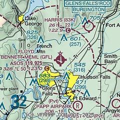
| Sectional chart |
|---|
|
CAUTION: Diagram may not be current

| Airport distance calculator |
|---|
|
|
| Sunrise and sunset |
|---|
|
Times for 13-Feb-2026
| | Local
(UTC-5) | | Zulu
(UTC) |
|---|
| Morning civil twilight | | 06:27 | | 11:27 |
| Sunrise | | 06:56 | | 11:56 |
| Sunset | | 17:21 | | 22:21 |
| Evening civil twilight | | 17:50 | | 22:50 |
|
| Current date and time |
|---|
| Zulu (UTC) | 13-Feb-2026 23:31:01 |
|---|
| Local (UTC-5) | 13-Feb-2026 18:31:01 |
|---|
|
| METAR |
|---|
| KGFL | 132253Z AUTO 20008KT 10SM CLR M03/M10 A3006 RMK AO2 SLP194 T10281100
|
|
| TAF |
|---|
| KGFL | 131739Z 1318/1418 19005KT P6SM FEW250 FM132100 20007KT P6SM SCT120 BKN200 FM140300 VRB03KT P6SM SCT020 OVC120 PROB30 1406/1409 2SM -SHSN BR BKN020 FM140900 VRB03KT P6SM SCT020 OVC040 FM141400 20005KT P6SM OVC035
|
|
| NOTAMs |
|---|
NOTAMs are issued by the DoD/FAA and will open in a separate window not controlled by AirNav.
|
|


