FAA INFORMATION EFFECTIVE 09 JULY 2026
Location
| FAA Identifier: | ANP |
| Lat/Long: | 38-56-34.3550N 076-34-06.2040W
38-56.572583N 076-34.103400W
38.9428764,-76.5683900
(estimated) |
| Elevation: | 34.2 ft. / 10 m (estimated) |
| Variation: | 10W (1985) |
| From city: | 5 miles SW of ANNAPOLIS, MD |
| Time zone: | UTC -4 (UTC -5 during Standard Time) |
| Zip code: | 21037 |
Airport Operations
| Airport use: | Open to the public |
| Activation date: | 06/1942 |
| Control tower: | no |
| ARTCC: | WASHINGTON CENTER |
| FSS: | LEESBURG FLIGHT SERVICE STATION |
| NOTAMs facility: | DCA (NOTAM-D service available) |
| Attendance: | 0800-1600
CONTACT AIRPORT MANAGER 410-956-1280 FOR APPROVAL OF ANY FLIGHT OPERATIONS BETWEEN 2200 - 0700 LOCAL. ARPT UNATNDD NEW YEARS; MEMORIAL DAY; JULY 4; LABOR DAY; THANKSGIVING & CHRISTMAS. |
| Wind indicator: | lighted |
| Segmented circle: | no |
| Lights: | ACTVT LIRL RWY 12/30 - CTAF. LIGHTING INOP BTW 2200-0700. |
| Beacon: | white-green (lighted land airport)
DUSK-2200. |
| Landing fee: | yes |
Airport Communications
| CTAF: | 122.9 |
| POTOMAC APPROACH: | 119.7 |
| POTOMAC DEPARTURE: | 119.7 |
| WX AWOS-3 at W29 (11 nm E): | 120.575 (410-643-8795) |
| WX AWOS-3 at FME (12 nm NW): | 123.925 |
| WX ASOS at BWI (15 nm N): | PHONE 227-217-0474 |
| WX AWOS-3 at CGS (17 nm W): | 121.225 (301-864-5497) |
Nearby radio navigation aids
| VOR radial/distance | | VOR name | | Freq | | Var |
|---|
| BALr173/14.4 | | BALTIMORE VORTAC | | 115.10 | | 11W |
| ADWr070/16.1 | | ANDREWS VORTAC | | 113.10 | | 10W |
| DCAr086/22.4 | | WASHINGTON VOR/DME | | 111.00 | | 09W |
| EMIr158/38.2 | | WESTMINSTER VORTAC | | 117.90 | | 08W |
| NDB name | | Hdg/Dist | | Freq | | Var | | ID |
|---|
| ELLICOTT | | 166/22.8 | | 371 | | 11W | | FND | ..-. -. -.. |
| GEORGETOWN | | 097/26.0 | | 323 | | 09W | | GTN | --. - -. |
Airport Services
| Fuel available: | 100LL |
| Parking: | tiedowns |
| Airframe service: | MAJOR |
| Powerplant service: | MAJOR |
Runway Information
Runway 12/30
| Dimensions: | 2505 x 48 ft. / 764 x 15 m |
| Surface: | asphalt, in fair condition
MINOR PAVEMENT CRACKS FULL LENGTH. |
| Runway edge lights: | low intensity |
| RUNWAY 12 | | RUNWAY 30 |
| Latitude: | 38-56.634667N | | 38-56.510482N |
| Longitude: | 076-34.355333W | | 076-33.851480W |
| Elevation: | 30.6 ft. | | 31.3 ft. |
| Traffic pattern: | left | | left |
| Runway heading: | 118 magnetic, 108 true | | 298 magnetic, 288 true |
| Displaced threshold: | 476 ft. | | 326 ft. |
| Markings: | basic, in fair condition | | nonprecision, in fair condition |
| Visual slope indicator: | 2-light PAPI on left (5.75 degrees glide path)
VGSI APCHS TO BE FLOWN. RWY 12 VGSI RELIABLE ON CNTLRN ONLY. | | 2-light PAPI on right (4.25 degrees glide path) |
| Touchdown point: | yes, no lights | | yes, no lights |
| Obstructions: | 105 ft. trees, 1873 ft. from runway, 32 ft. left of centerline, 15:1 slope to clear
6 FT FENCE ACROSS APCH END MARKED. 10 FT ROAD 156 FT FM THLD. | | 63 ft. trees, 803 ft. from runway, 84 ft. right of centerline, 9:1 slope to clear
+6 FT FENCE ACROSS APCH END MKD. +15 FT PUBLIC ROAD AT THLD, R OF CNTRLN. |
Airport Ownership and Management from official FAA records
| Ownership: | Privately-owned |
| Owner: | LEE AIRPORT AUTHORITY LLC
P.O. BOX 2342
ANNAPOLIS, MD 21401
Phone 410-956-1280
CORPORATION ESTABLISHED BY MARY C. LEE |
| Manager: | LEE RUNWAY MANAGER LLC
P.O. BOX 2342
ANNAPOLIS, MD 21401
Phone 410-956-1280 |
Additional Remarks
| - | NO LANDING ON GRASS. LDG FEE AFTER ONE HOUR OR OVERNIGHT. |
| - | TOUCH & GO OPNS PROHIBITED. |
| - | NO TAKE-OFFS AFTER 2200 DAILY. |
| - | NO GRASS CROSSOVER FM RWY 12/30 TO TWY ROLLOUT TO THE END OF RWY. |
| - | HVY BIRD AND WILDLIFE ACT ON AND INVOF ARPT. |
| - | ARPT CLSD 2200-0700 LCL, CTC ARPT MANAGER FOR DETAILS. |
| - | FOR CD CTC POTOMAC APCH AT 866-429-5882. |
Instrument Procedures
NOTE: All procedures below are presented as PDF files. If you need a reader for these files, you should download the free Adobe Reader.NOT FOR NAVIGATION. Please procure official charts for flight.
FAA instrument procedures published for use from 09 July 2026 at 0901Z to 06 August 2026 at 0900Z.
IAPs - Instrument Approach Procedures |
|---|
| RNAV (GPS)-A | |
download (215KB) |
| NOTE: Special Take-Off Minimums/Departure Procedures apply **CHANGED** | |
download (369KB) |
Other nearby airports with instrument procedures:
W00 - Freeway Airport (10 nm W)
W29 - Bay Bridge Airport (11 nm E)
KFME - Fort Meade Executive Airport (12 nm NW)
KBWI - Baltimore/Washington International Thurgood Marshall Airport (15 nm N)
KADW - Joint Base Andrews (16 nm SW)
KCGS - College Park Airport (17 nm W)
|
|

Road maps at:
MapQuest
Bing
Google
| Aerial photo |
|---|
WARNING: Photo may not be current or correct
 Photo taken 19-Oct-2016
looking northeast.
Photo taken 19-Oct-2016
looking northeast.
Do you have a better or more recent aerial photo of Lee Airport that you would like to share? If so, please send us your photo.
|
| Sectional chart |
|---|
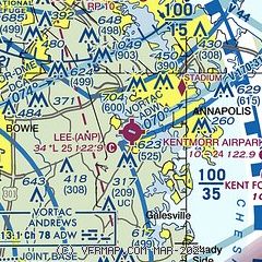
|
| Airport distance calculator |
|---|
|
|
| Sunrise and sunset |
|---|
|
Times for 13-Jul-2026
| | Local
(UTC-4) | | Zulu
(UTC) |
|---|
| Morning civil twilight | | 05:21 | | 09:21 |
| Sunrise | | 05:53 | | 09:53 |
| Sunset | | 20:31 | | 00:31 |
| Evening civil twilight | | 21:03 | | 01:03 |
|
| Current date and time |
|---|
| Zulu (UTC) | 13-Jul-2026 20:48:10 |
|---|
| Local (UTC-4) | 13-Jul-2026 16:48:10 |
|---|
|
| METAR |
|---|
KNAK
5nm NE | 131954Z AUTO 14006KT 10SM CLR 29/14 A3018 RMK AO2 SLP221 T02890144
|
KW29
11nm E | 132035Z AUTO 29006KT 10SM CLR 28/17 A3016 RMK AO2 T02850168
|
KFME
13nm NW | 132035Z AUTO 14007KT 10SM CLR 28/15 A3019 RMK AO1
|
KBWI
14nm N | 131954Z 16007KT 10SM FEW050 BKN250 29/14 A3017 RMK AO2 SLP215 T02940144
|
KADW
16nm SW | 131855Z AUTO 10008KT 10SM CLR 29/14 A3017 RMK AO2 SLP221 T02920138 $
|
KCGS
17nm W | 132035Z AUTO 06006KT 10SM CLR 30/14 A3016 RMK AO2 T02970136
|
|
| TAF |
|---|
KBWI
14nm N | 131720Z 1318/1424 13005KT P6SM SCT250 FM140500 00000KT P6SM SKC FM141400 24003KT P6SM SKC
|
KADW
16nm SW | 131700Z 1317/1423 VRB06KT 9999 SKC QNH3020INS TX30/1417Z TN18/1408Z
|
|
| NOTAMs |
|---|
NOTAMs are issued by the DoD/FAA and will open in a separate window not controlled by AirNav.
|
|

