FAA INFORMATION EFFECTIVE 11 JUNE 2026
Location
| FAA Identifier: | BWI |
| Lat/Long: | 39-10-32.6220N 076-40-08.3680W
39-10.543700N 076-40.139467W
39.1757283,-76.6689911
(estimated)
SURVEYED. |
| Elevation: | 143.4 ft. / 43.7 m (surveyed) |
| Variation: | 11W (2000) |
| From city: | 9 miles S of BALTIMORE, MD |
| Time zone: | UTC -4 (UTC -5 during Standard Time) |
| Zip code: | 21240 |
Airport Operations
| Airport use: | Open to the public |
| Activation date: | 01/1950 |
| Control tower: | yes |
| ARTCC: | WASHINGTON CENTER |
| FSS: | LEESBURG FLIGHT SERVICE STATION |
| NOTAMs facility: | BWI (NOTAM-D service available) |
| Attendance: | CONTINUOUS |
| Wind indicator: | lighted |
| Segmented circle: | yes |
| Beacon: | white-green (lighted land airport)
Operates sunset to sunrise. |
| Landing fee: | yes |
| Fire and rescue: | ARFF index D |
| International operations: | customs landing rights airport |
Airport Communications
| WX ASOS: | PHONE 227-217-0474 |
| BALTIMORE GROUND: | 121.9 |
| BALTIMORE TOWER: | 119.4 257.8 |
| POTOMAC APPROACH: | 119.0 ;020-100 119.7 ;131-180 124.55 ;101-130 128.7 ;181-019 119.0 ;131-180 119.7 ;020-130 125.525 ;181-019 |
| POTOMAC DEPARTURE: | 124.55 ;EAST 128.7 ;WEST |
| CLEARANCE DELIVERY: | 118.05 |
| ANTHM STAR: | 133.85 |
| CLASS B: | 119.0 ;020-100 119.7 ;131-180 124.55 ;101-130 128.7 ;181-019 |
| CLASS B/S: | 119.0 ;131-180 119.7 ;020-130 125.525 ;181-019 |
| CONLE DP: | 124.55 |
| D-ATIS: | 115.1 127.8 |
| DUKPN DP: | 124.55 |
| EMERG: | 121.5 243.0 |
| FIXET DP: | 124.55 |
| FOXHL DP: | 128.7 |
| LINSE DP: | 128.7 |
| MIIDY STAR: | 133.75 |
| PALEO DP: | 124.55 |
| RAVNN STAR: | 128.35 |
| SWANN DP: | 124.55 |
| TERPZ DP: | 128.7 |
| TRISH STAR: | 125.525 |
| WESTMINSTER STAR: | 126.825 ;10000 FT & BLW 133.85 ;11000 FT & ABV |
| WX AWOS-3 at FME (7 nm SW): | 123.925 |
| WX AWOS-3PT at MTN (15 nm NE): | PHONE 410-682-8848 |
| WX AWOS-3 at CGS (17 nm SW): | 121.225 (301-864-5497) |
| WX AWOS-3 at W29 (20 nm SE): | 120.575 (410-643-8795) |
- ASDE-X IN USE. OPERATE TRANSPONDERS WITH ALTITUDE REPORTING MODE AND ADS-B (IF EQUIPPED) ENABLED ON ALL AIRPORT SURFACES.
- ARRIVALS MAY BE EXTENDED OUTSIDE OF CLASS B.
Nearby radio navigation aids
| VOR radial/distance | | VOR name | | Freq | | Var |
|---|
| BAL at field | | BALTIMORE VORTAC | | 115.10 | | 11W |
| EMIr151/23.9 | | WESTMINSTER VORTAC | | 117.90 | | 08W |
| ADWr033/23.9 | | ANDREWS VORTAC | | 113.10 | | 10W |
| DCAr051/25.6 | | WASHINGTON VOR/DME | | 111.00 | | 09W |
| FDKr121/35.7 | | FREDERICK VOR/DME | | 116.85 | | 08W |
| AMLr077/39.9 | | ARMEL VOR/DME | | 113.50 | | 08W |
| NDB name | | Hdg/Dist | | Freq | | Var | | ID |
|---|
| ELLICOTT | | 154/8.4 | | 371 | | 11W | | FND | ..-. -. -.. |
| GEORGETOWN | | 064/25.8 | | 323 | | 09W | | GTN | --. - -. |
| OXONN | | 045/29.7 | | 332 | | 11W | | VQK | ...- --.- -.- |
Airport Services
| Fuel available: | 100LL JET-A |
| Parking: | hangars and tiedowns |
| Airframe service: | MAJOR |
| Powerplant service: | MAJOR |
| Bottled oxygen: | HIGH/LOW |
| Bulk oxygen: | HIGH/LOW |
Runway Information
Runway 10/28
| Dimensions: | 10503 x 150 ft. / 3201 x 46 m |
| Surface: | asphalt/grooved, in good condition |
| Weight bearing capacity: | | Single wheel: | 80.0 | | Double wheel: | 220.0 | | Double tandem: | 1020.0 | | Dual double tandem: | 1340.0 |
|
| Runway edge lights: | high intensity |
| RUNWAY 10 | | RUNWAY 28 |
| Latitude: | 39-10.484825N | | 39-10.357923N |
| Longitude: | 076-41.377080W | | 076-39.160390W |
| Elevation: | 139.0 ft. | | 126.4 ft. |
| Traffic pattern: | left | | left |
| Runway heading: | 105 magnetic, 094 true | | 285 magnetic, 274 true |
| Displaced threshold: | 550 ft. | | 700 ft. |
| Declared distances: | TORA:10503 TODA:10503 ASDA:10503 LDA:9953 | | TORA:10503 TODA:10503 ASDA:10503 LDA:9803 |
| Markings: | precision, in good condition | | precision, in good condition |
| Visual slope indicator: | 4-light PAPI on right (3.00 degrees glide path) | | 4-light PAPI on left (3.00 degrees glide path) |
| RVR equipment: | touchdown, midfield, rollout
MIDFIELD RVR SENSOR SHARED BY RWY 10/28 & RWY 15R/33L. | | touchdown, midfield, rollout |
| Approach lights: | ALSF2: standard 2,400 foot high intensity approach lighting system with centerline sequenced flashers (category II or III) | | MALSR: 1,400 foot medium intensity approach lighting system with runway alignment indicator lights |
| Centerline lights: | yes | | yes |
| Touchdown point: | yes, lighted | | yes, no lights |
| Instrument approach: | ILS | | ILS |
| Obstructions: | 35 ft. tree, 1606 ft. from runway, 305 ft. right of centerline, 40:1 slope to clear
APCH RATIO 50:1 TO DSPLCD THR. | | 31 ft. tree, 1230 ft. from runway, 425 ft. right of centerline, 33:1 slope to clear
APCH RATIO 50:1 TO DSPLCD THR. |
Runway 15R/33L
| Dimensions: | 9501 x 150 ft. / 2896 x 46 m |
| Surface: | asphalt/grooved, in good condition |
| Weight bearing capacity: | | Single wheel: | 80.0 | | Double wheel: | 220.0 | | Double tandem: | 675.0 | | Dual double tandem: | 890.0 |
|
| Runway edge lights: | high intensity |
| RUNWAY 15R | | RUNWAY 33L |
| Latitude: | 39-11.121678N | | 39-09.852185N |
| Longitude: | 076-40.919507W | | 076-39.743557W |
| Elevation: | 139.0 ft. | | 129.6 ft. |
| Traffic pattern: | left | | left |
| Runway heading: | 155 magnetic, 144 true | | 335 magnetic, 324 true |
| Displaced threshold: | 301 ft. | | 500 ft. |
| Declared distances: | TORA:9501 TODA:9501 ASDA:8601 LDA:8301 | | TORA:9501 TODA:9501 ASDA:8801 LDA:8301 |
| Markings: | precision, in good condition | | precision, in good condition |
| Visual slope indicator: | 4-light PAPI on right (3.00 degrees glide path) | | 4-light PAPI on left (3.00 degrees glide path) |
| RVR equipment: | touchdown, midfield, rollout | | touchdown, midfield, rollout |
| Approach lights: | MALSR: 1,400 foot medium intensity approach lighting system with runway alignment indicator lights | | MALSR: 1,400 foot medium intensity approach lighting system with runway alignment indicator lights |
| Centerline lights: | yes | | yes |
| Touchdown point: | yes, no lights | | yes, lighted |
| Instrument approach: | ILS | | ILS |
| Obstructions: | 126 ft. ant, lighted, 4724 ft. from runway, 908 ft. left of centerline, 35:1 slope to clear | | 154 ft. tower, 7460 ft. from runway, 906 ft. left of centerline, 47:1 slope to clear
RWY 33L +2 FT ROAD 170 FT FROM RWY END 500 FT LEFT. |
Runway 15L/33R
| Dimensions: | 5000 x 100 ft. / 1524 x 30 m |
| Surface: | asphalt/grooved, in fair condition |
| Weight bearing capacity: | | Single wheel: | 30.0 | | Double wheel: | 45.0 |
|
| Runway edge lights: | high intensity |
| RUNWAY 15L | | RUNWAY 33R |
| Latitude: | 39-11.242385N | | 39-10.574113N |
| Longitude: | 076-39.812402W | | 076-39.193845W |
| Elevation: | 141.4 ft. | | 114.0 ft. |
| Traffic pattern: | left | | left |
| Runway heading: | 155 magnetic, 144 true | | 335 magnetic, 324 true |
| Declared distances: | TORA:5000 TODA:5000 ASDA:5000 LDA:5000 | | TORA:5000 TODA:5000 ASDA:5000 LDA:5000 |
| Markings: | precision, in good condition | | precision, in good condition |
| Visual slope indicator: | 4-light PAPI on left (3.00 degrees glide path) | | 4-light PAPI on left (3.00 degrees glide path) |
| RVR equipment: | touchdown, rollout | | touchdown, rollout |
| Approach lights: | | | MALSR: 1,400 foot medium intensity approach lighting system with runway alignment indicator lights |
| Runway end identifier lights: | yes | | yes |
| Touchdown point: | yes, no lights | | yes, no lights |
| Instrument approach: | ILS | | ILS |
| Obstructions: | 31 ft. pole, 1120 ft. from runway, 615 ft. right of centerline, 30:1 slope to clear | | 39 ft. tree, 1470 ft. from runway, 585 ft. right of centerline, 32:1 slope to clear |
Airport Ownership and Management from official FAA records
| Ownership: | Publicly-owned |
| Owner: | STATE OF MARYLAND
PO BOX 8766
BWI AIRPORT, MD 21240-0766
Phone 410-859-7100 |
| Manager: | GREGORY SOLEK
AIRPORT OPERATIONS, PO BOX 8766
BWI AIRPORT, MD 21240-0766
Phone 410-859-7018 |
Additional Remarks
| A39-15L/33R | PCR VALUE: 269/F/A/X/T |
| A39-15R/33L | PCR VALUE: 759/F/A/X/T |
| A39-10/28 | PCR VALUE: 759/F/A/X/T |
| - | NOISE ABATEMENT PROCEDURES IN EFFECT - RSTRN FOR RWY 15L/33R EXCEPT FOR EMERG OR MERCY FLIGHTS CTC AMGR FOR INFO. |
| - | MAJOR CONSTR ON ARPT DLY; ACFT MOV & PRKG AREAS SUBJECT TO SHORT NOTICE CHANGE/CLOSURE. FOR CURRENT INFO PHONE BWI OPNS CNTR 410-859-7018. |
| - | ACFT ON VISUAL APCHS EXPECT TO MAINTAIN 3000 FT UNTIL 10 DME FM BAL VORTAC; DEP ACFT SHOULD EXPECT TURNS BASED ON BALTIMORE DME. |
| - | TAXIING PROHIBITED BTN CONCOURSE C & ADJ BLDG STRUCTURE SW OF CONCOURSE C. ACCESS TO GATE C12 MUST BE VIA TWY A. |
| - | TWY "S", SOUTH OF TWY "P", RSTRD TO ACFT 60000 LBS & LESS. |
| - | GA ACFT CTC 129.0 PRIOR TO ARR AT GA RAMP FOR SCTY PURPOSES. |
| - | PRACTICE LNDG & APCH BY TURBO-PWRD ACFT PROHIBITED 2200-0600; PRACTICE LNDG & TKOF BY B-747 ACFT PROHIBITED RWY 15R/33L. |
| - | TAXILANES 'T-1' & "H" RSTRD TO GROUP III ACFT WITH MAX WINGSPAN OF 118 FEET. |
| - | CONCOURSE A ALT DEICING AREA IS RSTRD TO B737-800 SIZE ACFT WITH WINGLETS OR SMLR ON SPOTS 6, 7 AND 8. |
| - | RWY 28 DE-ICE PAD LANE 1 RSTRD TO ACFT WITH WINGSPAN 171 FT OR LESS, LANE 2 RSTRD TO ACFT WITH WINGSPAN 135 FT OR LESS, LANE 3 IS USED BY LARGE ACFT MAX WINGSPAN 215 FT AND WHEN IN USE- LANES 2 AND 4 ARE UNAVBL. LANES 4, 5 & 6 ARE RSTRD TO ACFT WINGSPAN 135 FT OR LESS. |
| - | CONT MOWING OPERATIONS ADJ ALL RWYS & TWYS - APR THRU NOV. |
| - | TWY T BTN TWY H AND TWY E RSTD TO GROUP IV ACFT WITH WINGSPAN LESS THAN 171 FT. TWY T BTN TWY E AND TWY B RSTRD TO GROUP V ACFT WITH WINGSPAN LESS THAN 214 FT; WHEN GROUP V ACFT ARE ON TWY T, TWY A IS RSTRD TO MAX WINGSPANS OF 110 FT. |
| - | DUAL PARALLEL TAXILANES HAVE BEEN ADDED TO THE 'D'/'E' ALLEYWAY; TAXILANE 'N' AND TAXILANE 'N1'. TAXILANE 'N' IS DESIGNATED A "GROUP V" TAXILANE WITH MAX WINGSPAN OF 213 FT. TAXILANE 'N1' IS DESIGNATED A "GROUP IV" TAXILANE WITH MAX WINGSPAN OF 170 FT. |
| - | TWY 'A' IS RSTRD TO GROUP IV ACFT WINGSPAN 171 FT OR LESS. |
| - | RWY LEN AVBL FOR RWY 28 DEPS FM TWY U1 IS 9802 FT. |
| - | RWY STATUS LGTS IN OPN. |
| - | ACFT DEPARTING RWY 28 EXP DEP FM TWY U1. |
| - | DURING ATC ZERO EVENTS, UNICOM 119.4. |
| - | NO APRON PARKING FOR UNSKED ACR. |
| - | UNICOM 119.4. |
| - | RWY 15R DEICE PAD PSNS 1 THRU 5 RSTRD TO ACFT WITH WINGSPAN 117 FT 6 INS OR LESS. |
| - | DEER & BIRDS OCNLLY ON & INVOF ARPT. |
| - | DISTRACTING LGTS (GOLF DRIVING RANGE) RIGHT SIDE EXTDD CNTRLN RWY 33L FM AER TO 1/4 MI FINAL. |
Instrument Procedures
NOTE: All procedures below are presented as PDF files. If you need a reader for these files, you should download the free Adobe Reader.NOT FOR NAVIGATION. Please procure official charts for flight.
FAA instrument procedures published for use from 11 June 2026 at 0901Z to 09 July 2026 at 0900z.
STARs - Standard Terminal Arrivals |
|---|
| ANTHM FIVE (RNAV) **NEW** | |
2 pages:
[1] [2] (366KB) |
| ANTHM FIVE (RNAV), CONT.2 **NEW** | |
download (309KB) |
| MIIDY FOUR (RNAV) **NEW** | |
2 pages:
[1] [2] (473KB) |
| RAVNN NINE (RNAV) **NEW** | |
2 pages:
[1] [2] (454KB) |
| RAVNN NINE (RNAV), CONT.2 **NEW** | |
download (315KB) |
| TRISH FOUR (RNAV) **NEW** | |
2 pages:
[1] [2] (477KB) |
| WESTMINSTER SEVEN **NEW** | |
download (256KB) |
IAPs - Instrument Approach Procedures |
|---|
| ILS OR LOC RWY 10 | |
download (268KB) |
| ILS OR LOC RWY 15L | |
download (267KB) |
| ILS OR LOC RWY 15R | |
download (302KB) |
| ILS OR LOC RWY 28 | |
download (333KB) |
| ILS OR LOC RWY 33L | |
download (291KB) |
| ILS OR LOC RWY 33R | |
download (277KB) |
| ILS RWY 10 (SA CAT I) | |
download (250KB) |
| ILS RWY 33L (SA CAT I - II) | |
download (280KB) |
| ILS RWY 10 (CAT II - III) | |
download (244KB) |
| RNAV (RNP) X RWY 33L | |
download (213KB) |
| RNAV (RNP) Z RWY 10 | |
download (252KB) |
| RNAV (RNP) Z RWY 15R | |
download (236KB) |
| RNAV (RNP) Z RWY 28 | |
download (250KB) |
| RNAV (RNP) Z RWY 33L | |
download (227KB) |
| RNAV (GPS) RWY 15L | |
download (263KB) |
| RNAV (GPS) RWY 33R | |
download (275KB) |
| RNAV (GPS) Y RWY 10 | |
download (228KB) |
| RNAV (GPS) Y RWY 15R | |
download (274KB) |
| RNAV (GPS) Y RWY 28 | |
download (256KB) |
| RNAV (GPS) Y RWY 33L | |
download (252KB) |
| NOTE: Special Alternate Minimums apply | |
download (168KB) |
Departure Procedures |
|---|
| CONLE FIVE (RNAV) | |
2 pages:
[1] [2] (382KB) |
| DUKPN ONE (RNAV) | |
2 pages:
[1] [2] (393KB) |
| FIXET FIVE (RNAV) | |
2 pages:
[1] [2] (461KB) |
| FOXHL ONE (RNAV) | |
2 pages:
[1] [2] (398KB) |
| LINSE TWO (RNAV) | |
2 pages:
[1] [2] (405KB) |
| TERPZ EIGHT (RNAV) | |
2 pages:
[1] [2] (346KB) |
| TERPZ EIGHT (RNAV), CONT.2 | |
download (225KB) |
| NOTE: Special Take-Off Minimums/Departure Procedures apply | |
download (381KB) |
Other nearby airports with instrument procedures:
KFME - Fort Meade Executive Airport (7 nm SW)
KANP - Lee Airport (15 nm S)
W00 - Freeway Airport (15 nm S)
KMTN - Martin State Airport (15 nm NE)
KCGS - College Park Airport (17 nm SW)
W29 - Bay Bridge Airport (20 nm SE)
|
|

Road maps at:
MapQuest
Bing
Google
| Aerial photo |
|---|
WARNING: Photo may not be current or correct
 Photo taken 04-Jan-2007
looking northwest.
Photo taken 04-Jan-2007
looking northwest.
Do you have a better or more recent aerial photo of Baltimore/Washington International Thurgood Marshall Airport that you would like to share? If so, please send us your photo.
|
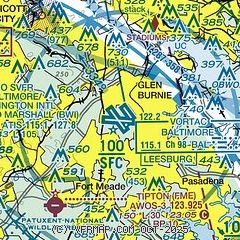
| Sectional chart |
|---|
|
 Download PDF
of official airport diagram from the FAA
| Airport distance calculator |
|---|
|
|
| Sunrise and sunset |
|---|
|
Times for 14-Jun-2026
| | Local
(UTC-4) | | Zulu
(UTC) |
|---|
| Morning civil twilight | | 05:09 | | 09:09 |
| Sunrise | | 05:41 | | 09:41 |
| Sunset | | 20:33 | | 00:33 |
| Evening civil twilight | | 21:05 | | 01:05 |
|
| Current date and time |
|---|
| Zulu (UTC) | 14-Jun-2026 19:42:30 |
|---|
| Local (UTC-4) | 14-Jun-2026 15:42:30 |
|---|
|
| METAR |
|---|
| KBWI | 141854Z 17007G17KT 10SM SCT060 BKN250 32/18 A2976 RMK AO2 SLP077 T03220183
|
KDMH
7nm N | 141853Z AUTO 33/21 A2977 RMK AO1 SLP080 T03330206 $
|
KFME
7nm SW | 141915Z AUTO 17005KT 10SM 31/20 A2979 RMK AO1
|
KNAK
14nm SE | 141854Z AUTO 16016G25KT 10SM CLR 29/18 A2979 RMK AO2 PK WND 15028/1830 SLP088 T02940183 $
|
KMTN
14nm NE | 141847Z 18013G21KT 10SM SCT070 30/21 A2980
|
KCGS
17nm SW | 141915Z AUTO 18010KT 150V210 10SM SCT065 33/18 A2977 RMK AO2 T03280181
|
KW29
20nm SE | 141915Z AUTO 19009G21KT 10SM CLR A2978 RMK AO2
|
|
| TAF |
|---|
| KBWI | 141735Z 1418/1524 21009G17KT P6SM SCT050 BKN250 FM142100 21013G23KT P6SM -SHRA SCT050 BKN080 PROB30 1422/1502 VRB15G35KT 4SM TSRA OVC040CB FM150400 24006KT 6SM -SHRA BKN045 FM150700 29008KT P6SM BKN045 FM151400 32012KT P6SM FEW250
|
KMTN
14nm NE | 141735Z 1418/1518 18014G19KT P6SM SCT060 BKN250 FM142100 21013G23KT P6SM -SHRA SCT060 BKN150 PROB30 1422/1502 VRB15G35KT 4SM TSRA OVC040CB FM150400 24006KT 6SM -SHRA BKN045 FM150700 29008KT P6SM BKN045 FM151400 32012KT P6SM FEW250
|
|
| NOTAMs |
|---|
NOTAMs are issued by the DoD/FAA and will open in a separate window not controlled by AirNav.
|
|


