FAA INFORMATION EFFECTIVE 12 JUNE 2025
Location
| FAA Identifier: | SER |
| Lat/Long: | 38-55-27.3232N 085-54-34.9941W
38-55.455387N 085-54.583235W
38.9242564,-85.9097206
(estimated) |
| Elevation: | 582.7 ft. / 177.6 m (surveyed) |
| Variation: | 02W (1985) |
| From city: | 2 miles SW of SEYMOUR, IN |
| Time zone: | UTC -4 (UTC -5 during Standard Time) |
| Zip code: | 47274 |
Airport Operations
| Airport use: | Open to the public |
| Activation date: | 05/1941 |
| Control tower: | no |
| ARTCC: | INDIANAPOLIS CENTER |
| FSS: | TERRE HAUTE FLIGHT SERVICE STATION |
| NOTAMs facility: | HUF (NOTAM-D service available) |
| Attendance: | 0800-1630 |
| Wind indicator: | lighted |
| Segmented circle: | yes |
| Lights: | ACTVT ODALS RWY 05 & 23; REIL RWY 05, 14, 23 & 32; PAPI RWY 05, 14, 23 & 32 - CTAF. MIRL RWY 05/23 & 14/32 PRESET ON. |
| Beacon: | white-green (lighted land airport)
Operates sunset to sunrise. |
Airport Communications
| CTAF/UNICOM: | 122.8 |
| WX AWOS-3: | 119.425 (812-522-4244) |
| LOUISVILLE APPROACH: | 132.075 [1230-0400Z++] |
| LOUISVILLE DEPARTURE: | 132.075 [1230-0400Z++] |
| WX AWOS-3 at OVO (16 nm NE): | 120.625 (812-346-5041) |
Nearby radio navigation aids
| VOR radial/distance | | VOR name | | Freq | | Var |
|---|
| OOMr114/35.3 | | HOOSIER VORTAC | | 110.20 | | 02W |
| NDB name | | Hdg/Dist | | Freq | | Var | | ID |
|---|
| BATESVILLE | | 235/39.5 | | 254 | | 05W | | HLB | .... .-.. -... |
Airport Services
| Fuel available: | 100LL JET-A1+
100LL:SELF SERVE AVBL 24 HR. |
| Parking: | hangars and tiedowns |
| Airframe service: | MINOR |
| Powerplant service: | MINOR |
| Bottled oxygen: | LOW |
Runway Information
Runway 5/23
| Dimensions: | 6001 x 100 ft. / 1829 x 30 m |
| Surface: | asphalt/grooved, in good condition |
| Weight bearing capacity: | | Single wheel: | 115.0 | | Double wheel: | 180.0 | | Double tandem: | 300.0 |
|
| Runway edge lights: | medium intensity |
| RUNWAY 5 | | RUNWAY 23 |
| Latitude: | 38-54.915948N | | 38-55.626148N |
| Longitude: | 085-54.664262W | | 085-53.783818W |
| Elevation: | 568.3 ft. | | 577.7 ft. |
| Traffic pattern: | left | | left |
| Runway heading: | 046 magnetic, 044 true | | 226 magnetic, 224 true |
| Markings: | nonprecision, in good condition | | nonprecision, in good condition |
| Visual slope indicator: | 2-light PAPI on left (3.00 degrees glide path) | | 2-light PAPI on left (3.00 degrees glide path) |
| Approach lights: | ODALS: omnidirectional approach lighting system | | ODALS: omnidirectional approach lighting system |
| Runway end identifier lights: | yes | | yes |
| Touchdown point: | yes, no lights | | yes, no lights |
| Instrument approach: | LOCALIZER | | |
Runway 14/32
| Dimensions: | 5502 x 100 ft. / 1677 x 30 m |
| Surface: | asphalt/grooved, in good condition |
| Weight bearing capacity: | | Single wheel: | 20.0 | | Double wheel: | 35.0 | | Double tandem: | 50.0 |
|
| Runway edge lights: | medium intensity |
| RUNWAY 14 | | RUNWAY 32 |
| Latitude: | 38-55.722890N | | 38-55.092132N |
| Longitude: | 085-55.257455W | | 085-54.424203W |
| Elevation: | 582.7 ft. | | 570.3 ft. |
| Traffic pattern: | left | | left |
| Runway heading: | 136 magnetic, 134 true | | 316 magnetic, 314 true |
| Markings: | nonprecision, in good condition | | nonprecision, in good condition |
| Visual slope indicator: | 2-light PAPI on left (3.00 degrees glide path) | | 2-light PAPI on left (3.00 degrees glide path) |
| Runway end identifier lights: | yes | | yes |
| Touchdown point: | yes, no lights | | yes, no lights |
| Obstructions: | 10 ft. crops, 440 ft. from runway, 24:1 slope to clear | | none |
Runway 18U/36U
| Dimensions: | 1215 x 100 ft. / 370 x 30 m |
| Surface: | turf, in fair condition |
| RUNWAY 18U | | RUNWAY 36U |
| Latitude: | 38-56.089530N | | 38-55.889350N |
| Longitude: | 085-54.939063W | | 085-54.934893W |
| Elevation: | 569.5 ft. | | 573.1 ft. |
| Traffic pattern: | left | | right |
| Runway heading: | 182 magnetic, 180 true | | 002 magnetic, 000 true |
| Touchdown point: | yes, no lights | | yes, no lights |
Runway 9U/27U
| Dimensions: | 1104 x 100 ft. / 336 x 30 m |
| Surface: | turf, in good condition |
| RUNWAY 9U | | RUNWAY 27U |
| Latitude: | 38-56.106178N | | 38-56.108513N |
| Longitude: | 085-54.978998W | | 085-54.746230W |
| Elevation: | 569.3 ft. | | 565.4 ft. |
| Traffic pattern: | left | | left |
| Runway heading: | 092 magnetic, 090 true | | 272 magnetic, 270 true |
| Touchdown point: | yes, no lights | | yes, no lights |
Airport Ownership and Management from official FAA records
| Ownership: | Publicly-owned |
| Owner: | SEYMOUR AIRPORT AUTHORITY
P.O. BOX 702
SEYMOUR, IN 47274
Phone 812-522-2031 |
| Manager: | COLIN SMITH
1025 A AVENUE, PO BOX 702
SEYMOUR, IN 47274
Phone 812-522-2031 |
Additional Remarks
| A52-09U | 30 FT PLINE MKD WITH BALLS 700 FT FM RWY END. |
| A52-18U | 20 FT BLDG 550 FT FM RWY END. |
| - | RDO CTL ACFT OPS ON & INVOF ARPT DLY FM APR - OCT. |
| - | TWY LGTS FM INT 14/32 & 05/23 TO APRON ONLY. |
| - | FOR CD CTC LOUISVILLE APCH AT 502-375-7499. |
Instrument Procedures
NOTE: All procedures below are presented as PDF files. If you need a reader for these files, you should download the free Adobe Reader.NOT FOR NAVIGATION. Please procure official charts for flight.
FAA instrument procedures published for use from 12 June 2025 at 0901Z to 10 July 2025 at 0900z.
IAPs - Instrument Approach Procedures |
|---|
| RNAV (GPS) RWY 05 | |
download (248KB) |
| RNAV (GPS) RWY 14 | |
download (278KB) |
| RNAV (GPS) RWY 23 | |
download (237KB) |
| RNAV (GPS) RWY 32 | |
download (251KB) |
| NOTE: Special Take-Off Minimums/Departure Procedures apply | |
download (474KB) |
Other nearby airports with instrument procedures:
KOVO - North Vernon Airport (16 nm NE)
KBAK - Columbus Municipal Airport (20 nm N)
KIMS - Madison Municipal Airport (23 nm SE)
KBFR - Virgil I Grissom Municipal Airport (26 nm W)
I34 - Greensburg Municipal Airport (30 nm NE)
|
|

Road maps at:
MapQuest
Bing
Google
| Aerial photo |
|---|
WARNING: Photo may not be current or correct

Do you have a better or more recent aerial photo of Freeman Municipal Airport that you would like to share? If so, please send us your photo.
|
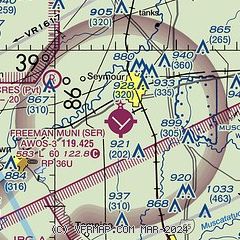
| Sectional chart |
|---|
|
| Airport distance calculator |
|---|
|
|
| Sunrise and sunset |
|---|
|
Times for 06-Jul-2025
| | Local
(UTC-4) | | Zulu
(UTC) |
|---|
| Morning civil twilight | | 05:54 | | 09:54 |
| Sunrise | | 06:26 | | 10:26 |
| Sunset | | 21:11 | | 01:11 |
| Evening civil twilight | | 21:43 | | 01:43 |
|
| Current date and time |
|---|
| Zulu (UTC) | 06-Jul-2025 04:42:27 |
|---|
| Local (UTC-4) | 06-Jul-2025 00:42:27 |
|---|
|
| METAR |
|---|
KBAK
21nm N | 060145Z 00000KT 10SM CLR 27/20 A3000 RMK LAST
|
KIMS
23nm SE | 060415Z AUTO 13004KT 7SM CLR 23/23 A3004 RMK AO2
|
KBFR
26nm W | 060415Z AUTO 22002KT 10SM BKN100 25/23 A3001 RMK AO2
|
KJVY
34nm S | 060415Z AUTO 00000KT 9SM FEW060 FEW085 25/24 A2999 RMK AO2
|
KBMG
36nm NW | 060353Z AUTO 00000KT 10SM CLR 25/21 A3001 RMK AO2 SLP151 T02500211
|
KHLB
39nm NE | 060415Z AUTO 00000KT 10SM CLR 22/22 A3002 RMK A01
|
KGEZ
40nm N | 060353Z AUTO 17003KT 10SM CLR 23/19 A3000 RMK AO2 SLP151 T02330194
|
|
| TAF |
|---|
KBMG
36nm NW | 051725Z 0518/0618 20007KT P6SM SCT070 TEMPO 0519/0523 BKN070 FM060000 20002KT P6SM SCT250 FM061600 23005KT P6SM SCT050
|
|
| NOTAMs |
|---|
NOTAMs are issued by the DoD/FAA and will open in a separate window not controlled by AirNav.
|
|


