FAA INFORMATION EFFECTIVE 14 MAY 2026
Location
| FAA Identifier: | FCM |
| Lat/Long: | 44-49-39.0260N 093-27-30.8580W
44-49.650433N 093-27.514300W
44.8275072,-93.4585717
(estimated) |
| Elevation: | 906.2 ft. / 276.2 m (surveyed) |
| Variation: | 03E (1985) |
| From city: | 11 miles SW of MINNEAPOLIS, MN |
| Time zone: | UTC -5 (UTC -6 during Standard Time) |
| Zip code: | 55347 |
Airport Operations
| Airport use: | Open to the public |
| Activation date: | 12/1945 |
| Control tower: | yes |
| ARTCC: | MINNEAPOLIS CENTER |
| FSS: | PRINCETON FLIGHT SERVICE STATION |
| NOTAMs facility: | FCM (NOTAM-D service available) |
| Attendance: | CONTINUOUS |
| Wind indicator: | lighted |
| Segmented circle: | no |
| Lights: | WHEN ATCT CLSD ACTVT OR INCR INTST MALSR RWY 10R; REIL RWY 28L, 18, & 36; PAPI RWY 10R, 28L, 18, & 36; HIRL RWY 10R/28L; MIRL RWY 18/36 - CTAF. |
| Beacon: | white-green (lighted land airport)
Operates sunset to sunrise. |
| Landing fee: | yes |
Airport Communications
| CTAF: | 119.15 |
| UNICOM: | 122.95 |
| ATIS: | 124.9 |
| WX ASOS: | PHONE 952-941-4156 |
| FLYING CLOUD GROUND: | 121.7 [0600-2100, 1ST SUN IN NOV-2ND SAT IN MAR; 0600-2200, 2ND SUN IN MAR-1ST SAT IN NOV.] |
| FLYING CLOUD TOWER: | 119.15 ;RWY 10R/28L 119.15 ;SOUTH 125.2 ;NORTH 125.2 ;RWY 10L/28R [0600-2100, 1ST SUN IN NOV-2ND SAT IN MAR; 0600-2200, 2ND SUN IN MAR-1ST SAT IN NOV.] |
| MINNEAPOLIS APPROACH: | 134.7 |
| MINNEAPOLIS DEPARTURE: | 134.7 |
| CLEARANCE DELIVERY: | 121.7 ;WHEN TWR CLSD |
| COULT DP: | 134.7 |
| EMERG: | 121.5 243.0 |
| KBREW DP: | 134.7 |
| ORSKY DP: | 134.7 |
| ROCHESTER DP: | 134.7 |
| SCHEP DP: | 134.7 |
| TWOLF STAR: | 126.95 |
| WLSTN DP: | 134.7 |
| ZMBRO DP: | 134.7 |
| WX ASOS at MSP (11 nm E): | PHONE 218-203-0160 |
| WX ASOS at MIC (15 nm N): | PHONE 763-531-2343 |
| WX AWOS-3 at LVN (15 nm SE): | 118.0 (952-469-5850) |
| WX ASOS at STP (18 nm E): | 118.35 (651-312-8888) |
| WX AWOS-3 at SGS (18 nm E): | 119.425 (651-457-8120) |
Nearby radio navigation aids
| VOR radial/distance | | VOR name | | Freq | | Var |
|---|
| FCM at field | | FLYING CLOUD VOR/DME | | 117.70 | | 01E |
| MSPr244/10.3 | | MINNEAPOLIS VOR/DME | | 115.30 | | 02E |
| FGTr309/16.7 | | FARMINGTON VORTAC | | 115.70 | | 06E |
| GEPr185/19.4 | | GOPHER VORTAC | | 117.30 | | 06E |
| FOWr352/37.6 | | HALFWAY VOR/DME | | 111.20 | | 02E |
Airport Services
| Fuel available: | 100LL JET-A
A:JET A LDG FEE, CTC FBO. |
| Parking: | hangars and tiedowns |
| Airframe service: | MAJOR |
| Powerplant service: | MAJOR |
| Bottled oxygen: | HIGH/LOW |
Runway Information
Runway 10R/28L
| Dimensions: | 5001 x 100 ft. / 1524 x 30 m |
| Surface: | asphalt/grooved, in good condition |
| Weight bearing capacity: | | Single wheel: | 30.0 | | Double wheel: | 60.0 |
|
| Runway edge lights: | high intensity |
| RUNWAY 10R | | RUNWAY 28L |
| Latitude: | 44-49.743162N | | 44-49.585958N |
| Longitude: | 093-28.242680W | | 093-27.107618W |
| Elevation: | 896.2 ft. | | 898.3 ft. |
| Traffic pattern: | right | | left |
| Runway heading: | 098 magnetic, 101 true | | 278 magnetic, 281 true |
| Markings: | precision, in good condition | | nonprecision, in good condition |
| Visual slope indicator: | 4-light PAPI on left (3.00 degrees glide path) | | 4-light PAPI on left (3.00 degrees glide path) |
| Approach lights: | MALSR: 1,400 foot medium intensity approach lighting system with runway alignment indicator lights | | |
| Runway end identifier lights: | no | | yes |
| Touchdown point: | yes, no lights | | yes, no lights |
| Instrument approach: | ILS | | |
| Obstructions: | 61 ft. tree, 3085 ft. from runway, 131 ft. left of centerline, 47:1 slope to clear | | none |
Runway 10L/28R
| Dimensions: | 3901 x 75 ft. / 1189 x 23 m |
| Surface: | asphalt, in fair condition |
| Weight bearing capacity: | |
| Runway edge lights: | medium intensity |
| Operational restrictions: | CLSD WHEN ATCT CLSD. |
| RUNWAY 10L | | RUNWAY 28R |
| Latitude: | 44-49.780132N | | 44-49.657460N |
| Longitude: | 093-27.903755W | | 093-27.018210W |
| Elevation: | 906.0 ft. | | 899.5 ft. |
| Traffic pattern: | left | | right |
| Runway heading: | 098 magnetic, 101 true | | 278 magnetic, 281 true |
| Markings: | nonprecision, in good condition | | nonprecision, in good condition |
| Visual slope indicator: | 4-light PAPI on left (3.00 degrees glide path) | | 4-light PAPI on left (3.00 degrees glide path) |
| Runway end identifier lights: | yes | | yes |
| Touchdown point: | yes, no lights | | yes, no lights |
Runway 18/36
| Dimensions: | 2690 x 75 ft. / 820 x 23 m |
| Surface: | asphalt, in good condition |
| Weight bearing capacity: | |
| Runway edge lights: | medium intensity |
| RUNWAY 18 | | RUNWAY 36 |
| Latitude: | 44-49.745158N | | 44-49.304857N |
| Longitude: | 093-27.260160W | | 093-27.325267W |
| Elevation: | 899.1 ft. | | 905.0 ft. |
| Traffic pattern: | left | | left |
| Runway heading: | 183 magnetic, 186 true | | 003 magnetic, 006 true |
| Markings: | nonprecision, in good condition | | nonprecision, in good condition |
| Visual slope indicator: | 4-light PAPI on left (3.50 degrees glide path) | | 4-light PAPI on left (3.00 degrees glide path)
RY 36 PAPI UNUSBL BYD 6 DEG LEFT OF CNTRLN. |
| Runway end identifier lights: | yes | | yes |
| Touchdown point: | yes, no lights | | yes, no lights |
| Obstructions: | 48 ft. tank, 907 ft. from runway, 262 ft. right of centerline, 14:1 slope to clear | | 4 ft. fence, 219 ft. from runway, 151 ft. right of centerline, 5:1 slope to clear
RWY 36 HAS 5 FT FENCE 129 FT FROM THE RWY END AND 244 FT R. |
Airport Ownership and Management from official FAA records
| Ownership: | Publicly-owned |
| Owner: | METROPOLITAN AIRPORT CMSN
6040 28TH AVE S
MINNEAPOLIS, MN 55450-2799
Phone 612-726-8100 |
| Manager: | ROBERT DOCKRY
9960 FLYING CLOUD DRIVE
EDEN PRAIRIE, MN 55347-4016
Phone 952-944-1035
ARPT OFC NR 952-944-1035. |
Additional Remarks
| - | DEER, BIRDS & WILDLIFE ON AND INVOF ARPT. |
| - | RWY 10R IS CALM WIND RWY WHEN ATCT CLSD. |
| - | TWY 'D' CLOSED FM TWY 'D2' TO APCH END RWY 36 TO ACFT WITH WINGSPANS OF 66 FT OR GREATER. |
| - | TWY A CLSD EAST OF BARON LANE TO ACFT WITH WINGSPANS 54 FT OR GREATER. |
| - | WRWY INCURSION RISK - PILOTS ARE REMINDED TO REVIEW ARPT HOT SPOT INFO BFR TXG FOR DEP & BFR LDG. SEE TPP ARPT DIAGRAM & CHART SUPPL SXN ON HOT SPOTS FOR ADDN INFO. |
| - | WRONG RWY ARR RISK, CLOSELY ALIGNED PARL RWYS. SEE TPP ARPT DIAGRAM. |
| - | TWY D BTWN D1 & D2 CLSD TO ACFT WINGSPANS 48 FT OR GTR. |
| - | TXL G CLSD TO WINGSPANS GTR THAN 43 FT. |
| - | TXL H CLSD TO WINGSPANS GTR THAN 40 FT. |
| - | FOR CD WHEN ATCT CLSD CTC MINNEAPOLIS APCH 121.7. |
| - | ARPT CLSD TO: JETS NOT MEETING FAR 36, JET TRNG & ACFT W/ CERTIFICATED MGTOW HIGHER THAN 60,000 LBS. |
| - | ULTRALIGHT OPNS PROHIBITED. |
| - | MAINTENANCE RUN-UPS ARE PROHIBITED BTN 2200-0700 LCL. |
| - | WHEN ATCT CLSD, SNOW REMOVAL OPS MONITOR 119.15. |
Instrument Procedures
NOTE: All procedures below are presented as PDF files. If you need a reader for these files, you should download the free Adobe Reader.NOT FOR NAVIGATION. Please procure official charts for flight.
FAA instrument procedures published for use from 14 May 2026 at 0901Z to 11 June 2026 at 0900Z.
STARs - Standard Terminal Arrivals |
|---|
| AGUDE SIX | |
download (218KB) |
| ENCEE THREE (RNAV) | |
download (160KB) |
| GOPHER ONE | |
download (248KB) |
| TWOLF FOUR | |
download (169KB) |
IAPs - Instrument Approach Procedures |
|---|
| ILS OR LOC RWY 10R **CHANGED** | |
download (353KB) |
| RNAV (GPS) RWY 10L **CHANGED** | |
download (318KB) |
| RNAV (GPS) RWY 10R **CHANGED** | |
download (320KB) |
| RNAV (GPS) RWY 28L **CHANGED** | |
download (275KB) |
| RNAV (GPS) RWY 28R **CHANGED** | |
download (285KB) |
| RNAV (GPS) RWY 36 **CHANGED** | |
download (279KB) |
| VOR/DME RWY 36 **CHANGED** | |
download (262KB) |
| VOR RWY 10R **CHANGED** | |
download (324KB) |
| COPTER ILS OR LOC RWY 10R **CHANGED** | |
download (278KB) |
| NOTE: Special Alternate Minimums apply | |
download (52KB) |
Departure Procedures |
|---|
| COULT SEVEN **CHANGED** | |
download (171KB) |
| KBREW TWO **CHANGED** | |
download (166KB) |
| ORSKY THREE **CHANGED** | |
download (177KB) |
| ROCHESTER ONE **CHANGED** | |
download (186KB) |
| SCHEP ONE | |
download (163KB) |
| WLSTN SEVEN **CHANGED** | |
download (156KB) |
| ZMBRO SEVEN **CHANGED** | |
download (175KB) |
| NOTE: Special Take-Off Minimums/Departure Procedures apply | |
download (162KB) |
Other nearby airports with instrument procedures:
KMSP - Minneapolis-St Paul International/Wold-Chamberlain Airport (11 nm E)
KMIC - Crystal Airport (15 nm N)
KLVN - Airlake Airport (15 nm SE)
KSTP - St Paul Downtown Airport Holman Field (18 nm E)
KSGS - South St Paul Municipal Airport/Richard E Fleming Field (18 nm E)
|
|

Road maps at:
MapQuest
Bing
Google
| Aerial photo |
|---|
WARNING: Photo may not be current or correct
 Photo taken 02-Jan-2016
looking west.
Photo taken 02-Jan-2016
looking west.
Do you have a better or more recent aerial photo of Flying Cloud Airport that you would like to share? If so, please send us your photo.
|
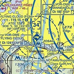
| Sectional chart |
|---|
|
CAUTION: Diagram may not be current
 Download PDF
of official airport diagram from the FAA
| Airport distance calculator |
|---|
|
|
| Sunrise and sunset |
|---|
|
Times for 02-Jun-2026
| | Local
(UTC-5) | | Zulu
(UTC) |
|---|
| Morning civil twilight | | 04:55 | | 09:55 |
| Sunrise | | 05:31 | | 10:31 |
| Sunset | | 20:52 | | 01:52 |
| Evening civil twilight | | 21:28 | | 02:28 |
|
| Current date and time |
|---|
| Zulu (UTC) | 02-Jun-2026 11:21:02 |
|---|
| Local (UTC-5) | 02-Jun-2026 06:21:02 |
|---|
|
| METAR |
|---|
| KFCM | 021053Z 00000KT 10SM CLR 13/13 A3027 RMK AO2 SLP250 T01330128
|
KMSP
10nm E | 021053Z 05003KT 10SM FEW080 FEW250 17/13 A3029 RMK AO2 SLP252 T01670128 $
|
KSGS
13nm E | 021055Z AUTO 00000KT 5SM BR CLR 14/13 A3030 RMK AO2 T01410127
|
KMIC
15nm N | 021053Z AUTO 00000KT 10SM CLR 13/12 A3028 RMK AO2 SLP251 T01280117
|
KLVN
16nm SE | 021055Z AUTO 00000KT 10SM CLR 12/12 A3029 RMK AO2
|
KSTP
18nm E | 021053Z 00000KT 10SM FEW002 14/13 A3029 RMK AO2 SLP254 T01440133
|
|
| TAF |
|---|
KMSP
10nm E | 020538Z 0206/0312 11004KT P6SM SKC FM021500 15009KT P6SM FEW250
|
|
| NOTAMs |
|---|
NOTAMs are issued by the DoD/FAA and will open in a separate window not controlled by AirNav.
|
|


