FAA INFORMATION EFFECTIVE 14 MAY 2026
Location
| FAA Identifier: | PHL |
| Lat/Long: | 39-52-19.5020N 075-14-26.3870W
39-52.325033N 075-14.439783W
39.8720839,-75.2406631
(estimated) |
| Elevation: | 35.9 ft. / 10.9 m (surveyed) |
| Variation: | 12W (2020) |
| From city: | 5 miles SW of PHILADELPHIA, PA |
| Time zone: | UTC -4 (UTC -5 during Standard Time) |
| Zip code: | 19113 |
Airport Operations
| Airport use: | Open to the public |
| Activation date: | 10/1940 |
| Control tower: | yes |
| ARTCC: | NEW YORK CENTER |
| FSS: | WILLIAMSPORT FLIGHT SERVICE STATION |
| NOTAMs facility: | PHL (NOTAM-D service available) |
| Attendance: | CONTINUOUS |
| Wind indicator: | lighted |
| Segmented circle: | no |
| Beacon: | white-green (lighted land airport)
Operates sunset to sunrise. |
| Landing fee: | yes |
| Fire and rescue: | ARFF index E |
| International operations: | customs landing rights airport |
Airport Communications
| UNICOM: | 122.95 |
| WX ASOS: | 133.4 (215-492-9617) |
| PHILADELPHIA GROUND: | 121.9 348.6 121.65 |
| PHILADELPHIA TOWER: | 118.5 ;RWY 08/26, 09L/27R, 17/35 135.1 ;RWY 09R/27L 327.05 |
| PHILADELPHIA APPROACH: | 123.8 ;001-089, 5000 FT & BLW 124.35 126.85 ;270-360, 5000 FT & BLW 127.35 ;090-269, 5000 FT & BLW 128.4 ;270-089, ABV 5000 FT 133.875 ;090-269, 6000-8000 FT 263.125 ;270-360, 5000 FT & BLW 272.575 ;270-089, ABV 5000 FT 273.575 ;270-089, ABV 5000 FT 291.7 ;001-089, 5000 FT & BLW 317.55 ;090-269 6000-8000 FT 317.55 ;090-269, 5000 FT & BLW 319.15 |
| PHILADELPHIA DEPARTURE: | 119.75 ;090-269 124.35 ;270-089 124.35 269.25 ;090-269 319.15 ;270-089 319.15 |
| CLEARANCE DELIVERY: | 118.85 348.6 |
| 5500 & BLO: | 123.8 ;NORTH 291.7 ;NORTH |
| BUNTS STAR: | 128.4 272.575 |
| CLASS B: | 118.35 ;SW 6000 FT & BLW 119.75 ;SE RWY 09 ACTIVE 10000 FT & 119.75 ;SE RWY 27 ACTIVE 8500-10000 119.75 ;SOUTH/SOUTHWEST RWY 27 8500- 123.8 ;NE 6500 FT & BLW 124.35 ;NE 7000-10000 FT 124.35 ;NW 8000-10000 FT 124.35 ;W RWY 09 ACTIVE 8500-10000 F 124.35 ;W RWY 27 ACTIVE 10000 FT & B 126.85 ;5500 FT & BLW 127.35 ;SE-SW 5000 FT & BLW 128.4 ;NORTH 6500-7500 128.4 ;WEST RWY 09 ACTIVE 8000 FT & 133.875 ;6000-8000 FT 133.875 ;SOUTHEAST RWY 27 5500-7500 263.125 ;5500 FT & BLW 269.25 ;SE RWY 09 ACTIVE 10000 FT & 269.25 ;SE RWY 27 ACTIVE 8500-10000 269.25 ;SOUTH/SOUTHWEST RWY 27 8500- 272.575 ;NORTH 6500-7500 272.575 ;WEST RWY 09 ACTIVE 8000 FT 273.575 ;N NE 6500-7500 273.575 ;W RWY 09 ACTIVE 8000 FT & B 291.7 ;NE RWY 27 ACTIVE 5000 FT & BL 317.55 ;6000-8000 FT 317.55 ;RWY 27, 5500-7500 FT 317.55 ;SE-SW 5000 FT & BLW 319.15 ;NE 7000-10000 FT 319.15 ;NW 8000-10000 FT 319.15 ;WEST RWY 09 ACTIVE 8500-1000 323.1 ;SW 6000 FT & BLW |
| D-ATIS: | 133.4 ;ARR 135.925 ;DEP |
| EMERG: | 121.5 243.0 |
| FINAL APCH: | 125.4 |
| IC: | 124.35 319.15 |
| JIIMS STAR: | 133.875 317.55 |
| PAATS STAR: | 133.875 317.55 |
| PHILADELPHIA DP: | 119.75 ;SOUTH DEP CON 124.35 ;NORTH DEP CON 269.25 ;SOUTH DEP CON 319.15 ;NORTH DEP CON |
| PRM: | 120.425 ;RWY 27L 123.6 ;RWY 26 |
| SLATT STAR: | 128.4 273.575 |
| SPUDS STAR: | 128.4 272.575 |
| WX AWOS-3 at LOM (16 nm N): | 118.925 (215-646-1068) |
| WX ASOS at PNE (16 nm NE): | PHONE 215-897-9068 |
| WX AWOS-3T at OQN (17 nm NW): | 121.4 ((610) 692-6190) |
| WX ASOS at VAY (19 nm E): | 119.325 (609-267-1176) |
- ASDE-X IN USE. OPERATE TRANSPONDERS WITH ALTITUDE REPORTING MODE AND ADS-B (IF EQUIPPED) ENABLED ON ALL AIRPORT SURFACES.
- CLASS B: PILOTS CAN EXPC TO EXIT & RE-ENTER THE PHL CLASS B ASP DRG MDT TO HVY ARR PDS.
Nearby radio navigation aids
| VOR radial/distance | | VOR name | | Freq | | Var |
|---|
| OODr021/14.4 | | WOODSTOWN VORTAC | | 112.80 | | 10W |
| MXEr107/20.0 | | MODENA VORTAC | | 113.20 | | 09W |
| DQOr065/20.5 | | DUPONT VORTAC | | 114.00 | | 10W |
| VCNr338/23.7 | | CEDAR LAKE VOR/DME | | 115.20 | | 10W |
| PTWr154/25.6 | | POTTSTOWN VORTAC | | 116.50 | | 09W |
| ARDr224/27.5 | | YARDLEY VOR/DME | | 108.20 | | 10W |
| GXUr266/30.8 | | MC GUIRE VORTAC | | 110.60 | | 12W |
| CYNr285/37.4 | | COYLE VORTAC | | 113.40 | | 10W |
| ACYr319/39.6 | | ATLANTIC CITY VORTAC | | 117.15 | | 10W |
| RBVr250/39.6 | | ROBBINSVILLE VORTAC | | 113.80 | | 10W |
| NDB name | | Hdg/Dist | | Freq | | Var | | ID |
|---|
| RAINBOW | | 001/27.7 | | 363 | | 11W | | RNB | .-. -. -... |
Airport Services
| Fuel available: | 100LL JET-A |
| Parking: | hangars and tiedowns |
| Airframe service: | MAJOR |
| Powerplant service: | MAJOR |
| Bottled oxygen: | HIGH/LOW |
| Bulk oxygen: | HIGH/LOW |
Runway Information
Runway 9R/27L
| Dimensions: | 12000 x 200 ft. / 3658 x 61 m |
| Surface: | asphalt/grooved, in good condition |
| Weight bearing capacity: | | Single wheel: | 120.0 | | Double wheel: | 250.0 | | Double tandem: | 550.0 | | Dual double tandem: | 1048.0 |
|
| Runway edge lights: | high intensity |
| RUNWAY 9R | | RUNWAY 27L |
| Latitude: | 39-51.648562N | | 39-52.144183N |
| Longitude: | 075-16.511760W | | 075-14.028650W |
| Elevation: | 20.1 ft. | | 10.2 ft. |
| Traffic pattern: | left | | left |
| Runway heading: | 087 magnetic, 075 true | | 267 magnetic, 255 true |
| Displaced threshold: | no | | 1913 ft. |
| Declared distances: | TORA:12000 TODA:12000 ASDA:12000 LDA:12000 | | TORA:12000 TODA:12000 ASDA:11825 LDA:9912 |
| Markings: | precision, in good condition | | precision, in good condition |
| Visual slope indicator: | 4-light PAPI on right (3.00 degrees glide path) | | 4-light PAPI on left (3.00 degrees glide path) |
| RVR equipment: | touchdown, midfield, rollout | | touchdown, midfield, rollout |
| Approach lights: | ALSF2: standard 2,400 foot high intensity approach lighting system with centerline sequenced flashers (category II or III) | | MALSR: 1,400 foot medium intensity approach lighting system with runway alignment indicator lights |
| Centerline lights: | yes | | yes |
| Touchdown point: | yes, lighted | | yes, no lights |
| Instrument approach: | ILS/DME | | ILS/DME |
| Obstructions: | 45 ft. trees, 335 ft. from runway, 497 ft. left of centerline, 3:1 slope to clear | | 189 ft. boat, 4500 ft. from runway, 827 ft. left of centerline, 23:1 slope to clear |
Runway 9L/27R
| Dimensions: | 9500 x 150 ft. / 2896 x 46 m |
| Surface: | asphalt/grooved, in good condition |
| Weight bearing capacity: | | Single wheel: | 120.0 | | Double wheel: | 250.0 | | Double tandem: | 542.0 | | Dual double tandem: | 1059.0 |
|
| Runway edge lights: | high intensity |
| RUNWAY 9L | | RUNWAY 27R |
| Latitude: | 39-52.120970N | | 39-52.513222N |
| Longitude: | 075-15.339682W | | 075-13.373818W |
| Elevation: | 13.2 ft. | | 10.4 ft. |
| Traffic pattern: | left | | left |
| Runway heading: | 087 magnetic, 075 true | | 267 magnetic, 255 true |
| Declared distances: | TORA:9500 TODA:9500 ASDA:9500 LDA:9500 | | TORA:9500 TODA:9500 ASDA:9500 LDA:8864 |
| Markings: | precision, in good condition | | precision, in good condition |
| Visual slope indicator: | | | 4-light PAPI on left (3.00 degrees glide path) |
| RVR equipment: | touchdown, midfield, rollout | | touchdown, midfield, rollout |
| Approach lights: | MALSR: 1,400 foot medium intensity approach lighting system with runway alignment indicator lights | | MALSR: 1,400 foot medium intensity approach lighting system with runway alignment indicator lights |
| Runway end identifier lights: | yes | | |
| Centerline lights: | yes | | yes |
| Touchdown point: | yes, no lights | | yes, no lights |
| Instrument approach: | ILS/DME | | ILS/DME |
| Obstructions: | 91 ft. trees, 4090 ft. from runway, 429 ft. right of centerline, 43:1 slope to clear | | 189 ft. boat, 4500 ft. from runway, 23:1 slope to clear |
Runway 17/35
| Dimensions: | 6500 x 150 ft. / 1981 x 46 m |
| Surface: | asphalt/grooved, in good condition |
| Weight bearing capacity: | | Single wheel: | 120.0 | | Double wheel: | 203.0 | | Double tandem: | 302.0 | | Dual double tandem: | 803.0 |
|
| Runway edge lights: | high intensity |
| RUNWAY 17 | | RUNWAY 35 |
| Latitude: | 39-53.259523N | | 39-52.259628N |
| Longitude: | 075-14.165447W | | 075-13.668857W |
| Elevation: | 8.2 ft. | | 12.9 ft. |
| Traffic pattern: | left | | left |
| Runway heading: | 171 magnetic, 159 true | | 351 magnetic, 339 true |
| Declared distances: | TORA:6500 TODA:6500 ASDA:6500 LDA:6500 | | TORA:6500 TODA:6500 ASDA:6500 LDA:6500 |
| Markings: | precision, in good condition | | precision, in good condition |
| Visual slope indicator: | 4-light PAPI on left (3.00 degrees glide path) | | 4-light PAPI on left (3.15 degrees glide path) |
| RVR equipment: | touchdown, rollout | | touchdown, rollout |
| Approach lights: | MALSF: 1,400 foot medium intensity approach lighting system with sequenced flashers | | |
| Runway end identifier lights: | no | | yes |
| Touchdown point: | yes, no lights | | yes, no lights |
| Instrument approach: | ILS/DME | | |
| Obstructions: | 50 ft. tree, 1279 ft. from runway, 516 ft. left of centerline, 21:1 slope to clear | | 189 ft. boat, 2150 ft. from runway, 10:1 slope to clear |
Runway 8/26
| Dimensions: | 5001 x 150 ft. / 1524 x 46 m |
| Surface: | asphalt/grooved, in good condition |
| Weight bearing capacity: | | Single wheel: | 83.0 | | Double wheel: | 135.0 | | Double tandem: | 226.0 |
|
| Runway edge lights: | high intensity |
| Operational restrictions: | LND RWY 26 TKOF RWY 08. |
| RUNWAY 8 | | RUNWAY 26 |
| Latitude: | 39-52.700245N | | 39-52.906375N |
| Longitude: | 075-13.800833W | | 075-12.765797W |
| Elevation: | 9.3 ft. | | 35.9 ft. |
| Traffic pattern: | left | | left |
| Runway heading: | 087 magnetic, 075 true | | 268 magnetic, 256 true |
| Declared distances: | TORA:5001 TODA:5001 ASDA:5001 LDA:5001 | | TORA:5001 TODA:5001 ASDA:5001 LDA:5001 |
| Markings: | basic, in good condition | | precision, in good condition |
| Visual slope indicator: | | | 4-light PAPI on right (3.15 degrees glide path)
PAPI UNUSBL BYD 8 DEGS R OF CNTRLN. |
| RVR equipment: | touchdown, rollout | | touchdown, rollout |
| Approach lights: | | | MALSR: 1,400 foot medium intensity approach lighting system with runway alignment indicator lights |
| Centerline lights: | yes | | yes |
| Touchdown point: | yes, no lights | | yes, no lights |
| Instrument approach: | | | ILS/DME |
| Obstructions: | none | | 24 ft. tree, 676 ft. from runway, 330 ft. left of centerline, 19:1 slope to clear |
Airport Ownership and Management from official FAA records
| Ownership: | Publicly-owned |
| Owner: | CITY OF PHILADELPHIA
DEPARTMENT OF AVIATION, 2 INTERNATIONAL PLAZA, SUITE 400
PHILADELPHIA, PA 19113
Phone 215-937-6800 |
| Manager: | ATIF SAEED
DEPARTMENT OF AVIATION, 2 INTERNATIONAL PLAZA, SUITE 400
PHILADELPHIA, PA 19113
Phone 215-937-6914 |
Additional Remarks
| A63-27R | RWY 27R LDA 9500 FT AVBL O/R TO ATC. |
| A39-09R/27L | PCR VALUE: 839/F/C/W/T |
| A39-09L/27R | PCR VALUE: 702/F/B/W/T |
| A39-17/35 | PCR VALUE: 554/F/C/W/T |
| A39-08/26 | PCR VALUE: 317/F/B/X/T |
| - | BIRDS ON & INVOF ARPT. |
| - | TWY J BTN TWYS K3 & Q RSTRD TO ACFT WITH WINGSPANS 171 FT & LESS. |
| - | ONLY NOSE-IN PRKG PMTD ON N REMOTE APNS. PPR FM ARPT OPS FOR ALL ACFT PRKG ON REMOTE APNS; CTC 215-937-6914/6800. |
| - | POSS UNMARKED SHIP OBSTN TRANSITING E OR W ALG THE DELAWARE RIVER REACHING HGTS OF 189 FT - BE ALERT WHEN APCHG PHL RWY 35 & WHENEVER CIRCLING OR VISUALLY APCHG ALL OTHER RWYS. |
| - | RWYS 27L, 27R & 35 SHIP CHNL (DELAWARE RIVER) MAX HGT OF SHIPS 189 FT. RWY 26 SHIP CHNL (SCHUYLKILL) MAX HGT OF SHIPS 149 FT. |
| - | ARPT IS LCTD IN A NOISE SENSITIVE AREA. AIRPORT NOISE ABATEMENT TKOF PROCS ARE TO BE USED. |
| - | TCAS EQUIPPED ACFT-TCAS ALERT MAY BE CAUSED BY TRANSPONDER EQUIPPED SHIPS LCTD PHL NAVAL BASE 3 NM E. |
| - | UNLGTD STACK 288 FT MSL (271 FT AGL) 2.3 NM SW OF ARPT. |
| - | RWY 09R ROLLOUT RVR USED FOR RWY 09L MIDPOINT RVR. |
| - | ALL ENGINE RUNUPS RQR PPR FM DUTY OPS OFFICER AT 937-6914/6800; RUNUPS 20 MIN MAX. |
| - | ALL ACFT TRAVELING ON TWY J MUST USE MNM PWR WHEN TURNING S DUE TO JETBLAST CONCERNS. |
Instrument Procedures
NOTE: All procedures below are presented as PDF files. If you need a reader for these files, you should download the free Adobe Reader.NOT FOR NAVIGATION. Please procure official charts for flight.
FAA instrument procedures published for use from 14 May 2026 at 0901Z to 11 June 2026 at 0900Z.
STARs - Standard Terminal Arrivals |
|---|
| BOJID FOUR (RNAV) | |
download (231KB) |
| BUNTS THREE | |
download (154KB) |
| JIIMS FOUR (RNAV) | |
download (351KB) |
| PAATS FOUR (RNAV) | |
2 pages:
[1] [2] (488KB) |
| SLATT SIX | |
download (205KB) |
| SPUDS SEVEN (RNAV) | |
download (255KB) |
IAPs - Instrument Approach Procedures |
|---|
| ILS OR LOC RWY 09L | |
download (290KB) |
| ILS OR LOC RWY 26 | |
download (256KB) |
| ILS OR LOC RWY 27L | |
download (267KB) |
| ILS OR LOC RWY 27R | |
download (292KB) |
| ILS Z OR LOC RWY 17 | |
download (296KB) |
| ILS Z OR LOC Z RWY 09R | |
download (275KB) |
| ILS Z RWY 09R (SA CAT I) | |
download (239KB) |
| ILS RWY 27R (SA CAT I - II) | |
download (276KB) |
| ILS Z RWY 09R (CAT II - III) | |
download (236KB) |
| ILS RWY 09L (SA CAT II) | |
download (234KB) |
| ILS RWY 27L (SA CAT II) | |
download (230KB) |
| ILS V RWY 09R (CONVERGING) | |
download (246KB) |
| ILS V RWY 17 (CONVERGING) | |
download (227KB) |
| RNAV (RNP) Z RWY 09L | |
download (229KB) |
| RNAV (RNP) Z RWY 09R | |
download (238KB) |
| RNAV (GPS) RWY 17 | |
download (235KB) |
| RNAV (GPS) RWY 26 | |
download (282KB) |
| RNAV (GPS) RWY 27L | |
download (252KB) |
| RNAV (GPS) RWY 27R | |
download (235KB) |
| RNAV (GPS) RWY 35 | |
download (225KB) |
| RNAV (GPS) Y RWY 09L | |
download (253KB) |
| RNAV (GPS) Y RWY 09R | |
download (248KB) |
| FREEDOM VISUAL RWY 09L | |
download (207KB) |
| LIBERTY VISUAL RWY 27L | |
download (190KB) |
| RIVER VISUAL RWY 09L/R | |
download (160KB) |
| NOTE: Special Alternate Minimums apply | |
download (145KB) |
Departure Procedures |
|---|
| PHILADELPHIA FOUR | |
2 pages:
[1] [2] (320KB) |
| NOTE: Special Take-Off Minimums/Departure Procedures apply | |
download (438KB) |
Other nearby airports with instrument procedures:
17N - Cross Keys Airport (14 nm SE)
19N - Pine Valley Airport (15 nm SE)
KLOM - Wings Field Airport (16 nm N)
KPNE - Northeast Philadelphia Airport (16 nm NE)
KOQN - Brandywine Regional Airport (17 nm NW)
KVAY - South Jersey Regional Airport (19 nm E)
|
|

Road maps at:
MapQuest
Bing
Google
| Aerial photo |
|---|
WARNING: Photo may not be current or correct
 Photo by David Newcomer
Photo taken 03-Feb-2017
8,500 looking west.
Photo by David Newcomer
Photo taken 03-Feb-2017
8,500 looking west.
Do you have a better or more recent aerial photo of Philadelphia International Airport that you would like to share? If so, please send us your photo.
|
| Sectional chart |
|---|
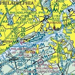
|
 Download PDF
of official airport diagram from the FAA
| Airport distance calculator |
|---|
|
|
| Sunrise and sunset |
|---|
|
Times for 28-May-2026
| | Local
(UTC-4) | | Zulu
(UTC) |
|---|
| Morning civil twilight | | 05:06 | | 09:06 |
| Sunrise | | 05:37 | | 09:37 |
| Sunset | | 20:19 | | 00:19 |
| Evening civil twilight | | 20:51 | | 00:51 |
|
| Current date and time |
|---|
| Zulu (UTC) | 28-May-2026 18:41:37 |
|---|
| Local (UTC-4) | 28-May-2026 14:41:37 |
|---|
|
| METAR |
|---|
| KPHL | 281754Z 36015G26KT 10SM SCT065 SCT090 26/08 A2988 RMK AO2 PK WND 01026/1752 SLP117 60000 T02560078 10267 20200 58004
|
KLOM
16nm N | 281815Z AUTO 33008KT 280V010 10SM SCT070 OVC100 23/08 A2990 RMK AO2 T02290080
|
KPNE
16nm NE | 281754Z 34016G25KT 10SM FEW080 BKN100 25/08 A2989 RMK AO2 SLP119 T02500078 10267 20206 58004 $
|
KOQN
17nm NW | 281815Z AUTO 35010G15KT 10SM CLR 23/06 A2992 RMK AO2
|
KVAY
19nm E | ASOS 119.325 609-267-1176
281754Z AUTO 36010KT 10SM BKN090 OVC100 23/08 A2987 RMK AO2 SLP114 60001 T02330078 10256 20183 58004
|
|
| TAF |
|---|
| KPHL | 281720Z 2818/2924 34016G26KT P6SM FEW080 FM290100 34009KT P6SM SKC FM290600 34005KT P6SM SKC FM291800 27008KT P6SM SKC
|
KPNE
16nm NE | 281720Z 2818/2918 34015G24KT P6SM FEW060 FM290000 35009KT P6SM SKC FM290600 32006KT P6SM SKC
|
|
| NOTAMs |
|---|
NOTAMs are issued by the DoD/FAA and will open in a separate window not controlled by AirNav.
|
|


