FAA INFORMATION EFFECTIVE 19 FEBRUARY 2026
Location
| FAA Identifier: | DCA |
| Lat/Long: | 38-51-05.1850N 077-02-15.7970W
38-51.086417N 077-02.263283W
38.8514403,-77.0377214
(estimated) |
| Elevation: | 14.1 ft. / 4.3 m (surveyed) |
| Variation: | 11W (2020) |
| From city: | 3 miles S of WASHINGTON, DC |
| Time zone: | UTC -5 (UTC -4 during Daylight Saving Time) |
| Zip code: | 22202 |
Airport Operations
| Airport use: | Open to the public |
| Activation date: | 03/1941 |
| Control tower: | yes |
| ARTCC: | WASHINGTON CENTER |
| FSS: | LEESBURG FLIGHT SERVICE STATION |
| NOTAMs facility: | DCA (NOTAM-D service available) |
| Attendance: | CONTINUOUS |
| Wind indicator: | lighted |
| Segmented circle: | no |
| Beacon: | white-green (lighted land airport)
Operates sunset to sunrise. |
| Landing fee: | yes |
| Fire and rescue: | ARFF index C |
| International operations: | customs landing rights airport |
Airport Communications
| UNICOM: | 122.95 |
| WX ASOS: | 132.65 (276-200-0159) |
| WASHINGTON GROUND: | 121.7 257.6 |
| WASHINGTON TOWER: | 119.1 121.275 ;HELICOPTERS 257.6 |
| POTOMAC APPROACH: | 119.85 ;WEST/SOUTH 124.2 ;EAST |
| POTOMAC DEPARTURE: | 118.95 ;WEST 125.65 ;EAST |
| CLEARANCE DELIVERY: | 128.25 |
| PRE-TAXI CLEARANCE: | 128.25 |
| BOOCK DP: | 125.65 |
| CAPSS STAR: | 119.85 |
| CLASS B: | 119.85 ;WEST/SOUTH 124.2 ;EAST |
| CLIPR STAR: | 128.7 |
| CLTCH DP: | 118.95 |
| D-ATIS: | 132.65 |
| DEALE STAR: | 124.55 |
| DOCTR DP: | 125.65 |
| EMERG: | 121.5 243.0 |
| FINAL APCH: | 124.7 |
| FRDMM STAR: | 118.675 |
| HOLTB DP: | 125.65 |
| HORTO DP: | 118.95 |
| IRONS STAR: | 119.85 ;DCA ONLY |
| JDUBB DP: | 118.95 |
| NATIONAL DP: | 118.95 125.65 |
| NUMMY STAR: | 118.675 |
| REBLL DP: | 118.95 |
| SCRAM DP: | 118.95 |
| SKILS STAR: | 128.7 |
| SOOKI DP: | 125.65 |
| TIKEE STAR: | 120.45 |
| TRUPS STAR: | 118.675 |
| WYNGS DP: | 118.95 |
| WX AWOS-3 at CGS (9 nm NE): | 121.225 (301-864-5497) |
| WX AWOS-3 at FME (19 nm NE): | 123.925 |
| WX AWOS-3PT at GAI (20 nm N): | 128.275 (301-977-2971) |
- ASDE-X IN USE. OPERATE TRANSPONDERS WITH ALTITUDE REPORTING MODE AND ADS-B (IF EQUIPPED) ENABLED ON ALL AIRPORT SURFACES.
- ARRIVALS MAY BE EXTENDED OUTSIDE OF CLASS B.
Nearby radio navigation aids
| VOR radial/distance | | VOR name | | Freq | | Var |
|---|
| DCA at field | | WASHINGTON VOR/DME | | 111.00 | | 09W |
| ADWr298/8.4 | | ANDREWS VORTAC | | 113.10 | | 10W |
| AMLr112/20.6 | | ARMEL VOR/DME | | 113.50 | | 08W |
| BALr233/26.0 | | BALTIMORE VORTAC | | 115.10 | | 11W |
| BRVr035/34.3 | | BROOKE VORTAC | | 114.50 | | 09W |
| FDKr163/37.1 | | FREDERICK VOR/DME | | 116.85 | | 08W |
| EMIr192/38.7 | | WESTMINSTER VORTAC | | 117.90 | | 08W |
| NDB name | | Hdg/Dist | | Freq | | Var | | ID |
|---|
| OXONN | | 006/5.2 | | 332 | | 11W | | VQK | ...- --.- -.- |
| GEORGETOWN | | 148/6.2 | | 323 | | 09W | | GTN | --. - -. |
| ELLICOTT | | 216/28.8 | | 371 | | 11W | | FND | ..-. -. -.. |
Airport Services
| Fuel available: | A |
| Parking: | hangars and tiedowns |
| Airframe service: | MINOR |
| Powerplant service: | MINOR |
| Bottled oxygen: | NONE |
| Bulk oxygen: | NONE |
Runway Information
Runway 1/19
| Dimensions: | 7169 x 150 ft. / 2185 x 46 m |
| Surface: | asphalt/grooved, in good condition |
| Weight bearing capacity: | | Single wheel: | 110.0 | | Double wheel: | 200.0 | | Double tandem: | 360.0 |
|
| Runway edge lights: | high intensity |
| RUNWAY 1 | | RUNWAY 19 |
| Latitude: | 38-50.494092N | | 38-51.671555N |
| Longitude: | 077-02.204907W | | 077-02.323422W |
| Elevation: | 11.4 ft. | | 12.1 ft. |
| Traffic pattern: | left | | right |
| Runway heading: | 007 magnetic, 356 true | | 186 magnetic, 175 true |
| Declared distances: | TORA:6869 TODA:6869 ASDA:6869 LDA:6869 | | TORA:6869 TODA:6869 ASDA:6869 LDA:6869 |
| Markings: | precision, in good condition | | precision, in good condition |
| Visual slope indicator: | 4-light PAPI on right (3.00 degrees glide path) | | 4-light PAPI on left (3.00 degrees glide path)
RWY 19 PAPI-4L CONSISTS OF TWO PAPI-4L SYSTEMS. RWY 19 PAPI-4L IS ROTATED 21 DEGS TO RIGHT OF CNTRLN. THE ROTATED PAPI-4L SYSTEM SUPPORTS VISUAL AND INSTR APCHS TO RWY 19. ADZY, ACFT ON TWY CREATE TMPRY OBSTN TO PAPI-4L. |
| RVR equipment: | touchdown, rollout | | touchdown, rollout |
| Approach lights: | ALSF2: standard 2,400 foot high intensity approach lighting system with centerline sequenced flashers (category II or III) | | MALSF: 1,400 foot medium intensity approach lighting system with sequenced flashers |
| Runway end identifier lights: | | | no |
| Centerline lights: | yes | | yes |
| Touchdown point: | yes, lighted | | yes, no lights |
| Instrument approach: | ILS/DME | | LDA/DME |
| Obstructions: | 180 ft. tower, lighted, 7700 ft. from runway, 1600 ft. left of centerline, 41:1 slope to clear | | 27 ft. tree, 990 ft. from runway, 240 ft. left of centerline, 29:1 slope to clear
+10 FT BLDG (L/M) +120 FT FROM AER 300 FT LEFT. |
Runway 15/33
| Dimensions: | 5204 x 150 ft. / 1586 x 46 m |
| Surface: | asphalt/grooved, in excellent condition |
| Weight bearing capacity: | | Single wheel: | 110.0 | | Double wheel: | 200.0 | | Double tandem: | 360.0 |
|
| Runway edge lights: | medium intensity |
| RUNWAY 15 | | RUNWAY 33 |
| Latitude: | 38-51.669687N | | 38-50.988243N |
| Longitude: | 077-02.597818W | | 077-01.932547W |
| Elevation: | 14.0 ft. | | 10.3 ft. |
| Traffic pattern: | right | | left |
| Runway heading: | 154 magnetic, 143 true | | 334 magnetic, 323 true |
| Declared distances: | TORA:5204 TODA:5204 ASDA:5204 LDA:5204 | | TORA:5204 TODA:5204 ASDA:5204 LDA:5204 |
| Markings: | nonprecision, in good condition | | nonprecision, in good condition |
| Visual slope indicator: | 4-light PAPI on left (3.00 degrees glide path) | | 4-light PAPI on left (3.00 degrees glide path) |
| Runway end identifier lights: | yes | | yes |
| Touchdown point: | yes, no lights | | yes, no lights |
| Obstructions: | 49 ft. trees, lighted, 380 ft. from runway, 510 ft. right of centerline, 3:1 slope to clear
RWY 15 +8 FT BLAST FENCE 120 FT FM AER 250 FT RIGHT. | | 253 ft. trees, 9600 ft. from runway, 37:1 slope to clear |
Runway 4/22
| Dimensions: | 5000 x 150 ft. / 1524 x 46 m |
| Surface: | asphalt/grooved, in good condition |
| Weight bearing capacity: | | Single wheel: | 110.0 | | Double wheel: | 200.0 | | Double tandem: | 360.0 |
|
| Runway edge lights: | medium intensity |
| RUNWAY 4 | | RUNWAY 22 |
| Latitude: | 38-50.467573N | | 38-51.210660N |
| Longitude: | 077-02.487285W | | 077-02.032847W |
| Elevation: | 11.4 ft. | | 11.0 ft. |
| Traffic pattern: | left | | right |
| Runway heading: | 037 magnetic, 026 true | | 217 magnetic, 206 true |
| Displaced threshold: | 200 ft. | | no |
| Declared distances: | TORA:5000 TODA:5000 ASDA:5000 LDA:4800 | | TORA:4540 TODA:4540 ASDA:4400 LDA:4400 |
| Markings: | nonprecision, in good condition | | nonprecision, in good condition |
| Visual slope indicator: | 4-light PAPI on left (3.25 degrees glide path) | | 4-light PAPI on left (3.00 degrees glide path) |
| Runway end identifier lights: | yes | | yes |
| Touchdown point: | yes, no lights | | yes, no lights |
| Obstructions: | 10 ft. road, lighted, 400 ft. from runway, 500 ft. left of centerline, 20:1 slope to clear
THREE OBSTRUCTION LGTS POLES--ONE 600 FEET LEFT, ONE ON CENTERLINE, ONE 600 FEET RIGHT. | | 2 ft. gnd, 220 ft. from runway, 10:1 slope to clear |
Airport Ownership and Management from official FAA records
| Ownership: | Publicly-owned |
| Owner: | METRO WASH ARPT AUTHORITY
1 AVIATION CIRCLE
WASHINGTON, DC 20001-6000
Phone 703-417-8600 |
| Manager: | TERRY LIERCKE
1 AVIATION CIRCLE
WASHINGTON, DC 20001-6000
Phone 703-417-8050 |
Additional Remarks
| A39-01/19 | PCR VALUE: 580/F/B/W/T |
| A39-04/22 | PCR VALUE: 420/F/B/W/T |
| A39-15/33 | PCR VALUE: 540/F/B/W/T |
| E60-33 | ENGINEERED MATERIALS ARRESTING SYSTEM (EMAS) 332 FT IN LENGTH BY 170 FT IN WIDTH LCTD AT THE DER 33. |
| E60-04 | ENGINEERED MATERIALS ARRESTING SYSTEM (EMAS) 336 FT IN LENGTH BY 170 FT IN WIDTH LCTD AT THE DER 04. |
| E60-15 | ENGINEERED MATERIALS ARRESTING SYSTEM (EMAS) 142 FT IN LENGTH BY 170 FT IN WIDTH LCTD AT THE DER 15. |
| - | TWY K ENDS AT GATE 5. |
| - | FLOCKS OF BIRDS ON & INVOF ARPT; FQT GULL & GEESE & DUCK POPULATIONS AB OVER ADJ RIVER AREAS. |
| - | TRNG FLIGHTS THAT INCLUDE MULTIPLE APCHS AND/OR TOUCH & GO OPNS REQUIRE PRIOR PERMISSION FM THE ARPT MGR. |
| - | LEFT-HAND TURN-OFFS FROM RWY 33 TO TWY 'K' PROHIBITED. |
| - | ACFT ARRIVING/DEPARTING THE GA PARKING AREA ARE PROHIBITED FM TAXING BTN ACR PUSHBACK OPNS & THE GATES. |
| - | BE ADVISED SOME AIRCREWS MISTAKE RWY 15 FOR RWY 19. |
| - | RONALD REAGAN WASHINGTON NATIONAL ARPRT (KDCA) IS AN EMERGENCY USE ONLY FIELD FOR ALL DOD OWNED AND OPERATED ACFT. |
| - | TWY N BTN APCH END RWY 15 AND TWY K CLSD TO ACFT WINGSPAN MORE THAN 124FT. |
| - | LGT FM VEHICLE PARKING LOT LCTD 1000 FT SW OF RWY 01 COULD GIVE FALSE INDICATIONS OF BEING PART OF RWY 01 APCH LGT SYS DRG PERIODS OF REDUCED VIS & LOW CEILINGS. |
| - | FORM 150R CREDIT CARD FOR ALL RQRD SVCS. NO MIL FACS. |
| A30-19X | THIS RWY EXISTS TO SUPPORT THE DCA LDA ASSOCIATED WITH THE ILS. |
Instrument Procedures
NOTE: All procedures below are presented as PDF files. If you need a reader for these files, you should download the free Adobe Reader.NOT FOR NAVIGATION. Please procure official charts for flight.
FAA instrument procedures published for use from 19 February 2026 at 0901Z to 19 March 2026 at 0900Z.
STARs - Standard Terminal Arrivals |
|---|
| CAPSS THREE (RNAV) | |
download (287KB) |
| CLIPR THREE (RNAV) | |
download (202KB) |
| DEALE THREE (RNAV) | |
download (245KB) |
| FRDMM SIX (RNAV) | |
2 pages:
[1] [2] (520KB) |
| IRONS SEVEN | |
download (213KB) |
| NUMMY THREE | |
download (251KB) |
| SKILS FIVE (RNAV) | |
download (226KB) |
| TIKEE FOUR (RNAV) | |
download (216KB) |
| TRUPS FIVE (RNAV) | |
2 pages:
[1] [2] (550KB) |
IAPs - Instrument Approach Procedures |
|---|
| ILS OR LOC RWY 01 | |
download (278KB) |
| ILS RWY 01 (SA CAT I) | |
download (238KB) |
| ILS RWY 01 (CAT II) | |
download (231KB) |
| RNAV (RNP) RWY 01 | |
download (244KB) |
| RNAV (RNP) Z RWY 19 | |
download (221KB) |
| RNAV (GPS) RWY 15 | |
download (241KB) |
| RNAV (GPS) RWY 33 | |
download (225KB) |
| RNAV (GPS) Y RWY 19 | |
download (258KB) |
| LDA Y RWY 19 | |
download (268KB) |
| LDA Z RWY 19 | |
download (269KB) |
| COPTER ILS OR LOC/DME RWY 01 | |
download (259KB) |
| MOUNT VERNON VISUAL RWY 01 | |
download (183KB) |
| RIVER VISUAL RWY 19 | |
download (186KB) |
| NOTE: Special Alternate Minimums apply | |
download (167KB) |
Departure Procedures |
|---|
| AMEEE ONE (RNAV) | |
2 pages:
[1] [2] (482KB) |
| CLTCH THREE (RNAV) | |
2 pages:
[1] [2] (453KB) |
| DOCTR FIVE (RNAV) | |
2 pages:
[1] [2] (549KB) |
| HORTO FOUR (RNAV) | |
2 pages:
[1] [2] (425KB) |
| JDUBB FOUR (RNAV) | |
2 pages:
[1] [2] (432KB) |
| NATIONAL EIGHT | |
2 pages:
[1] [2] (436KB) |
| REBLL FIVE (RNAV) | |
2 pages:
[1] [2] (416KB) |
| SCRAM SIX (RNAV) | |
2 pages:
[1] [2] (431KB) |
| SOOKI SIX (RNAV) **NEW** | |
2 pages:
[1] [2] (516KB) |
| WYNGS FIVE (RNAV) | |
2 pages:
[1] [2] (421KB) |
| NOTE: Special Take-Off Minimums/Departure Procedures apply | |
download (366KB) |
Other nearby airports with instrument procedures:
KVKX - Potomac Airfield (7 nm SE)
KADW - Joint Base Andrews (8 nm E)
KCGS - College Park Airport (9 nm NE)
KDAA - Davison Army Airfield (11 nm SW)
W00 - Freeway Airport (14 nm NE)
2W5 - Maryland Airport (15 nm S)
KFME - Fort Meade Executive Airport (19 nm NE)
KGAI - Montgomery County Airpark (20 nm N)
|
|

Road maps at:
MapQuest
Bing
Google
| Aerial photo |
|---|
WARNING: Photo may not be current or correct
 Photo by Aaron Marcase
Photo taken 18-Jul-2017
looking north-northwest.
Photo by Aaron Marcase
Photo taken 18-Jul-2017
looking north-northwest.
Do you have a better or more recent aerial photo of Ronald Reagan Washington National Airport that you would like to share? If so, please send us your photo.
|
| Sectional chart |
|---|
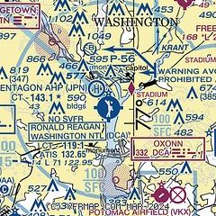
|
 Download PDF
of official airport diagram from the FAA
| Airport distance calculator |
|---|
|
|
| Sunrise and sunset |
|---|
|
Times for 24-Feb-2026
| | Local
(UTC-5) | | Zulu
(UTC) |
|---|
| Morning civil twilight | | 06:22 | | 11:22 |
| Sunrise | | 06:49 | | 11:49 |
| Sunset | | 17:54 | | 22:54 |
| Evening civil twilight | | 18:21 | | 23:21 |
|
| Current date and time |
|---|
| Zulu (UTC) | 24-Feb-2026 14:36:20 |
|---|
| Local (UTC-5) | 24-Feb-2026 09:36:20 |
|---|
|
| METAR |
|---|
| KDCA | 241352Z 31015G26KT 10SM FEW040 FEW250 M02/M11 A3008 RMK AO2 SLP186 T10171106 $
|
KADW
8nm E | 241355Z AUTO 31017G24KT 10SM CLR M01/M11 A3006 RMK AO2 PK WND 32026/41 SLP189 T10151114 $
|
KCGS
9nm NE | 241415Z AUTO 30012G24KT 10SM CLR M02/M11 A3009 RMK AO2 T10151113
|
KDAA
10nm SW | 241355Z AUTO 30013G18KT 10SM CLR M01/M12 A3007 RMK AO2 PK WND 28027/19 SLP186 T10081118 $
|
KFME
19nm NE | 241415Z AUTO 29014G21KT 10SM CLR M01/M10 A3009 RMK AO1
|
KIAD
20nm W | 241352Z 30015G22KT 10SM FEW040 M03/M12 A3008 RMK AO2 SLP190 T10281117
|
KGAI
20nm N | 241356Z AUTO 30017G23KT 10SM FEW036 M04/M11 A3006 RMK AO2 SLP198 T10391106 FZRANO
|
|
| TAF |
|---|
| KDCA | 241120Z 2412/2518 31012G16KT P6SM SKC FM242000 28009KT P6SM FEW130 BKN250 FM250200 18006KT P6SM BKN090 OVC130 FM250600 19007KT P6SM OVC090 WS020/20035KT FM251300 21010G18KT P6SM BKN060 OVC110
|
KADW
8nm E | 241302Z 2413/2515 32015G25KT 9999 SKC 510002 QNH2998INS BECMG 2415/2416 32010G20KT 9999 FEW045 FEW150 510052 QNH2996INS BECMG 2418/2419 25009KT 9999 SCT100 QNH2992INS BECMG 2423/2424 19012KT 9999 SCT100 BKN180 QNH2977INS BECMG 2506/2507 20015G25KT 8000 -RASN OVC070 620709 510002 QNH2974INS BECMG 2508/2509 20010G20KT 9999 NSW OVC055 WS020/22040KT 620709 QNH2971INS BECMG 2510/2511 21015G25KT 9000 -RA OVC045 620709 510002 QNH2969INS TX03/2420Z TNM02/2413Z
|
KDAA
10nm SW | 241300Z 2413/2519 30010G20KT 9999 FEW050 SCT150 510104 QNH2992INS BECMG 2419/2420 27012KT 9999 SCT100 BKN250 QNH2982INS BECMG 2501/2502 18009KT 9999 BKN100 BKN150 QNH2977INS BECMG 2506/2507 20010KT 8000 -RASN BKN080 OVC120 620802 520103 QNH2974INS BECMG 2508/2509 20012KT 9999 NSW OVC055 WS020/22040KT 620555 QNH2971INS BECMG 2512/2513 21012G18KT 9999 BKN070 OVC100 620703 510002 QNH2969INS TX05/2420Z TNM02/2413Z
|
KIAD
20nm W | 241120Z 2412/2518 30012G19KT P6SM FEW040 FM241600 28008G16KT P6SM FEW080 SCT250 FM242200 18006KT P6SM FEW120 BKN250 FM250300 18008KT P6SM BKN080 OVC120 FM250700 19007KT P6SM OVC090 WS020/20030KT FM251400 21010G18KT P6SM BKN070 OVC120
|
|
| NOTAMs |
|---|
NOTAMs are issued by the DoD/FAA and will open in a separate window not controlled by AirNav.
|
|


